Beinn Ìme
Beinn Ìme /ˌbɛn ˈiːmə/[2] (Scottish Gaelic: Beinn Ime) is the highest mountain in the Arrochar Alps, in the Southern Highlands of Scotland. There are three usual routes of ascent. From Succoth, one may follow the same path that is used to reach The Cobbler before taking the right fork near the base of the Cobbler's main crags and continuing up the glen, across the bealach and up Ben Ìme's eastern ridge. Alternatively, the summit can be reached from the pass of Rest and be Thankful and from the Loch Lomond side, using the private road that leads to Loch Sloy. Beinn Ìme separates the Dunbartonshire landscape of Loch Lomond in the East and the Argyll Highlands of Loch Fyne and Loch Goil anywhere north, west, south west. Beinn Ìme is the landmark to the entrance to Argyll.
| Beinn Ìme | |
|---|---|
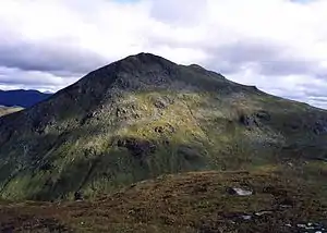
 Beinn Ime seen from Butterbridge below Rest and be Thankful. | |
| Highest point | |
| Elevation | 1,011 m (3,317 ft) [1] |
| Prominence | c. 696 m |
| Parent peak | Ben Oss |
| Listing | Munro, Marilyn |
| Naming | |
| English translation | Butter mountain |
| Language of name | Scottish Gaelic |
| Pronunciation | Gaelic [peɲˈimə] ( |
| Geography | |
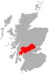
| Location | Argyll and Bute, Scotland |
| Parent range | Arrochar Alps, Grampian Mountains |
| OS grid | NN255084 |
References
- "walkhighlands Beinn Ime". walkhighlands.co.uk. 2013. Retrieved 16 October 2013.
- G.M. Miller, BBC Pronouncing Dictionary of British Names (Oxford UP, 1971), p. 8.
External links
 |  | ||
List of Munros | |||
| Northern Highlands (20) | 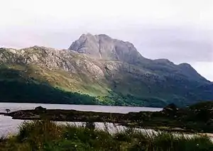   | |
|---|---|---|
| Western Highlands (20) | ||
| Central and Eastern Highlands (13) | ||
| Southern Highlands (15) | ||
| Islands (13) | ||
| Scottish Lowlands, England and Wales (13) | ||
| Republic of Ireland, Northern Ireland (25) | ||