Belaya (Kama)
The Belaya (Russian: Бе́лая, romanized: Belaja; Bashkir: Ағиҙел, romanized: Ağiźel, lit. 'Ağiðel' [ä.ʁi̠.ˈðɪ̞l], ![]() pronunciation ; Tatar: Агыйдел [ˌʌɣiˈdel]) is a river in Bashkortostan, Russian Federation. Its source lies in the south-western Ural Mountains.
pronunciation ; Tatar: Агыйдел [ˌʌɣiˈdel]) is a river in Bashkortostan, Russian Federation. Its source lies in the south-western Ural Mountains.
| Belaya | |
|---|---|
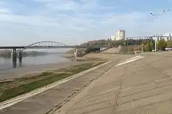 The Belaya in Ufa | |
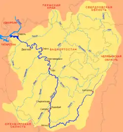 Belaya basin | |
| Location | |
| Country | Bashkortostan, Russia |
| Physical characteristics | |
| Source | |
| • location | Iremel mountain |
| • coordinates | 54°33′0″N 59°3′0″E |
| Mouth | Kama, Nizhnekamsk Reservoir |
• coordinates | 55°53′14″N 53°36′14″E |
| Length | 1,430 km (890 mi) |
| Basin size | 142,000 km2 (55,000 sq mi) |
| Discharge | |
| • average | 858 m3/s (30,300 cu ft/s) (near Birsk) |
| Basin features | |
| Progression | Kama→ Volga→ Caspian Sea |
It is 1,430 kilometres (890 mi) long, and its drainage basin covers 142,000 square kilometres (55,000 sq mi).[1][2]
Settlements along the Belaya include Beloretsk, Sterlitamak, Ufa (at the confluence with the river Ufa), and Birsk. The Belaya flows into the Kama near Neftekamsk.
Tributaries
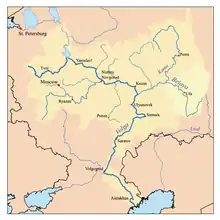
Map of the Volga watershed with the Belaya highlighted
The largest tributaries of the Belaya are, from source to mouth:[1]
References
- «Река БЕЛАЯ», Russian State Water Registry
- "Belaya River". Britannica.com. Retrieved 30 May 2016.
Gallery
 The middle Belaya valley
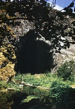 The entrance to the Kapova Cave
- The Belaya River in Ufa
| Wikimedia Commons has media related to Belaya River. |
The river Kama | ||
|---|---|---|
Left tributary of the Volga | ||
| Tributaries | 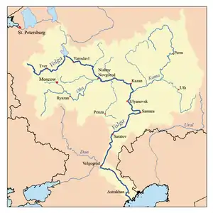 | |
| Reservoirs | ||
| Hydroelectric stations | ||
This article is issued from Wikipedia. The text is licensed under Creative Commons - Attribution - Sharealike. Additional terms may apply for the media files.