Benavente, Portugal
Benavente (Portuguese pronunciation: [bɨnɐˈvẽt(ɨ)] (![]() listen)) is a municipality and parish in Santarém District in Portugal. The population in 2011 was 29,019,[1] in an area of 521.38 km².[2]
listen)) is a municipality and parish in Santarém District in Portugal. The population in 2011 was 29,019,[1] in an area of 521.38 km².[2]
Benavente | |
|---|---|
 Flag  Coat of arms | |
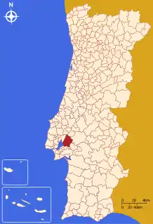 | |
| Coordinates: 38°58′N 8°48′W | |
| Country | |
| Region | Alentejo |
| Intermunic. comm. | Lezíria do Tejo |
| District | Santarém |
| Parishes | 4 |
| Government | |
| • President | Carlos Coutinho (CDU) |
| Area | |
| • Total | 521.38 km2 (201.31 sq mi) |
| Population (2011) | |
| • Total | 29,019 |
| • Density | 56/km2 (140/sq mi) |
| Time zone | UTC±00:00 (WET) |
| • Summer (DST) | UTC+01:00 (WEST) |
| Local holiday | Ascension Day (date varies) |
| Website | http://www.cm-benavente.pt |
History
In 1199 the fixation of foreign settlers on the left bank of the Tagus River created a Town on a peninsula in the tagus estuary. Situated in the western limits of Coruche castle dominion, subordinate to the Order of Calatrava. This small settlement remained under the Seignory of this Military Order, which named it Benavente, the same name as a castle of the same Military order in the Kingdom of León (Benavente, Zamora). It received its foral on March 25, 1200, given by D. Paio (or Pelágio), master of the Military Order of Santa Maria of Évora. The foral was confirmed in Santarém in 1218 by Sancho I. King Manuel gave it a new foral on January 16, 1516.
The present Mayor is Carlos Coutinho, elected by the Unitarian Democratic Coalition (Communist and Green coalition).
Benavente is crossed by National Road 118, which divides the town's historical centre on the west side, destroyed by an earthquake on 27 April 1909, and the new town built after the quake on the east.
The municipal holiday is Ascension Day.
Economy
Agriculture, livestock farming, forestry, and food industries are the main activities. The Companhia das Lezírias is headquartered in the municipality, in Samora Correia.
Parishes
Administratively, the municipality is divided into 4 civil parishes (freguesias):[3]
- Barrosa
- Benavente
- Samora Correia
- Santo Estêvão
References
- Instituto Nacional de Estatística
- "Áreas das freguesias, concelhos, distritos e país". Archived from the original on 2018-11-05. Retrieved 2018-11-05.
- Diário da República. "Law nr. 11-A/2013, page 552 25" (pdf) (in Portuguese). Retrieved 18 July 2014.
External links
| Authority control |
|
|---|