Benleagh
Benleagh (Irish: Binn Liath, meaning "Grey Peak")[2] at 689 metres (2,260 ft), does not have the prominence to qualify as an Arderin,[3] but its prominence does allow it to rank as the 125th–highest peak on the Vandeleur-Lynam scale.[4][5] Benlagh is situated in the southern sector of the Wicklow Mountains, and is part of the large massif of Lugnaquilla 925 metres (3,035 ft), Wicklow's highest mountain.[6]
| Benleagh | |
|---|---|
| Binn Liath | |
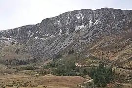 Southerly cliffs of Benleagh as viewed from the Fraughan Rock Glen | |
| Highest point | |
| Elevation | 689 m (2,260 ft) [1] |
| Prominence | 24 m (79 ft) [1] |
| Listing | Vandeleur-Lynam |
| Coordinates | |
| Naming | |
| English translation | grey peak |
| Language of name | Irish |
| Geography | |
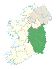
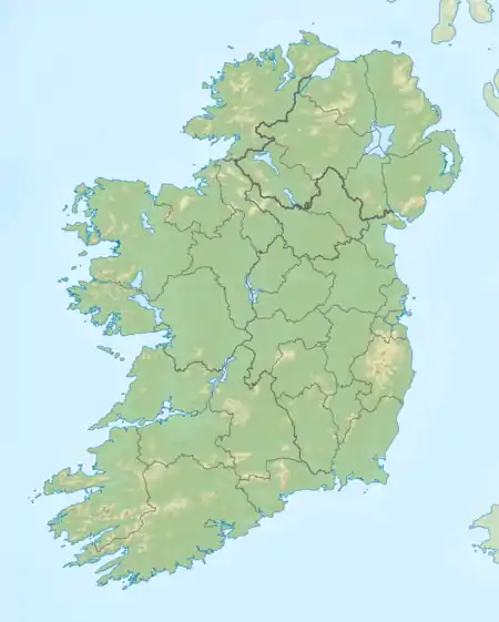 Benleagh Location in Ireland | |
| Location | Wicklow, Ireland |
| Parent range | Wicklow Mountains |
| OSI/OSNI grid | T038941[1] |
| Topo map | OSi Discovery 56 |
| Geology | |
| Mountain type | Aphyric granodiorite Bedrock[1] |
Benleagh's southern flank forms the steep walls and cliffs of the hanging valley of Fraughan Rock Glen, which then falls into the U-shaped valley of Glenmalure below; Benleagh forms a "horseshoe" around the Fraughan Rock Glen with Lugnaquillia at its apex and Cloghernagh 800 metres (2,600 ft), to the south.[7] Benleagh also sits on a broad "spine" that links Lugnaquilla in the south, to Camenabologue and Table Mountain to the north, which circle the Glen of Imaal.[6][8]
Bibliography
- Fairbairn, Helen (2014). Dublin & Wicklow: A Walking Guide. Collins Press. ISBN 978-1848892019.
- Fairbairn, Helen (2014). Ireland's Best Walks: A Walking Guide. Collins Press. ISBN 978-1848892118.
- MountainViews Online Database (Simon Stewart) (2013). A Guide to Ireland's Mountain Summits: The Vandeleur-Lynams & the Arderins. Collins Books. ISBN 978-1-84889-164-7.
- Dillion, Paddy (1993). The Mountains of Ireland: A Guide to Walking the Summits. Cicerone. ISBN 978-1852841102.
Gallery
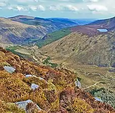 View south-east from summit of Benleagh
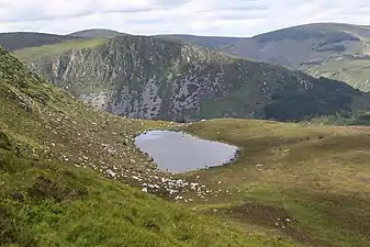 Cliffs of Benleagh from Arts Lough, below summit of Cloghernagh
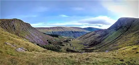 View east across the Fraughan Rock Glen with Benleagh (left) and Cloghernagh (right)
See also
| Wikimedia Commons has media related to Benleagh. |
References
- "Benleagh". MountainViews Online Database. Retrieved 8 February 2019.
- Paul Tempan (February 2012). "Irish Hill and Mountain Names" (PDF). MountainViews.ie.
- Simon Stewart (October 2018). "Arderins: Irish mountains of 500+m with a prominence of 30m". MountainViews Online Database.
- Simon Stewart (October 2018). "Vandeleur-Lynams: Irish mountains of 600+m with a prominence of 15m". MountainViews Online Database.
- Mountainviews, (September 2013), "A Guide to Ireland's Mountain Summits: The Vandeleur-Lynams & the Arderins", Collins Books, Cork, ISBN 978-1-84889-164-7
- Dillion, Paddy (1993). The Mountains of Ireland: A Guide to Walking the Summits. Cicerone. ISBN 978-1852841102.
Walk 10: Ballineddan Mountain, Slievemaan, Lugnaquillia, Camenabologue East Top, Camenabologue
- Fairbairn, Helen (2014). Ireland's Best Walks: A Walking Guide. Collins Press. ISBN 978-1848892118.
Route 65: Lugnaquilla
- Fairbairn, Helen (2014). Dublin & Wicklow: A Walking Guide. Collins Press. ISBN 978-1848892019.
External links
- MountainViews: The Irish Mountain Website, Benleagh
- MountainViews: Irish Online Mountain Database
- The Database of British and Irish Hills , the largest database of British Isles mountains ("DoBIH")
- Hill Bagging UK & Ireland, the searchable interface for the DoBIH
| British Isles |  | |
|---|---|---|
| Scotland | ||
| Outside Scotland | ||
| England | ||
| Ireland | ||
| County tops | ||
.jpg.webp)