Naul Hills
The Naul Hills, or Man-of-War Hills [2] are low-lying hills in Fingal, Ireland, close to the village of Naul, formerly called The Naul,[3] (Irish: An Aill, meaning "the cliff"). They lie beside the County Meath border, 30 kilometres north of Dublin City (17 km north of the airport), 16 km north-northwest of Swords, and 8 km southwest of Balbriggan.[4]
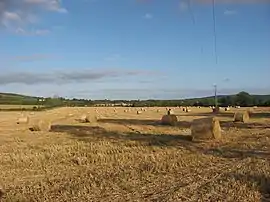
Mounds near Knockbrack hill
| Naul Hills | |
|---|---|
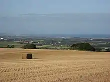
 View from Flemingtown, Co. Meath, towards the Naul Hills, with Knockbrack to the right | |
| Highest point | |
| Elevation | 176 m (577 ft) [1] |
| Coordinates | 53.571871°N 6.258884°W |
| Naming | |
| Language of name | English |
| Geography | |
| Location | Fingal, Ireland |
| Parent range | Naul Hills |
| OSI/OSNI grid | O133602 |
| Topo map | OSI Discovery 43 |
| Climbing | |
| Easiest route | West from M1 on R122, then south on R108. |
Typical hill elevations run between 140 and 150 metres, with the highest point in the area being the 176m Knockbrack (Irish: An Cnoc Breac, meaning "the speckled hill").[1][5] Limestone quarrying has been carried out in the hills, and the London Encyclopaedia (1829) remarked, "there are coals at Naul...but the coal vein is not worked." [6]
References
- Ordnance Survey map of Naul area Archived 2012-08-29 at the Wayback Machine Ordnance Survey Ireland. Retrieved 2010-08-02.
- The Neighbourhood of Dublin by Weston St. John Joyce (3rd ed. 1920). Chapter X: Rathfarnham, Whitechurch, Kelly's Glen and Kilmashogue Mountain.
- "Entry for Naul in A Topographical Dictionary of Ireland by Samuel Lewis, 1837". Retrieved 2009-11-27.
- "Fingal County Council, 2002". Archived from the original on 2011-07-22. Retrieved 2009-11-27.
- Knockbrack Placenames Database of Ireland. Retrieved: 2011-12-29.
- The London Encyclopaedia, Vol. VII, London, T. Tegg & Son, 1829. Retrieved: 2010-08-12
See also
- Naul, Dublin
- List of mountains in Ireland
This article is issued from Wikipedia. The text is licensed under Creative Commons - Attribution - Sharealike. Additional terms may apply for the media files.