Bergrivier Local Municipality
Bergrivier Local Municipality is a local municipality in the Western Cape province of South Africa. It governs the towns of Piketberg (the seat of the municipal council), Velddrif and Porterville, as well as the surrounding villages and rural areas. As of 2011 it had a population of 61,897.[2] It is located within the West Coast District Municipality and has municipality code WC013.
Bergrivier | |
|---|---|
 Seal | |
.svg.png.webp) Location in the Western Cape | |
| Coordinates: 32°45′S 18°45′E | |
| Country | South Africa |
| Province | Western Cape |
| District | West Coast |
| Seat | Piketberg |
| Wards | 7 |
| Government | |
| • Type | Municipal council |
| • Mayor | Ray van Rooy (DA) |
| Area | |
| • Total | 4,407 km2 (1,702 sq mi) |
| Population (2011)[2] | |
| • Total | 61,897 |
| • Density | 14/km2 (36/sq mi) |
| Racial makeup (2011) | |
| • Black African | 11.3% |
| • Coloured | 70.9% |
| • Indian/Asian | 0.4% |
| • White | 16.9% |
| First languages (2011) | |
| • Afrikaans | 90.7% |
| • Xhosa | 3.8% |
| • English | 2.5% |
| • Other | 3% |
| Time zone | UTC+2 (SAST) |
| Municipal code | WC013 |
Geography
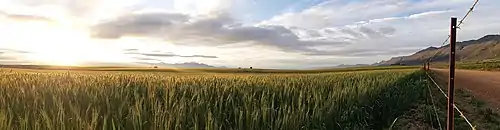
The municipality covers an area of 4,407 square kilometres (1,702 sq mi) stretching from the Atlantic Ocean in the west to the Groot Winterhoek Mountains in the east. Much of its southern border follows the Berg River, while to the north it stretches as far as the Olifants River Mountains. The Piketberg mountain occupies the middle of the area. To the north it abuts on the Cederberg Municipality, to the east the Witzenberg Municipality, and to the south the Drakenstein, Swartland and Saldanha Bay Municipalities.
According to the 2011 census the municipality has a population of 61,897 people in 16,275 households. Of this population, 70.9% describe themselves as "Coloured", 16.9% as "White", and 11.3% as "Black African". The first language of 90.7% of the population is Afrikaans, while 3.8% speak Xhosa and 2.5% speak English.[4]
The municipal headquarters are in the town of Piketberg, which is situated slightly north of the Berg River on the eastern slope of the mountain also known as the Piketberg. According to the 2011 census, Piketberg has a population of 12,075. The other principal towns in the municipality are Velddrif (pop. 11,017) on the Atlantic coast at the mouth of the Berg River, and Porterville (pop. 7,057) on the edge of the Groot Winterhoek Mountains.
There are smaller agricultural villages in the vicinity of Piketberg at Goedverwacht (pop. 1,979) and Wittewater (pop. 848), and in the northern parts of the municipality at Aurora (pop. 578), Eendekuil (pop. 1,530), and Redelinghuys (pop. 574). Dwarskersbos (pop. 670) is a fishing village and coastal resort near Velddrif.
Politics
The municipal council consists of thirteen members elected by mixed-member proportional representation. Seven councillors are elected by first-past-the-post voting in seven wards, while the remaining six are chosen from party lists so that the total number of party representatives is proportional to the number of votes received. In the election of 3 August 2016 the Democratic Alliance (DA) obtained a majority of nine seats on the council.
The following table shows the results of the 2016 election.[5][6][7]
| Party | Votes | Seats | ||||||
|---|---|---|---|---|---|---|---|---|
| Ward | List | Total | % | Ward | List | Total | ||
| Democratic Alliance | 10,450 | 10,405 | 20,855 | 64.1 | 7 | 2 | 9 | |
| ANC | 5,324 | 5,295 | 10,619 | 32.6 | 0 | 4 | 4 | |
| Freedom Front Plus | 326 | 290 | 616 | 1.9 | 0 | 0 | 0 | |
| Economic Freedom Fighters | 185 | 195 | 380 | 1.2 | 0 | 0 | 0 | |
| The Peoples Independent Civic Organisation | – | 48 | 47 | 0.1 | – | 0 | 0 | |
| Independent | 29 | – | 29 | 0.1 | 0 | – | 0 | |
| Total | 16,314 | 16,233 | 32,547 | 7 | 6 | 13 | ||
| Valid votes | 16,314 | 16,233 | 32,547 | 99.1 | ||||
| Spoilt votes | 118 | 175 | 293 | 0.9 | ||||
| Total votes cast | 16,432 | 16,408 | 32,840 | |||||
| Total voter turnout | 16,433 | |||||||
| Registered voters | 26,310 | |||||||
| Turnout percentage | 62.5 | |||||||
The DA subsequently lost one seat to the African National Congress (ANC) in a by-election on 23 August 2017.[8] However, the DA won the ward back in another by-election held on 16 January 2019.[9] The 2016 council composition was thus restored.
The local council sends two representatives to the council of the West Coast District Municipality: one from the Democratic Alliance and one from the African National Congress.[10]
References
- "Contact list: Executive Mayors". Government Communication & Information System. Archived from the original on 14 July 2010. Retrieved 22 February 2012.
- "Statistics by place". Statistics South Africa. Retrieved 27 September 2015.
- "Statistics by place". Statistics South Africa. Retrieved 27 September 2015.
- "Bergrivier Local Municipality". Census 2011.
- "Results Summary – All Ballots: Bergrivier" (PDF). Electoral Commission. Retrieved 27 May 2017.
- "Seat Calculation Detail: Bergrivier" (PDF). Electoral Commission. Retrieved 27 May 2017.
- "Voter Turnout Report: Bergrivier" (PDF). Electoral Commission. Retrieved 27 May 2017.
- "By-elections 23 August 2017 Comparison Report" (PDF). Electoral Commission. Retrieved 31 August 2017.
- "DA takes ANC ward in Western Cape by-election". The Citizen. 17 January 2019.
- "Political composition of councils February 2017" (PDF). Western Cape Department of Local Government. February 2017. Retrieved 24 May 2017.
External links
Municipalities and communities of West Coast District Municipality, Western Cape | ||
|---|---|---|
District seat: Moorreesburg | ||
| Matzikama | .svg.png.webp) West Coast District within South Africa | |
| Cederberg | ||
| Bergrivier | ||
| Saldanha Bay | ||
| Swartland | ||