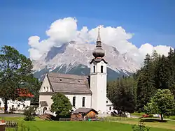
Biberwier
Biberwier is a municipality with 612 inhabitants (as of 1 January 2019) in the district of Reutte in the Austrian state of Tyrol. The municipality is located in the district court Reutte.
Biberwier | |
|---|---|
 | |
 Biberwier Location within Austria | |
| Coordinates: 47°23′00″N 10°53′34″E | |
| Country | Austria |
| State | Tyrol |
| District | Reutte |
| Government | |
| • Mayor | Paul Mascher |
| Area | |
| • Total | 29.42 km2 (11.36 sq mi) |
| Elevation | 989 m (3,245 ft) |
| Population (2018-01-01)[2] | |
| • Total | 628 |
| • Density | 21/km2 (55/sq mi) |
| Time zone | UTC+1 (CET) |
| • Summer (DST) | UTC+2 (CEST) |
| Postal code | 6633 |
| Area code | 05673 |
| Vehicle registration | RE |
| Website | www.biberwier.tirol.gv.at |
Geography
The village is located on the southern edge of the Lermooser Moos, between a mountain slope and the landslide landscape of the Fern Pass in the Tyrolean Alps. The municipality is crossed by the Loisach, which springs west of the village. The community is located near the border with Germany on the edge of the Wetterstein Mountains and is visible from the Zugspitze.
Neighboring municipalities
Places adjacent to Biberwier | |
|---|---|

History
The name derives from beavers, who have demonstrably lived until 1800 in the municipality. Corpus of finds from the Roman period bear witness to the early importance of the place on the Via Claudia Augusta. The track grooves at the northern entrance are probably later. From the Middle Ages to the year 1921, there was here, at the Silberleithe, the largest mining company in Außerfern, the union Silberleithen, the Galmei-, lead and zinc ore mined. Since the end of 2004, the Montan hiking trail Silberleithen has opened up this former mining area for tourism. With the opened in 1984 Lermooser tunnel, the place was relieved of transit traffic.
Biberwier is located on the cycle path, which runs as Via Claudia Augusta along an ancient Roman road of the same name.
Today Biberwier with the ski area Marienbergjoch and the swimming lakes Blindsee, Mittersee and Weißensee is a two-season tourism community.
Coat of arms
Blazon: Divided by gold and blue in the serpent cut, left in the upper field, following the division line, a blue wheel, whose hub is covered with the gold mining markers mallet and iron, right below a sitting, looking to the left beaver. The colors of the community flag are yellow-blue.[3]
The beaver in 1983 awarded municipal coat of arms symbolizes the toponym, mallets and iron refer to the historic mining, the wheel on the important transport system.[4]
Personalities
- Karl Koch (1887-1971), composer, choirmaster and music teacher
- Johann Weinhart (* 1925), sculptor
- Stefan Schennach (born 1956), politician
- Markus Inderst (* 1974), journalist and author
References
- "Dauersiedlungsraum der Gemeinden Politischen Bezirke und Bundesländer - Gebietsstand 1.1.2018". Statistics Austria. Retrieved 10 March 2019.
- "Einwohnerzahl 1.1.2018 nach Gemeinden mit Status, Gebietsstand 1.1.2018". Statistics Austria. Retrieved 9 March 2019.
- Landesgesetzblatt für Tirol, Nr. 25/1983. (Digitalisat)
- "Tirol Atlas: Wappen von Tirol - Biberwier". Archived from the original on 2007-06-30. Retrieved 2020-07-01.
