Biscay, Minnesota
Biscay /ˈbɪskiː/ BIS-kee is a city in McLeod County, Minnesota, United States. The population was 113 at the 2010 census.[6]
Biscay | |
|---|---|
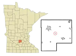 Location of Biscay within McLeod County, Minnesota | |
| Coordinates: 44°49′37″N 94°16′24″W | |
| Country | United States |
| State | Minnesota |
| County | McLeod |
| Area | |
| • Total | 0.07 sq mi (0.18 km2) |
| • Land | 0.07 sq mi (0.18 km2) |
| • Water | 0.00 sq mi (0.00 km2) |
| Elevation | 1,024 ft (312 m) |
| Population | |
| • Total | 113 |
| • Estimate (2019)[3] | 110 |
| • Density | 1,549.30/sq mi (596.60/km2) |
| Time zone | UTC-6 (Central (CST)) |
| • Summer (DST) | UTC-5 (CDT) |
| FIPS code | 27-06112[4] |
| GNIS feature ID | 0655408[5] |
History
A post office called Biscay was established in 1888, and remained in operation until 1954.[7] The city was named after the Bay of Biscay on the Atlantic Ocean.[8]
Geography
According to the United States Census Bureau, the city has a total area of 0.08 square miles (0.21 km2), all of it land.[9] It is the smallest city in Minnesota by land area.[10]
Biscay is located at the junction of Minnesota State Highway 22 and Major Avenue, between the cities of Glencoe and Hutchinson.
Demographics
| Historical population | |||
|---|---|---|---|
| Census | Pop. | %± | |
| 1960 | 70 | — | |
| 1970 | 105 | 50.0% | |
| 1980 | 114 | 8.6% | |
| 1990 | 113 | −0.9% | |
| 2000 | 114 | 0.9% | |
| 2010 | 113 | −0.9% | |
| 2019 (est.) | 110 | [3] | −2.7% |
| U.S. Decennial Census[11] | |||
2010 census
As of the census[2] of 2010, there were 113 people, 43 households, and 33 families living in the city. The population density was 1,412.5 inhabitants per square mile (545.4/km2). There were 47 housing units at an average density of 587.5 per square mile (226.8/km2). The racial makeup of the city was 90.3% White, 0.9% Asian, 5.3% from other races, and 3.5% from two or more races. Hispanic or Latino of any race were 8.8% of the population.
There were 43 households, of which 23.3% had children under the age of 18 living with them, 69.8% were married couples living together, 4.7% had a female householder with no husband present, 2.3% had a male householder with no wife present, and 23.3% were non-families. 20.9% of all households were made up of individuals, and 11.6% had someone living alone who was 65 years of age or older. The average household size was 2.63 and the average family size was 3.06.
The median age in the city was 45.2 years. 28.3% of residents were under the age of 18; 6.1% were between the ages of 18 and 24; 15% were from 25 to 44; 32.7% were from 45 to 64; and 17.7% were 65 years of age or older. The gender makeup of the city was 46.0% male and 54.0% female.
2000 census
As of the census[4] of 2000, there were 114 people, 45 households, and 31 families living in the city. The population density was 1,642.4 people per square mile (628.8/km2). There were 48 housing units at an average density of 691.5 per square mile (264.8/km2). The racial makeup of the city was 93.86% White, 6.14% from other races. Hispanic or Latino of any race were 11.40% of the population.
There were 45 households, out of which 26.7% had children under the age of 18 living with them, 66.7% were married couples living together, 2.2% had a female householder with no husband present, and 28.9% were non-families. 22.2% of all households were made up of individuals, and 6.7% had someone living alone who was 65 years of age or older. The average household size was 2.53 and the average family size was 3.03.
In the city, the population was spread out, with 22.8% under the age of 18, 7.9% from 18 to 24, 28.1% from 25 to 44, 35.1% from 45 to 64, and 6.1% who were 65 years of age or older. The median age was 39 years. For every 100 females, there were 86.9 males. For every 100 females age 18 and over, there were 104.7 males.
The median income for a household in the city was $49,583, and the median income for a family was $59,583. Males had a median income of $38,750 versus $25,625 for females. The per capita income for the city was $22,988. None of the population or the families were below the poverty line.
References
- "2019 U.S. Gazetteer Files". United States Census Bureau. Retrieved July 26, 2020.
- "U.S. Census website". United States Census Bureau. Retrieved 2012-11-13.
- "Population and Housing Unit Estimates". United States Census Bureau. May 24, 2020. Retrieved May 27, 2020.
- "U.S. Census website". United States Census Bureau. Retrieved 2008-01-31.
- "US Board on Geographic Names". United States Geological Survey. 2007-10-25. Retrieved 2008-01-31.
- "2010 Census Redistricting Data (Public Law 94-171) Summary File". American FactFinder. United States Census Bureau. Retrieved 27 April 2011.
- "McLeod County". Jim Forte Postal History. Retrieved 19 July 2015.
- Upham, Warren (1920). Minnesota Geographic Names: Their Origin and Historic Significance. Minnesota Historical Society. p. 317.
- "US Gazetteer files 2010". United States Census Bureau. Archived from the original on 2012-01-25. Retrieved 2012-11-13.
- Kaul, Greta (6 August 2019). "Why there's a tiny city called Hilltop in the middle of Columbia Heights". MinnPost. Retrieved August 7, 2019.
- "Census of Population and Housing". Census.gov. Retrieved June 4, 2015.
Municipalities and communities of McLeod County, Minnesota, United States | ||
|---|---|---|
| Cities | 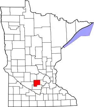 Map of Minnesota highlighting McLeod County | |
| Townships | ||
| Unincorporated communities | ||
| Ghost town | ||
| ||