Black Lake Denesuline First Nation
Black Lake is a Denesuline First Nations band government in the boreal forest of northern Saskatchewan, Canada. It is located on the northwest shore of Black Lake where the Fond du Lac River leaves the lake to flow to Lake Athabasca.
Band symbol | |
-001.jpg.webp) Satellite image of Black Lake | |
| People | Chipewyan |
|---|---|
| Treaty | Treaty 8 |
| Headquarters | Black Lake |
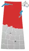
| Province | Saskatchewan |
| Land[1] | |
| Reserve(s) | |
| Land area | 322.197 km2 |
| Population (2019)[2] | |
| On reserve | 1638 |
| Off reserve | 617 |
| Total population | 2255 |
| Government[3] | |
| Chief | Archie Robillard |
| Tribal Council[4] | |
| Prince Albert Grand Council | |
| Website | |
| blacklakefirstnation.ca | |
It is the main administrative headquarters of the Black Lake Denesuline Nation reserve with a land base of over 32,000 hectares (79,074 acres).[5] Formerly, the Black Lake band used the name "Stony Rapids", which is now the name of a separate community 20 kilometres (12 mi) northwest and downstream on the Fond du Lac River, not on reserve land.
Black Lake Dene Nation
Black Lake Dene Nation is a band government with territory at three locations: Chicken 224, Chicken 225 and Chicken 226.[6][7]
- Chicken 224 is 25,819.40 hectares (63,801.1 acres) 59.1896°N 105.6353°W. It includes the village of Black Lake (population 1.070 in 2011) and extends from Black Lake up to the border of the village of Stony Rapids and includes territory on both sides of the Fond du Lac River.[8]
- Chicken 225 is 2,183.40 hectares (5,395.3 acres) 59.287°N 105.7564°W (population 0 in 2011) on the north side of Stony Lake on the Fond du Lac River [7]
- Chicken 226 is 4,216.90 hectares (10,420.2 acres) 59.2158°N 104.9427°W on the eastern end of Black Lake
Black Lake First Nation had a total registered membership of 2,044 with 1,592 members residing on-reserve and 452 members residing at locations off-reserve in September, 2013.[6] It is a member of the Prince Albert Grand Council.[6]
Demographics
The 2011 census reported 1,040 residents of Black Lake chose Dene as their mother tongue in 2011. All but 5 residents spoke English.[7]
| Canada census – Black Lake Denesuline First Nation community profile | |||
|---|---|---|---|
| 2011 | 2006 | ||
| Population: | 1,070 (-3.5% from 2006) | 1,109 (+5.2% from 2001) | |
| Land area: | 234.44 km2 (90.52 sq mi) | 234.44 km2 (90.52 sq mi) | |
| Population density: | 4.6/km2 (12/sq mi) | 4.7/km2 (12/sq mi) | |
| Median age: | 22.5 (M: 22.4, F: 22.8) | 20.9 (M: 20.8, F: 21.1) | |
| Total private dwellings: | 234 | 227 | |
| Median household income: | |||
| References: 2011[9] 2006[10] earlier[11] | |||
Infrastructure
Transportation
Black lake is accessible via road year round following the completion of secondary highway 905 (Previously a seasonal road). Black lake is also accessible from the community of Stony Rapids (which is accessible by air) by road.
The community is served by air by Black Lake Water Aerodrome, and by Stony Rapids Airport.
Health care
The Athabasca Health Facility completed in 2003 at the cost of $12.7 million provides health care services to the Athabasca region. The hospital, located on reserve land (Chicken 224) adjacent to the northern hamlet of Stony Rapids, is part of the Athabasca Health Authority.[12][13]
Education
Father Porte Memorial School offers kindergarten to 12 and has an enrolment of 460 students.[14]
See also
References
- "First Nation Detail". Indigenous and Northern Affairs Canada. Government of Canada. Retrieved September 10, 2019.
- "First Nation Detail". Indigenous and Northern Affairs Canada. Government of Canada. Retrieved September 10, 2019.
- "First Nation Detail". Indigenous and Northern Affairs Canada. Government of Canada. Retrieved September 10, 2019.
- "First Nation Detail". Indigenous and Northern Affairs Canada. Government of Canada. Retrieved September 10, 2019.
- Denesuliné in Treaty Eight
- "AANDC (First Nation Detail)". Archived from the original on 2013-10-17. Retrieved 2013-10-15.
- "2011 Community Profiles". Statistics Canada. Government of Canada. Retrieved 2013-04-05.
- "Natural Resources Canada-Canadian Geographical Names (Query by Geographical Name)". Retrieved 2015-02-04.
- "2011 Community Profiles". 2011 Canadian Census. Statistics Canada. July 5, 2013. Retrieved 2012-06-03.
- "2006 Community Profiles". 2006 Canadian Census. Statistics Canada. March 30, 2011. Retrieved 2012-06-03.
- "2001 Community Profiles". 2001 Canadian Census. Statistics Canada. February 17, 2012.
- "Athabasca Health Authority". Archived from the original on 2014-08-27. Retrieved 2014-09-09.
- "New Health Centre opens in Athabasca Basin". NEWS RELEASE - JULY 16, 2003. Government of Saskatchewan. Retrieved 2014-09-09.
- "Northern Saskatchewan school excelling in 'mathletics'". CBC News (Oct 01, 2014). Retrieved 2014-10-01.
| Ethnolinguistic groups | |||||||||||||||||||||
|---|---|---|---|---|---|---|---|---|---|---|---|---|---|---|---|---|---|---|---|---|---|
| Historical polities | |||||||||||||||||||||
| Numbered Treaties | |||||||||||||||||||||
| Tribal councils and band governments |
| ||||||||||||||||||||
| |||||||||||||||||||||