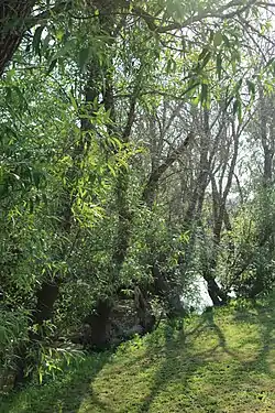
Blucher Creek
Blucher Creek is a 5.2-mile-long (8.4 km)[2] stream that rises in the hills south of Sebastopol, California, United States, and empties into the Laguna de Santa Rosa.
| Blucher Creek | |
|---|---|
 Blucher Creek at Todd Rd. near its confluence in the Laguna de Santa Rosa | |
| Etymology | surname |
| Location | |
| Country | United States |
| State | California |
| Region | Sonoma County |
| Physical characteristics | |
| Source | English Hill |
| • location | 4 mi (6 km) south of Sebastopol, California |
| • coordinates | 38°20′52″N 122°50′41″W[1] |
| Mouth | Laguna de Santa Rosa |
• location | 6 mi (10 km) southwest of Santa Rosa, California |
• coordinates | 38°22′40″N 122°47′0″W[1] |
• elevation | 71 ft (22 m)[1] |
Course
Blucher Creek originates on English Hill, and initially descends to the north. It soon curves eastward to parallel Blucher Valley Road. It crosses under Bloomfield Road, Canfield Road, Lone Pine Road, and Gravenstein Highway (State Route 116) to reach a confluence with the Laguna de Santa Rosa just west of Todd Road.
References
- U.S. Geological Survey Geographic Names Information System: Blucher Creek
- U.S. Geological Survey. National Hydrography Dataset high-resolution flowline data. The National Map Archived 2012-04-05 at WebCite, accessed March 9, 2011
This article is issued from Wikipedia. The text is licensed under Creative Commons - Attribution - Sharealike. Additional terms may apply for the media files.