Bludenz District
The Bezirk Bludenz is an administrative district (Bezirk) in Vorarlberg, Austria.
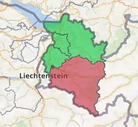
Bludenz District
Bezirk Bludenz | |
|---|---|
| |
| Country | Austria |
| State | Vorarlberg |
| Number of municipalities | 29 |
| Area | |
| • Total | 1,287.63 km2 (497.16 sq mi) |
| Population (2012) | |
| • Total | 61,407 |
| • Density | 48/km2 (120/sq mi) |
| Time zone | UTC+01:00 (CET) |
| • Summer (DST) | UTC+02:00 (CEST) |
| Website | https://www.bludenz.at/ |
Area of the district is 1,287.63 km², population is 61,407 (January 1, 2012), and population density 48 persons per km². Administrative center of the district is Bludenz.
| Year | Pop. | ±% |
|---|---|---|
| 1869 | 21,436 | — |
| 1880 | 22,448 | +4.7% |
| 1890 | 23,290 | +3.8% |
| 1900 | 24,307 | +4.4% |
| 1910 | 25,461 | +4.7% |
| 1923 | 26,346 | +3.5% |
| 1934 | 30,621 | +16.2% |
| 1939 | 31,672 | +3.4% |
| 1951 | 38,360 | +21.1% |
| 1961 | 43,000 | +12.1% |
| 1971 | 49,539 | +15.2% |
| 1981 | 53,104 | +7.2% |
| 1991 | 56,944 | +7.2% |
| 2001 | 60,471 | +6.2% |
| Source: Statistik Austria | ||
Administrative divisions
The district is divided into 29 municipalities, one of them is a town, and two of them are market towns.
Towns
- Bludenz (13,801)
Municipalities
- Bartholomäberg (2,281)
- Blons (324)
- Bludesch (2,220)
- Brand (666)
- Bürs (3,113)
- Bürserberg (528)
- Dalaas (1,512)
- Fontanella (433)
- Gaschurn (1,515)
- Innerbraz (933)
- Klösterle (690)
- Lech am Arlberg (1,636)
- Lorüns (281)
- Ludesch (3,375)
- Nüziders (4,880)
- Raggal (822)
- Sankt Anton im Montafon (751)
- Sankt Gallenkirch (2,190)
- Sankt Gerold (361)
- Silbertal (860)
- Sonntag (679)
- Stallehr (288)
- Thüringen (2,158)
- Thüringerberg (683)
- Tschagguns (2,169)
- Vandans (2,599)
(population numbers January 1, 2012)
This article is issued from Wikipedia. The text is licensed under Creative Commons - Attribution - Sharealike. Additional terms may apply for the media files.