Klösterle, Austria
Klösterle is a municipality in the district of Bludenz in the Austrian state of Vorarlberg.
Klösterle | |
|---|---|
 | |
 Coat of arms | |
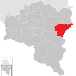 Location in the district | |
 Klösterle Location within Austria | |
| Coordinates: 47°07′51″N 10°05′19″E | |
| Country | Austria |
| State | Vorarlberg |
| District | Bludenz |
| Government | |
| • Mayor | Florian Morscher |
| Area | |
| • Total | 62.31 km2 (24.06 sq mi) |
| Elevation | 1,073 m (3,520 ft) |
| Population (2018-01-01)[2] | |
| • Total | 688 |
| • Density | 11/km2 (29/sq mi) |
| Time zone | UTC+1 (CET) |
| • Summer (DST) | UTC+2 (CEST) |
| Postal code | 6754 |
| Area code | 05582 |
| Vehicle registration | BZ |
| Website | www.kloesterle.at |
Population
| Year | Pop. | ±% |
|---|---|---|
| 1869 | 526 | — |
| 1880 | 1,064 | +102.3% |
| 1890 | 630 | −40.8% |
| 1900 | 703 | +11.6% |
| 1910 | 721 | +2.6% |
| 1923 | 764 | +6.0% |
| 1934 | 712 | −6.8% |
| 1939 | 721 | +1.3% |
| 1951 | 793 | +10.0% |
| 1961 | 799 | +0.8% |
| 1971 | 860 | +7.6% |
| 1981 | 782 | −9.1% |
| 1991 | 747 | −4.5% |
| 2001 | 767 | +2.7% |
| 2011 | 684 | −10.8% |
Climate
| Climate data for Klösterle, Austria (Langen Am Arlberg) 1981–2010 | |||||||||||||
|---|---|---|---|---|---|---|---|---|---|---|---|---|---|
| Month | Jan | Feb | Mar | Apr | May | Jun | Jul | Aug | Sep | Oct | Nov | Dec | Year |
| Record high °C (°F) | 11.2 (52.2) |
15.2 (59.4) |
18.6 (65.5) |
23.2 (73.8) |
28.6 (83.5) |
30.5 (86.9) |
32.0 (89.6) |
32.0 (89.6) |
27.6 (81.7) |
25.4 (77.7) |
20.0 (68.0) |
15.0 (59.0) |
32.0 (89.6) |
| Average high °C (°F) | 1.6 (34.9) |
2.3 (36.1) |
5.3 (41.5) |
9.3 (48.7) |
15.0 (59.0) |
17.8 (64.0) |
20.1 (68.2) |
19.5 (67.1) |
15.8 (60.4) |
12.3 (54.1) |
5.8 (42.4) |
2.2 (36.0) |
10.6 (51.1) |
| Daily mean °C (°F) | −2.4 (27.7) |
−2.2 (28.0) |
0.9 (33.6) |
4.4 (39.9) |
9.6 (49.3) |
12.4 (54.3) |
14.5 (58.1) |
13.8 (56.8) |
10.3 (50.5) |
7.1 (44.8) |
1.6 (34.9) |
−1.4 (29.5) |
5.7 (42.3) |
| Average low °C (°F) | −4.7 (23.5) |
−4.8 (23.4) |
−2.3 (27.9) |
0.9 (33.6) |
5.5 (41.9) |
8.3 (46.9) |
10.7 (51.3) |
10.5 (50.9) |
7.4 (45.3) |
4.3 (39.7) |
−0.9 (30.4) |
−3.7 (25.3) |
2.6 (36.7) |
| Record low °C (°F) | −27.0 (−16.6) |
−22.8 (−9.0) |
−17.0 (1.4) |
−10.8 (12.6) |
−4.0 (24.8) |
−1.8 (28.8) |
0.4 (32.7) |
0.0 (32.0) |
−2.0 (28.4) |
−10.0 (14.0) |
−16.2 (2.8) |
−16.5 (2.3) |
−27.0 (−16.6) |
| Average precipitation mm (inches) | 117 (4.6) |
105 (4.1) |
130 (5.1) |
100 (3.9) |
138 (5.4) |
175 (6.9) |
196 (7.7) |
203 (8.0) |
141 (5.6) |
98 (3.9) |
112 (4.4) |
121 (4.8) |
1,637 (64.4) |
| Average relative humidity (%) (at 14:00) | 66.2 | 65.3 | 63.3 | 59.9 | 57.0 | 60.6 | 61.5 | 64.6 | 65.9 | 63.8 | 68.5 | 69.0 | 63.8 |
| Source: Central Institute for Meteorology and Geodynamics[3][4][5][6][7] | |||||||||||||
| Climate data for Klösterle, Austria (Langen Am Arlberg) 1971–2000 | |||||||||||||
|---|---|---|---|---|---|---|---|---|---|---|---|---|---|
| Month | Jan | Feb | Mar | Apr | May | Jun | Jul | Aug | Sep | Oct | Nov | Dec | Year |
| Record high °C (°F) | 11.2 (52.2) |
15.2 (59.4) |
18.2 (64.8) |
20.5 (68.9) |
26.0 (78.8) |
29.0 (84.2) |
32.0 (89.6) |
31.0 (87.8) |
29.0 (84.2) |
24.0 (75.2) |
20.0 (68.0) |
15.0 (59.0) |
32.0 (89.6) |
| Average high °C (°F) | 1.7 (35.1) |
2.4 (36.3) |
4.9 (40.8) |
7.9 (46.2) |
14.1 (57.4) |
16.6 (61.9) |
19.1 (66.4) |
19.0 (66.2) |
15.7 (60.3) |
11.7 (53.1) |
5.2 (41.4) |
2.3 (36.1) |
10.1 (50.2) |
| Daily mean °C (°F) | −1.7 (28.9) |
−1.6 (29.1) |
0.6 (33.1) |
3.3 (37.9) |
8.8 (47.8) |
11.5 (52.7) |
14.0 (57.2) |
13.9 (57.0) |
10.7 (51.3) |
7.1 (44.8) |
1.5 (34.7) |
−0.7 (30.7) |
5.6 (42.1) |
| Average low °C (°F) | −4.6 (23.7) |
−4.5 (23.9) |
−2.4 (27.7) |
0.1 (32.2) |
5.0 (41.0) |
7.6 (45.7) |
10.2 (50.4) |
10.3 (50.5) |
7.4 (45.3) |
4.0 (39.2) |
−1.3 (29.7) |
−3.4 (25.9) |
2.4 (36.3) |
| Record low °C (°F) | −27.0 (−16.6) |
−22.8 (−9.0) |
−22.0 (−7.6) |
−10.8 (12.6) |
−6.0 (21.2) |
−0.4 (31.3) |
0.0 (32.0) |
0.0 (32.0) |
−1.5 (29.3) |
−8.0 (17.6) |
−16.2 (2.8) |
−18.0 (−0.4) |
−27.0 (−16.6) |
| Average precipitation mm (inches) | 117.7 (4.63) |
102.4 (4.03) |
122.7 (4.83) |
103.9 (4.09) |
131.5 (5.18) |
191.6 (7.54) |
209.3 (8.24) |
186.7 (7.35) |
137.8 (5.43) |
103.9 (4.09) |
119.0 (4.69) |
127.1 (5.00) |
1,653.6 (65.10) |
| Average snowfall cm (inches) | 138.9 (54.7) |
147.0 (57.9) |
155.6 (61.3) |
72.8 (28.7) |
14.4 (5.7) |
0.1 (0.0) |
0.0 (0.0) |
0.6 (0.2) |
1.6 (0.6) |
13.3 (5.2) |
82.9 (32.6) |
133.8 (52.7) |
761.0 (299.6) |
| Average precipitation days (≥ 1.0 mm) | 11.8 | 10.6 | 13.1 | 13.9 | 14.6 | 17.3 | 16.7 | 16.0 | 12.5 | 10.6 | 12.1 | 12.6 | 161.8 |
| Average relative humidity (%) (at 14:00) | 64.2 | 63.7 | 61.6 | 60.6 | 56.5 | 61.2 | 60.7 | 63.2 | 63.1 | 62.0 | 68.3 | 66.3 | 62.6 |
| Source: Central Institute for Meteorology and Geodynamics[8] | |||||||||||||
See also
References
- "Dauersiedlungsraum der Gemeinden Politischen Bezirke und Bundesländer - Gebietsstand 1.1.2018". Statistics Austria. Retrieved 10 March 2019.
- "Einwohnerzahl 1.1.2018 nach Gemeinden mit Status, Gebietsstand 1.1.2018". Statistics Austria. Retrieved 9 March 2019.
- "Klimamittel 1981–2010: Lufttemperatur" (in German). Central Institute for Meteorology and Geodynamics. Archived from the original on 21 October 2019. Retrieved 19 November 2019.
- "Klimamittel 1981–2010: Niederschlag" (in German). Central Institute for Meteorology and Geodynamics. Archived from the original on 29 December 2014. Retrieved 19 November 2019.
- "Klimamittel 1981–2010: Schnee" (in German). Central Institute for Meteorology and Geodynamics. Archived from the original on 29 December 2014. Retrieved 19 November 2019.
- "Klimamittel 1981–2010: Luftfeuchtigkeit" (in German). Central Institute for Meteorology and Geodynamics. Archived from the original on 21 October 2019. Retrieved 19 November 2019.
- "Klimamittel 1981–2010: Strahlung" (in German). Central Institute for Meteorology and Geodynamics. Archived from the original on 29 December 2014. Retrieved 19 November 2019.
- "Klimadaten von Österreich 1971–2000 – Vorarlberg-Langen Am Arlberg" (in German). Central Institute for Meteorology and Geodynamics. Archived from the original on 12 October 2019. Retrieved 7 November 2019.
| Wikimedia Commons has media related to Klösterle. |
This article is issued from Wikipedia. The text is licensed under Creative Commons - Attribution - Sharealike. Additional terms may apply for the media files.