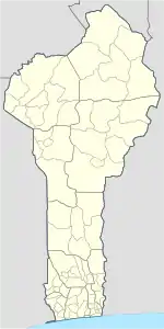
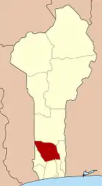
Bohicon
Bohicon is a city in Benin, and a conurbation of Abomey lying 9 kilometres east of the city on the railway line from Cotonou to Parakou and on Benin's main highway RNIE 2 which joins the RNIE 4. The commune covers an area of 139 square kilometres and as of 2002 had a population of 113,091 people.[1][2]
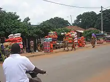
Bohicon traders of textiles such as cushions and matresses
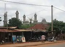
Bohicon Mosque
Bohicon | |
|---|---|
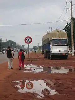 Road leading into Bohicon from the south | |
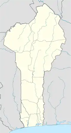 Bohicon Location in Benin | |
| Coordinates: 7°12′N 2°04′E | |
| Country | |
| Department | Zou Department |
| Area | |
| • Total | 44 km2 (17 sq mi) |
| Elevation | 167 m (548 ft) |
| Population (2012) | |
| • Total | 149,271 |
| • Density | 3,400/km2 (8,800/sq mi) |
| Time zone | UTC+1 (WAT) |
A speciality sold in the market is afitin (soy dawa-dawa/soy iru), which is traditionally and somewhat famously in Benin made by women in the region. It is a protein-rich fermented food widely used in West Africa as a seasoning.
Climate
| Climate data for Bohicon (1961–1990) | |||||||||||||
|---|---|---|---|---|---|---|---|---|---|---|---|---|---|
| Month | Jan | Feb | Mar | Apr | May | Jun | Jul | Aug | Sep | Oct | Nov | Dec | Year |
| Record high °C (°F) | 36.7 (98.1) |
37.8 (100.0) |
37.7 (99.9) |
36.5 (97.7) |
34.9 (94.8) |
33.5 (92.3) |
31.7 (89.1) |
31.8 (89.2) |
32.9 (91.2) |
33.9 (93.0) |
35.3 (95.5) |
35.4 (95.7) |
37.8 (100.0) |
| Average high °C (°F) | 34.4 (93.9) |
35.8 (96.4) |
35.2 (95.4) |
33.8 (92.8) |
32.4 (90.3) |
30.7 (87.3) |
29.3 (84.7) |
29.1 (84.4) |
30.2 (86.4) |
31.7 (89.1) |
33.8 (92.8) |
33.8 (92.8) |
32.5 (90.5) |
| Daily mean °C (°F) | 28.4 (83.1) |
29.7 (85.5) |
29.5 (85.1) |
28.7 (83.7) |
27.8 (82.0) |
26.4 (79.5) |
25.5 (77.9) |
25.3 (77.5) |
26.0 (78.8) |
27.0 (80.6) |
28.4 (83.1) |
28.1 (82.6) |
27.6 (81.7) |
| Average low °C (°F) | 22.4 (72.3) |
23.6 (74.5) |
23.9 (75.0) |
23.6 (74.5) |
23.1 (73.6) |
22.2 (72.0) |
21.8 (71.2) |
21.5 (70.7) |
21.7 (71.1) |
22.2 (72.0) |
22.9 (73.2) |
22.4 (72.3) |
22.6 (72.7) |
| Record low °C (°F) | 19.2 (66.6) |
21.0 (69.8) |
21.0 (69.8) |
20.9 (69.6) |
20.6 (69.1) |
20.2 (68.4) |
20.1 (68.2) |
20.3 (68.5) |
20.3 (68.5) |
20.3 (68.5) |
20.7 (69.3) |
19.0 (66.2) |
19.0 (66.2) |
| Average precipitation mm (inches) | 3.6 (0.14) |
28.3 (1.11) |
74.9 (2.95) |
127.3 (5.01) |
153.2 (6.03) |
175.0 (6.89) |
142.2 (5.60) |
112.4 (4.43) |
140.0 (5.51) |
118.8 (4.68) |
22.3 (0.88) |
14.4 (0.57) |
1,112.4 (43.80) |
| Average precipitation days (≥ 1.0 mm) | 1 | 2 | 5 | 9 | 10 | 12 | 9 | 8 | 9 | 9 | 2 | 1 | 77 |
| Mean monthly sunshine hours | 210.8 | 201.6 | 204.6 | 204.0 | 210.8 | 171.0 | 114.7 | 96.1 | 123.0 | 195.3 | 231.0 | 213.9 | 2,176.8 |
| Mean daily sunshine hours | 6.8 | 7.2 | 6.6 | 6.8 | 6.8 | 5.7 | 3.7 | 3.1 | 4.1 | 6.3 | 7.7 | 6.9 | 6.0 |
| Source: NOAA[3] | |||||||||||||
Administration
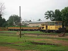
Bohicon Railway Station
Bohicon is one of the 77 official Communes of Benin. The city is located 9 kilometres from Abomey but the commune is divided into arrondissements:
- Bohicon 1
- Bohicon 2
- Sdohomé
- Saclo
- Passangon
- Ouassaho
- Lissezoun
- Gnidjazoun
- Avogbana
- Agongointo
Notable landmarks
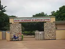
Lycée Technique de Bohicon
- Lycée Technique de Bohicon (LYTEB)
- Collège Monseigneur Steinmetz
- Bohicon Railway Station
- Parc Archeologique d'Agongointo
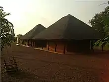
Entrance to the Parc Archéologique d'Agongointo
Notable people
- Nicéphore Dieu-Donné Soglo - former President of Benin
- Hubert Maga - Born in Parakou but studied in Bohicon.
- Abraham Zinzindohoue - former Benin Minister of Justice
- Ben La Desh - Musician from Rotterdam but born in Bohicon.
References
- "Bohicon". Atlas Monographique des Communes du Bénin. Retrieved January 5, 2010.
- "Communes of Benin". Statoids. Archived from the original on April 30, 2012. Retrieved January 5, 2010.
- "Bohicon Climate Normals 1961–1990". National Oceanic and Atmospheric Administration. Retrieved January 13, 2015.
External links
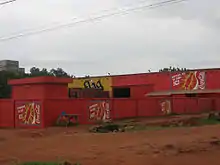
Globalisation evident in Bohicon with heavy Coca-Cola advertising
| Wikimedia Commons has media related to Bohicon. |
This article is issued from Wikipedia. The text is licensed under Creative Commons - Attribution - Sharealike. Additional terms may apply for the media files.