Bondurant, Wyoming
Bondurant is a census-designated place (CDP) in Sublette County, Wyoming, United States. The population was 93 at the 2010 census. The town was named after B. F. Bondurant.
Bondurant, Wyoming | |
|---|---|
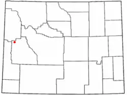 Location of Bondurant, Wyoming | |
 Bondurant, Wyoming Location in the United States | |
| Coordinates: 43°11′8″N 110°23′11″W | |
| Country | United States |
| State | Wyoming |
| County | Sublette |
| Area | |
| • Total | 52.8 sq mi (137 km2) |
| • Land | 52.8 sq mi (137 km2) |
| • Water | 0.0 sq mi (0 km2) |
| Elevation | 6,611 ft (2,015 m) |
| Population | |
| • Total | 93 |
| • Density | 1.8/sq mi (0.68/km2) |
| Time zone | UTC−7 (Mountain (MST)) |
| • Summer (DST) | UTC−6 (MDT) |
| ZIP code | 82922 |
| Area code(s) | 307 |
| FIPS code | 56-08365[2] |
| GNIS feature ID | 1598291[3] |
Demographics
As of the census[2] of 2000, there were 155 people, 75 households, and 45 families residing in the CDP. The population density was 2.0 people per square mile (0.8/km2). There were 128 housing units at an average density of 1.6/sq mi (0.6/km2). The racial makeup of the CDP was 98.06% White, 1.94% from other races. Hispanic or Latino of any race were 4.52% of the population.
There were 75 households, out of which 18.7% had children under the age of 18 living with them, 54.7% were married couples living together, and 38.7% were non-families. 32.0% of all households were made up of individuals, and 10.7% had someone living alone who was 65 years of age or older. The average household size was 2.07 and the average family size was 2.54.
In the CDP, the population was spread out, with 14.8% under the age of 18, 7.7% from 18 to 24, 28.4% from 25 to 44, 31.6% from 45 to 64, and 17.4% who were 65 years of age or older. The median age was 44 years. For every 100 females, there were 121.4 males. For every 100 females age 18 and over, there were 112.9 males.
The median income for a household in the CDP was $39,063, and the median income for a family was $41,250. Males had a median income of $26,563 versus $23,636 for females. The per capita income for the CDP was $19,432. About 9.5% of families and 19.2% of the population were below the poverty line, including 21.7% of those under the age of eighteen and 19.0% of those 65 or over.
Geography
Bondurant is located at 43°11′8″N 110°23′11″W (43.185600, −110.386251),[4] in the Hoback Basin.
According to the United States Census Bureau, the CDP has a total area of 52.8 square miles (136.7 km2), all land.[5]
Climate
Due to its high elevation, Bondurant experiences a subarctic climate (Köppen Dfc). Winters are long and cold, sometimes severely cold, and snowy, with annual snowfall averaging 129 inches (330 centimeters). Summers are short and warm, sometimes hot. Precipitation is heaviest in winter, but fairly even throughout the year. Bondurant is the coldest town in the state of Wyoming and one of the coldest in the Contiguous US with a yearly mean temperature of only 32.7 °F (0.4 °C). Freezes occur regularly year round, even during summer, so crop growth is difficult within Bondurant. Snowfalls have been recorded during every month of the year, and consistent on and between the dates September 12 and June 2.[6]
| Climate data for Bondurant, Wyoming | |||||||||||||
|---|---|---|---|---|---|---|---|---|---|---|---|---|---|
| Month | Jan | Feb | Mar | Apr | May | Jun | Jul | Aug | Sep | Oct | Nov | Dec | Year |
| Record high °F (°C) | 46 (8) |
54 (12) |
65 (18) |
77 (25) |
85 (29) |
89 (32) |
95 (35) |
93 (34) |
89 (32) |
79 (26) |
66 (19) |
49 (9) |
95 (35) |
| Average high °F (°C) | 22.4 (−5.3) |
27.9 (−2.3) |
36.8 (2.7) |
46.3 (7.9) |
59.7 (15.4) |
69.4 (20.8) |
77.4 (25.2) |
76.7 (24.8) |
67.3 (19.6) |
54.4 (12.4) |
35.7 (2.1) |
22.3 (−5.4) |
49.7 (9.8) |
| Daily mean °F (°C) | 8.1 (−13.3) |
12.1 (−11.1) |
21.3 (−5.9) |
32.5 (0.3) |
44.2 (6.8) |
50.8 (10.4) |
56.4 (13.6) |
55.2 (12.9) |
46.5 (8.1) |
35.6 (2.0) |
21.4 (−5.9) |
8.0 (−13.3) |
32.7 (0.4) |
| Average low °F (°C) | −6.2 (−21.2) |
−3.8 (−19.9) |
5.7 (−14.6) |
18.6 (−7.4) |
28.6 (−1.9) |
32.1 (0.1) |
35.3 (1.8) |
33.7 (0.9) |
25.6 (−3.6) |
16.8 (−8.4) |
7.1 (−13.8) |
−6.4 (−21.3) |
15.6 (−9.1) |
| Record low °F (°C) | −56 (−49) |
−57 (−49) |
−39 (−39) |
−23 (−31) |
7 (−14) |
13 (−11) |
18 (−8) |
12 (−11) |
3 (−16) |
−14 (−26) |
−39 (−39) |
−51 (−46) |
−57 (−49) |
| Average precipitation inches (mm) | 2.41 (61) |
1.94 (49) |
1.66 (42) |
1.20 (30) |
1.67 (42) |
1.56 (40) |
1.42 (36) |
1.34 (34) |
1.35 (34) |
1.35 (34) |
2.07 (53) |
2.20 (56) |
20.17 (511) |
| Average snowfall inches (cm) | 29.1 (74) |
21.2 (54) |
16.2 (41) |
5.8 (15) |
1.3 (3.3) |
0.3 (0.76) |
0 (0) |
0 (0) |
0.3 (0.76) |
4.3 (11) |
17.6 (45) |
32.9 (84) |
129 (328.82) |
| Source 1: NOAA (normals, 1971–2000)[7] | |||||||||||||
| Source 2: The Weather Channel (Records)[8] | |||||||||||||
Education
Public education in the community of Bondurant is provided by Sublette County School District #1. Schools serving the community include Bondurant Elementary School (grades K-4), Pinedale Middle School (grades 5–8), and Pinedale High School (grades 9–12).
References
- "2010 City Population and Housing Occupancy Status". U.S. Census Bureau. Retrieved July 13, 2012.
- "U.S. Census website". United States Census Bureau. Retrieved 2008-01-31.
- "US Board on Geographic Names". United States Geological Survey. October 25, 2007. Retrieved January 31, 2008.
- "US Gazetteer files: 2010, 2000, and 1990". United States Census Bureau. February 12, 2011. Retrieved April 23, 2011.
- "2010 Wyoming Place Names". U.S. Census Bureau. Archived from the original on July 4, 2012. Retrieved July 13, 2012.
- Team, National Weather Service Corporate Image Web. "National Weather Service Climate". w2.weather.gov. Retrieved April 25, 2020.
- "Climatography of the United States NO.81" (PDF). National Oceanic and Atmospheric Administration. Archived from the original (PDF) on July 13, 2014. Retrieved January 13, 2011.
- "Monthly Averages for Bondurant, WY". The Weather Channel. Retrieved January 13, 2011.
Municipalities and communities of Sublette County, Wyoming, United States | ||
|---|---|---|
| Towns | 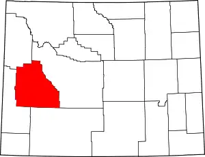 | |
| CDPs | ||
| Unincorporated communities | ||
| Ghost towns | ||
| ||