Bono Region
The Bono region is one of the 16 administrative regions of Ghana. It is as a result of the remainder of Brong-Ahafo region when Bono East region and Ahafo region were created.[3] Sunyani, also known as the green city of Ghana is the regional capital. Sunyani can pride itself as the cleanest capital city and a major conference destination.[4]
Bono Region | |
|---|---|
 Bui Bayou near the border with Savannah Region | |
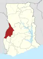 Location of Bono in Ghana | |
| Coordinates: | |
| Country | Ghana |
| Capital | Sunyani |
| Districts | 12 |
| Government | |
| • Regional Minister | Mrs Evelyn Ama Kumi-Richardson [1] |
| Area | |
| • Total | 11,481 km2 (4,433 sq mi) |
| Population (2019)Projection[2] | |
| • Total | 1,082,520 |
| GDP (PPP) | |
| GDP (Nominal) | |
| Time zone | GMT |
Creation of the region
The region was created after Ahafo region and Bono East region respectively have been carved out of the then Brong-Ahafo region. This was in fulfillment of promise made by candidate Nana Akuffo Addo in his 2016 campaign activities. The implementation of plans for the creation of this region is seeded to the newly created Ministry of Regional Reorganization and Development under the leadership of Hon. Dan Botwe. Brong Ahafo Region in effect ceased to exist and so does the Brong Ahafo Region Co-ordinating Council (BARCC).
Consequently, in the spirit of Article 255 of the 1992 constitution and Article 186 of the Local Governance Act, 2016 (Act 936 as Amended), the Bono Regional Co-ordinating Council (BRCC) is a new entity and thus replaces the BARCC. Because of this, it became necessary to inaugurate the BRCC to enable it to perform its functions accordingly.[5]
Municipalities and districts of Bono region
There are about 11 districts in this region[6]

| Districts | Capital | ||
| Banda | Banda Ahenkro | ||
| Berekum East Municipal | Berekum | ||
| Berekum West | Jinijini | ||
| Dormaa Central Municipal | Dormaa-Ahenkro | ||
| Dormaa East | Wamfie | ||
| Dormaa West | Nkrankwanta | ||
| Jaman North | Sampa | ||
| Jaman South Municipal | Drobo | ||
| Sunyani Municipal | Sunyani | ||
| Sunyani West | Odumase | ||
| Tain | Nsawkaw | ||
| Wenchi Municipal | Wenchi |
Vegetation and climate
The topography of this of this area is mainly characterized by a low elevation not exceeding 152 metres above sea level. It has moist semi-deciduous forest and the soil is very fertile. The region produces Cash crops like cashew, timber etc and food crops such as maize, cassava, plantain, cocoyam, tomatoes and many others.[4]
Location and size
Bono Region shares a border at the north with the Savannah Region, is bordered on the west by Ghana-Cote d’Ivoire international border, on the east by Bono East, and on the south by Ahafo Region.
It has a population of about 1,082,520 according to Ghana statistical service in 2019 census.[7]
Tourism and parks
- Bui National Park, which is 1,821-kilometer square and covers part of the Black Volta River, is endowed with several species of antelopes and a variety of birds. It is also known for its hippopotamus population. The tourist can take a cruise on the Black Volta River through the National Park.
- Bui Dam, located at the base of the Banda Mountains, was built to improve Ghana's energy requirements.[4]
- Duasidan Monkey Sanctuary, located 10km southwest of Dormaa Ahenkro, hosts a rare breed of Mona Monkeys. The tourist is welcomed by the presence of these monkeys as you enter their forest-like abode. Bamboo trees form a canopy in the middle of the forest, which serves as a resting ground for visitors. Monkeys can be seen swinging up and down tree branches and peeling bananas left out for them. The visitor gets a chance to see how monkeys carry their babies on the move.[4]
Education and religion
- The region prides itself on having public institutions such as University of Energy and Natural Resources, Sunyani Technical University, plus many other private educational institutions.
- Bono Ancestral Worship and spirituality and Christianity is the dominant religion within this domain.[8]
Cultural and social life
There are several cultural practices and festivals within this region. Kwafie is celebrated by the Dormaa, Berekum and Nsoatre people in November, December or January, and Munufie by Drobo. They are celebrated to cleanse and feed the stools and gods respectively. It is climaxed with a large bonfire in the palace courtyard. It is believed that the people of Dormaa Ahenkro (Aduana) brought fire to Ghana, hence this legend is symbolically re-enacted. Akwantukese is celebrated by the people of Suma in March.[4]
References
- https://www.gbcghanaonline.com/news/president-akufo-addo-swears-in-ministers-of-bono-and-oti-region/2019/
- Ghana Statistical Service
- "Brong Ahafo to be known as Bono Region". myjoyonline.com.
- WhiteOrange. "Brong Ahafo". Ghana Tourism Authority. Retrieved 31 January 2020.
- Ayibani, Imoro Tebra (29 July 2019). "Ghana: Bono Regional Coordinating Council Inaugurated in Sunyani". allAfrica.com. Retrieved 31 January 2020.
- "The Database – GhanaPlaceNames". Google. Retrieved 31 January 2020.
- "Ghana Statistical Services". statsghana.gov.gh. Retrieved 31 January 2020.
- "REPORT OF THE COMMISSION OF INQUIRY INTO THE CREATION OF NEW REGIONS" presented to His Excellency The President of the Republic of Ghana, Nana Addo Dankwa Akufo-Addo on Tuesday, 26th day of June 2018.
Places adjacent to Bono Region | ||||||||||
|---|---|---|---|---|---|---|---|---|---|---|
| ||||||||||