Booragoon, Western Australia
Booragoon is a southern suburb of Perth, Western Australia, located within the City of Melville.
| Booragoon Perth, Western Australia | |||||||||||||||
|---|---|---|---|---|---|---|---|---|---|---|---|---|---|---|---|
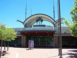 Garden City, Booragoon | |||||||||||||||
 Booragoon | |||||||||||||||
| Coordinates | 32.039°S 115.831°E | ||||||||||||||
| Population | 5,315 (2006 census)[1] | ||||||||||||||
| Established | 1950s | ||||||||||||||
| Postcode(s) | 6154 | ||||||||||||||
| Location | 12 km (7 mi) from the Perth CBD | ||||||||||||||
| LGA(s) | City of Melville | ||||||||||||||
| State electorate(s) | Alfred Cove, Bateman | ||||||||||||||
| Federal Division(s) | Tangney | ||||||||||||||
| |||||||||||||||
Booragoon is the indigenous name for the lower reaches of the Canning River.[2]
It is home to Westfield Booragoon (formerly the Garden City Shopping Centre) and the council offices for the City of Melville. Transport is provided by the nearby Booragoon bus station.
References
- Australian Bureau of Statistics (25 October 2007). "Booragoon (State Suburb)". 2006 Census QuickStats. Retrieved 5 October 2008.
- "Perth suburb names". Landgate. 25 January 2017. Retrieved 20 May 2017.
This article is issued from Wikipedia. The text is licensed under Creative Commons - Attribution - Sharealike. Additional terms may apply for the media files.