Bounoura
Bounoura (Arabic: بونورة) is a town and commune and capital of Bounoura District in Ghardaïa Province, Algeria. According to the 2008 census it has a population of 35,405,[1] up from 27,775 in 1998,[2] with an annual growth rate of 2.5%.[1] It is effectively a suburb of the provincial capital Ghardaïa.
Bounoura
بونورة | |
|---|---|
Commune and town | |
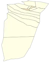 Location of Bounoura commune within Ghardaïa Province | |
 Bounoura Location of Bounoura within Algeria | |
| Coordinates: 32°28′57″N 3°42′13″E | |
| Country | |
| Province | Ghardaïa Province |
| District | Bounoura District |
| Elevation | 493 m (1,617 ft) |
| Population (2008)[1] | |
| • Total | 35,405 |
| Time zone | UTC+1 (CET) |
Geography
Bounoura lies on the banks of the Wadi Mzab, an intermittent river in the M'zab valley, just downstream upstream of Ghardaïa. The area has been listed as a UNESCO World Heritage Site.[3]
Transportation
Bounoura is located on the N1 highway, part of the Trans-Sahara Highway, which leads north to Laghouat and south to El Goléa, In Salah and Tamanrasset.
Education
7.0% of the population has a tertiary education, and another 16.0% has completed secondary education.[4] The overall literacy rate is 86.3%, and is 95.3% among males (the equal highest in the province) and 77.2% among females.[5]
Localities
The commune of Bounoura is composed of five localities:[6]
- Vieux Ksar de Bounane
- Beni Izguen à partir du nouveau lycée et nouveau C.E.M.
- Quartier Sidi Abbaz
- Palmeraies de Bounoura
- Beni Isguen
References
- "Population: Ghardaïa Wilaya" (PDF) (in French). Office National des Statistiques Algérie. Archived from the original (PDF) on 16 May 2013. Retrieved 13 February 2013.
- "Algeria Communes". Statoids. Retrieved 9 March 2013.
- "M'Zab Valley". UNESCO World Heritage Centre. Retrieved 13 February 2013.
- "Structure relative de la population résidente des ménages ordinaires et collectifs âgée de 6 ans et plus selon le niveau d'instruction et la commune de résidence" (PDF) (in French). Office National des Statistiques Algérie. Archived from the original (PDF) on 16 May 2013. Retrieved 13 February 2013.
- "Taux d'analphabétisme et taux d'alphabétisation de la population âgée de 15 ans et plus, selon le sexe et la commune de résidence " (PDF) (in French). Office National des Statistiques Algérie. Archived from the original (PDF) on 16 May 2013. Retrieved 13 February 2013.
- "Décret n° 84-365, fixant la composition, la consistance et les limites territoriale des communes. Wilaya d'El Oued" (PDF) (in French). Journal officiel de la République Algérienne. 19 December 1984. p. 1578. Archived from the original (PDF) on 2 March 2013 or before. Retrieved 2 March 2013. Check date values in:
|archivedate=(help)
Places adjacent to Bounoura | |
|---|---|
.svg.png.webp)
