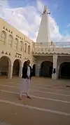
El Guerrara
El Guerrara (Arabic: القرارة) (also written al-Qarārah or Guerara[2]) is a town and commune, coextensive with El Guerrara District, in Ghardaïa Province, Algeria. According to the 2008 census it has a population of 59,514,[1] up from 48,313 in 1998,[2] with an annual growth rate of 2.1%.[1]
El Guerrara
القرارة | |
|---|---|
Commune and town | |
 | |
 Location of El Guerrara commune within Ghardaïa Province | |
 El Guerrara Location of El Guerrara within Algeria | |
| Coordinates: 32°47′25″N 4°29′32″E | |
| Country | |
| Province | Ghardaïa Province |
| District | El Guerrara District (coextensive) |
| Elevation | 310 m (1,020 ft) |
| Population (2008)[1] | |
| • Total | 59,514 |
| Time zone | UTC+1 (CET) |
Climate
El Guerrara has a hot desert climate (Köppen climate classification BWh), with very hot summers and mild winters, and very little precipitation throughout the year.
| Climate data for Berriane | |||||||||||||
|---|---|---|---|---|---|---|---|---|---|---|---|---|---|
| Month | Jan | Feb | Mar | Apr | May | Jun | Jul | Aug | Sep | Oct | Nov | Dec | Year |
| Average high °C (°F) | 16.4 (61.5) |
19.1 (66.4) |
22.4 (72.3) |
27.8 (82.0) |
32.4 (90.3) |
37.9 (100.2) |
42.2 (108.0) |
40.9 (105.6) |
35.0 (95.0) |
27.9 (82.2) |
21.2 (70.2) |
17.1 (62.8) |
28.4 (83.0) |
| Daily mean °C (°F) | 10.3 (50.5) |
12.6 (54.7) |
15.5 (59.9) |
20.1 (68.2) |
24.6 (76.3) |
29.8 (85.6) |
33.5 (92.3) |
32.4 (90.3) |
27.9 (82.2) |
21.2 (70.2) |
15.0 (59.0) |
11.1 (52.0) |
21.2 (70.1) |
| Average low °C (°F) | 4.2 (39.6) |
6.1 (43.0) |
8.7 (47.7) |
12.5 (54.5) |
16.8 (62.2) |
21.8 (71.2) |
24.8 (76.6) |
24.0 (75.2) |
20.9 (69.6) |
14.5 (58.1) |
8.8 (47.8) |
5.1 (41.2) |
14.0 (57.2) |
| Average precipitation mm (inches) | 8 (0.3) |
5 (0.2) |
9 (0.4) |
6 (0.2) |
5 (0.2) |
2 (0.1) |
1 (0.0) |
2 (0.1) |
6 (0.2) |
7 (0.3) |
9 (0.4) |
8 (0.3) |
68 (2.7) |
| Source: climate-data.org[3] | |||||||||||||
Transportation
El Guerrara is on the W33, a regional road between Berriane on the N1 to the west, and the N3 about halfway between Touggourt and Ouargla to the east.
Education
3.9% of the population has a tertiary education (the equal lowest in the province), and another 19.1% has completed secondary education.[4] The overall literacy rate is 82.9%, and is 88.1% among males and 77.5% among females.[5]
Localities
The commune of El Guerrara is composed of three localities:[6]
- Vieux Ksar de El Guerrara
- Quartiers périphériques
- Palmeraie et village socialiste agricole
References
- "Population: Ghardaïa Wilaya" (PDF) (in French). Office National des Statistiques Algérie. Archived from the original (PDF) on 16 May 2013. Retrieved 13 February 2013.
- "Algeria Communes". Statoids. Retrieved 9 March 2013.
- "Climate data for: El Guerrara". climate-data.org. Archived from the original on 14 April 2013. Retrieved 27 March 2013.
- "Structure relative de la population résidente des ménages ordinaires et collectifs âgée de 6 ans et plus selon le niveau d'instruction et la commune de résidence" (PDF) (in French). Office National des Statistiques Algérie. Archived from the original (PDF) on 16 May 2013. Retrieved 13 February 2013.
- "Taux d'analphabétisme et taux d'alphabétisation de la population âgée de 15 ans et plus, selon le sexe et la commune de résidence " (PDF) (in French). Office National des Statistiques Algérie. Archived from the original (PDF) on 16 May 2013. Retrieved 13 February 2013.
- "Décret n° 84-365, fixant la composition, la consistance et les limites territoriale des communes. Wilaya d'El Oued" (PDF) (in French). Journal officiel de la République Algérienne. 19 December 1984. p. 1578. Archived from the original (PDF) on 2 March 2013 or before. Retrieved 2 March 2013. Check date values in:
|archivedate=(help)
Places adjacent to El Guerrara | |
|---|---|
.svg.png.webp)
