Braintree, Vermont
Braintree is a town in Orange County, Vermont, United States created by Vermont charter on August 1, 1781. The population was 1,194 at the 2000 census. Braintree includes the places Braintree Center, Braintree Hill, East Braintree, West Braintree, Peth and Snowsville.
Braintree, Vermont | |
|---|---|
Town | |
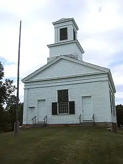 Braintree Meeting House, Braintree, Vermont | |
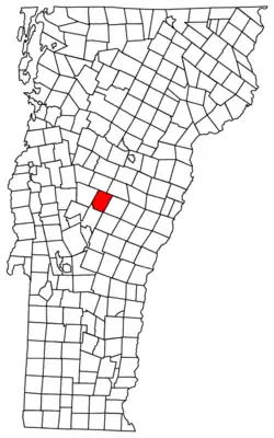 Located in Orange County, Vermont | |
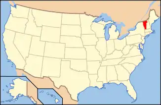 Location of Vermont with the U.S.A. | |
| Coordinates: 43°57′42″N 72°42′18″W | |
| Country | United States |
| State | Vermont |
| County | Orange |
| Chartered | 1781 (Vermont) |
| Communities | Braintree Hill East Braintree West Braintree |
| Area | |
| • Total | 38.3 sq mi (99.3 km2) |
| • Land | 38.3 sq mi (99.2 km2) |
| • Water | 0.04 sq mi (0.1 km2) |
| Elevation | 777 ft (295 m) |
| Population (2000) | |
| • Total | 1,194 |
| • Density | 31.2/sq mi (12.0/km2) |
| • Households | 482 |
| • Families | 325 |
| Time zone | UTC-5 (EST) |
| • Summer (DST) | UTC-4 (EDT) |
| ZIP code | 05060 |
| Area code(s) | 802 |
| FIPS code | 50-07600[1] |
| GNIS feature ID | 1462047[2] |
| Website | braintreevt.com |
Geography
According to the United States Census Bureau, the town has a total area of 38.3 square miles (99.2 km2), of which 38.3 square miles (99.1 km2) is land and 0.04 square mile (0.1 km2) (0.10%) is water.
Demographics
| Historical population | |||
|---|---|---|---|
| Census | Pop. | %± | |
| 1790 | 221 | — | |
| 1800 | 531 | 140.3% | |
| 1810 | 850 | 60.1% | |
| 1820 | 1,033 | 21.5% | |
| 1830 | 1,209 | 17.0% | |
| 1840 | 1,332 | 10.2% | |
| 1850 | 1,228 | −7.8% | |
| 1860 | 1,225 | −0.2% | |
| 1870 | 1,066 | −13.0% | |
| 1880 | 1,051 | −1.4% | |
| 1890 | 854 | −18.7% | |
| 1900 | 776 | −9.1% | |
| 1910 | 760 | −2.1% | |
| 1920 | 707 | −7.0% | |
| 1930 | 635 | −10.2% | |
| 1940 | 648 | 2.0% | |
| 1950 | 626 | −3.4% | |
| 1960 | 536 | −14.4% | |
| 1970 | 751 | 40.1% | |
| 1980 | 1,065 | 41.8% | |
| 1990 | 1,174 | 10.2% | |
| 2000 | 1,194 | 1.7% | |
| 2010 | 1,246 | 4.4% | |
| 2014 (est.) | 1,231 | [3] | −1.2% |
| U.S. Decennial Census[4] | |||
As of the census[1] of 2000, there were 1,194 people, 482 households, and 325 families residing in the town. The population density was 31.2 people per square mile (12.0/km2). There were 567 housing units at an average density of 14.8 per square mile (5.7/km2). The racial makeup of the town was 98.41% White, 0.34% Native American, 0.17% Asian, 0.17% Pacific Islander, 0.25% from other races, and 0.67% from two or more races. Hispanic or Latino of any race were 0.50% of the population.
There were 482 households, out of which 32.8% had children under the age of 18 living with them, 51.9% were married couples living together, 10.4% had a female householder with no husband present, and 32.4% were non-families. 24.7% of all households were made up of individuals, and 11.2% had someone living alone who was 65 years of age or older. The average household size was 2.48 and the average family size was 2.94.
In the town, the population was spread out, with 25.3% under the age of 18, 6.9% from 18 to 24, 28.0% from 25 to 44, 27.3% from 45 to 64, and 12.6% who were 65 years of age or older. The median age was 40 years. For every 100 females, there were 99.3 males. For every 100 females age 18 and over, there were 97.3 males.
The median income for a household in the town was $37,232, and the median income for a family was $45,357. Males had a median income of $30,707 versus $21,411 for females. The per capita income for the town was $16,480. About 2.7% of families and 6.5% of the population were below the poverty line, including 5.2% of those under age 18 and 4.3% of those age 65 or over.
Notable people
- Edwin Flint, Wisconsin State Senator
- Waldo Flint, Wisconsin State Senator
- Jefferson P. Kidder, lawyer, jurist and Lieutenant Governor of Vermont
References
- "U.S. Census website". United States Census Bureau. Retrieved 2008-01-31.
- "US Board on Geographic Names". United States Geological Survey. 2007-10-25. Retrieved 2008-01-31.
- "Annual Estimates of the Resident Population for Incorporated Places: April 1, 2010 to July 1, 2014". Archived from the original on May 23, 2015. Retrieved June 4, 2015.
- "U.S. Decennial Census". United States Census Bureau. Retrieved May 16, 2015.
External links
Municipalities and communities of Orange County, Vermont, United States | ||
|---|---|---|
| Towns | 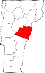 Map of Vermont highlighting Orange County | |
| Villages | ||
| CDPs | ||
| Other communities | ||
| ||