Brendale, Queensland
Brendale is a suburb in the Moreton Bay Region, Queensland, Australia.[2] In the 2016 census, Brendale had a population of 2,758 people.[1]
| Brendale Moreton Bay Region, Queensland | |||||||||||||||
|---|---|---|---|---|---|---|---|---|---|---|---|---|---|---|---|
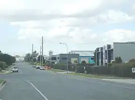
 Strathwyn Street, Brendale, 2008 | |||||||||||||||
 Brendale | |||||||||||||||
| Coordinates | 27.3238°S 152.9813°E | ||||||||||||||
| Population | 2,758 (2016 census)[1] | ||||||||||||||
| • Density | 257.8/km2 (668/sq mi) | ||||||||||||||
| Postcode(s) | 4500 | ||||||||||||||
| Area | 10.7 km2 (4.1 sq mi) | ||||||||||||||
| Time zone | AEST (UTC+10:00) | ||||||||||||||
| Location |
| ||||||||||||||
| LGA(s) | Moreton Bay Region | ||||||||||||||
| State electorate(s) | Pine Rivers | ||||||||||||||
| Federal Division(s) | Dickson | ||||||||||||||
| |||||||||||||||
Geography
Brendale is north of Brisbane, the state capital, located immediately south of Strathpine on the South Pine River.
Brendale is mostly an industrial suburb, although several parks exist within it. It contains a Powerlink 275/110 kV electrical transmission substation called South Pine Substation, as well as a waste treatment plant.[3]
History
The origin of the suburb's name is from the name given to a horse stud established by William (Bill) Bowden in the early 1960s.[2]
In the 2011 census Brendale had a population of 1,847.[4]
In the 2016 census, Brendale had a population of 2,758 people.[1]
Demographics
In the 2011 census, Brendale recorded a population of 1,847 people, 51% female and 49% male.
The median age of the Brendale population was 34 years, 3 years below the national median of 37.
65.3% of people living in Brendale were born in Australia. The other top responses for country of birth were New Zealand 10%, India 3.8%, England 3.5%, Philippines 1.5%, Fiji 0.9%.
83% of people spoke only English at home; the next most common languages were 1.8% Punjabi, 0.9% Tagalog, 0.9% Hindi, 0.8% Shona, 0.8% Japanese.
Education
There are no schools in Brendale. The nearest primary schools are in neighbouring Strathpine, Bald Hills, and Eatons Hill. The nearest secondary schools are in Strathpine, Albany Creek and Bray Park.[5]
References
- Australian Bureau of Statistics (27 June 2017). "Brendale (SSC)". 2016 Census QuickStats. Retrieved 20 October 2018.

- "Brendale – suburb in Moreton Bay Region (entry 45368)". Queensland Place Names. Queensland Government. Retrieved 11 June 2019.
- Moreton Bay Regional Council. "Strathpine - Brendale". Archived from the original on 6 April 2012. Retrieved 8 December 2011.
- Australian Bureau of Statistics (31 October 2012). "Brendale (State Suburb)". 2011 Census QuickStats. Retrieved 29 April 2013.

- "Queensland Globe". State of Queensland. Retrieved 17 August 2019.
External links
| Wikimedia Commons has media related to Brendale, Queensland. |
- "Brendale". Queensland Places. Centre for the Government of Queensland, University of Queensland.