Broadlands, Illinois
Broadlands is a village in Champaign County, Illinois, along the East Branch of the Embarras River. The population was 349 at the 2010 census. Originally owned by the Sullivant family, Broadlands was, at over 70,000 acres (280 km2), one of the world's largest farms in the late 1860s. Broadlands was sold to John T. Alexander in 1866, and it was broken up upon his death in 1876 to pay his creditors.[3]
Broadlands | |
|---|---|
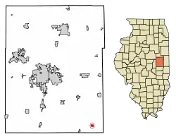 Location of Broadlands in Champaign County, Illinois. Note: Broadlands is the village in the lower right, colored red. | |
.svg.png.webp) Location of Illinois in the United States | |
| Coordinates: 39°54′31″N 87°59′44″W | |
| Country | United States |
| State | Illinois |
| County | Champaign |
| Township | Ayers |
| Area | |
| • Total | 0.32 sq mi (0.84 km2) |
| • Land | 0.32 sq mi (0.84 km2) |
| • Water | 0.00 sq mi (0.00 km2) |
| Elevation | 681 ft (208 m) |
| Population (2010) | |
| • Total | 349 |
| • Estimate (2019)[2] | 337 |
| • Density | 1,046.58/sq mi (403.50/km2) |
| Time zone | UTC-6 (CST) |
| • Summer (DST) | UTC-5 (CDT) |
| Area code(s) | 217 |
| FIPS code | 17-08420 |
| Wikimedia Commons | Broadlands, Illinois |
| Website | http://www.villageofbroadlands.com/ |
Geography
Broadlands is located at 39°54′31″N 87°59′44″W (39.908550, -87.995458).[4]
According to the 2010 census, Broadlands has a total area of 0.33 square miles (0.85 km2), all land.[5]
Demographics
| Historical population | |||
|---|---|---|---|
| Census | Pop. | %± | |
| 1910 | 480 | — | |
| 1920 | 384 | −20.0% | |
| 1930 | 377 | −1.8% | |
| 1940 | 361 | −4.2% | |
| 1950 | 333 | −7.8% | |
| 1960 | 344 | 3.3% | |
| 1970 | 315 | −8.4% | |
| 1980 | 346 | 9.8% | |
| 1990 | 340 | −1.7% | |
| 2000 | 312 | −8.2% | |
| 2010 | 349 | 11.9% | |
| 2019 (est.) | 337 | [2] | −3.4% |
| U.S. Decennial Census[6] | |||
As of the census[7] of 2000, there were 312 people, 119 households, and 86 families residing in the village. The population density was 1,152.7 people per square mile (446.2/km2). There were 133 housing units at an average density of 491.4 per square mile (190.2/km2). The racial makeup of the village was 97.12% White, 0.64% African American, 1.28% Native American, and 0.96% from two or more races.
There were 119 households, out of which 37.8% had children under the age of 18 living with them, 60.5% were married couples living together, 10.9% had a female householder with no husband present, and 26.9% were non-families. 26.1% of all households were made up of individuals, and 16.8% had someone living alone who was 65 years of age or older. The average household size was 2.62 and the average family size was 3.14.
In the village, the population was spread out, with 30.1% under the age of 18, 3.5% from 18 to 24, 30.8% from 25 to 44, 21.5% from 45 to 64, and 14.1% who were 65 years of age or older. The median age was 37 years. For every 100 females, there were 95.0 males. For every 100 females age 18 and over, there were 81.7 males.
The median income for a household in the village was $36,023, and the median income for a family was $37,708. Males had a median income of $35,938 versus $23,472 for females. The per capita income for the village was $15,366. About 5.4% of families and 6.3% of the population were below the poverty line, including 8.8% of those under age 18 and 11.1% of those age 65 or over.
The Village has a restaurant (Lincoln Street Lounge), an insurance agency (Loman-Ray Insurance), a post office, and a lawn care business (BA Lawncare). The Broadlands Fire Department has a new fire station with an upgraded classroom and space for newer vehicles. Additional amenities available to all residents include a choice of three high-speed internet providers and water piped from the Mahomet Aquifer, as compared to the treated well water provided by some other nearby villages.
Elementary and junior high students from Broadlands attend school in Homer, while students in all of Heritage Community School District #8 (Homer, Allerton, Broadlands, Longview) attend the expanded high school in Broadlands.
The Broadlands Community Club holds a homecoming festival each year. The Club typically has events throughout the day for children and adults including a parade, afternoon entertainment, a fish fry and homemade pies.
The Village's official web site is http://www.villageofbroadlands.org
The Village Board now meets monthly, on the first Thursday, at 7 p.m. at Village Hall, 110 S. Lincoln St. Public input is welcomed.
References
- "2019 U.S. Gazetteer Files". United States Census Bureau. Retrieved July 14, 2020.
- "Population and Housing Unit Estimates". United States Census Bureau. May 24, 2020. Retrieved May 27, 2020.
- https://timesmachine.nytimes.com/timesmachine/1876/09/03/81697247.pdf
- "US Gazetteer files: 2010, 2000, and 1990". United States Census Bureau. 2011-02-12. Retrieved 2011-04-23.
- "G001 - Geographic Identifiers - 2010 Census Summary File 1". United States Census Bureau. Archived from the original on 2020-02-13. Retrieved 2015-08-02.
- "Census of Population and Housing". Census.gov. Retrieved June 4, 2015.
- "U.S. Census website". United States Census Bureau. Retrieved 2008-01-31.
External links
- Village of Broadlands Official Web Site
- The New York Times, October 12, 1866
- The New York Times, August 26, 1866
- The New York Times, October 2, 1869
Municipalities and communities of Champaign County, Illinois, United States | ||
|---|---|---|
| Cities | Map of Illinois highlighting Champaign County | |
| Villages | ||
| Townships | ||
| CDPs | ||
| Other unincorporated communities | ||
| Ghost town | ||
| Footnotes | ‡This populated place also has portions in an adjacent county or counties | |
| ||