Sadorus Township, Champaign County, Illinois
Sadorus Township is a township in Champaign County, Illinois, USA. As of the 2010 census, its population was 967 and it contained 437 housing units.[2]
Sadorus Township | |
|---|---|
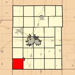 Location in Champaign County | |
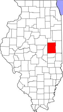 Champaign County's location in Illinois | |
| Coordinates: 39°55′51″N 88°23′49″W | |
| Country | United States |
| State | Illinois |
| County | Champaign |
| Established | November 8, 1859 |
| Area | |
| • Total | 37.95 sq mi (98.3 km2) |
| • Land | 37.9 sq mi (98 km2) |
| • Water | 0.05 sq mi (0.1 km2) 0.13% |
| Elevation | 699 ft (213 m) |
| Population (2010) | |
| • Estimate (2016)[1] | 962 |
| • Density | 25.5/sq mi (9.8/km2) |
| Time zone | UTC-6 (CST) |
| • Summer (DST) | UTC-5 (CDT) |
| FIPS code | 17-019-66547 |
Geography
Sadorus is Township 17 North, Range 7 East of the Third Principal Meridian.
According to the 2010 census, the township has a total area of 37.95 square miles (98.3 km2), of which 37.9 square miles (98 km2) (or 99.87%) is land and 0.05 square miles (0.13 km2) (or 0.13%) is water.[2]
Unincorporated towns
(This list is based on USGS data and may include former settlements.)
Cemeteries
The township contains eight cemeteries: O'Bryan, Old Adkins, Old Cloys, Old Frame, Rice, Rock, Sadorus and Saint Joseph.
References
- "Sadorus Township, Champaign County, Illinois". Geographic Names Information System. United States Geological Survey. Retrieved 2010-01-04.
- United States Census Bureau cartographic boundary files
- "Population and Housing Unit Estimates". Retrieved June 9, 2017.
- "Population, Housing Units, Area, and Density: 2010 - County -- County Subdivision and Place -- 2010 Census Summary File 1". United States Census. Archived from the original on 2020-02-12. Retrieved 2013-05-28.
- "Census of Population and Housing". Census.gov. Retrieved June 4, 2016.
External links
Places adjacent to Sadorus Township, Champaign County, Illinois | |
|---|---|
Municipalities and communities of Champaign County, Illinois, United States | ||
|---|---|---|
| Cities | Map of Illinois highlighting Champaign County | |
| Villages | ||
| Townships | ||
| CDPs | ||
| Other unincorporated communities | ||
| Ghost town | ||
| Footnotes | ‡This populated place also has portions in an adjacent county or counties | |
| ||
This article is issued from Wikipedia. The text is licensed under Creative Commons - Attribution - Sharealike. Additional terms may apply for the media files.