Brownsville, Vermont
Brownsville is an unincorporated community in West Windsor, Vermont, United States. Located on Vermont Route 44, the village houses a number of administrative offices for the town of West Windsor.
Brownsville, Vermont | |
|---|---|
 Brownsville, VT looking west along Route 44 | |
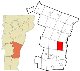 Location in Windsor County and the state of Vermont. | |
 Brownsville, Vermont Location in the United States | |
| Coordinates: 43°28′07″N 72°28′15″W | |
| Country | United States |
| State | Vermont |
| County | Windsor |
| Elevation | 682 ft (208 m) |
| Time zone | UTC-5 (Eastern (EST)) |
| • Summer (DST) | UTC-4 (EDT) |
| ZIP code | 05037 |
| Area code(s) | 802 |
| GNIS feature ID | 1456613[1] |
| Website | www |
History
The village derives its name from two settlers, John and Briant Brown. The West Windsor Historical Society is in Brownsville and has a wealth of information on the sheep farms and industries that sustained the early residents.
Just east of Brownsville is the entrance to Ascutney Mountain Resort, which used to be one of the major ski areas in the state, until it closed for good in 2010 and their ski lifts were sold in August 2014.
Slightly south and west of Brownsville is the 656-acre (2.65 km2) Little Ascutney Wildlife Management Area, a state owned conservation area hosting wildlife such as white-tailed deer, fisher, coyotes, bobcats, beaver and otter.
Home of the Brownsville Society
 View of town and Mt. Ascutney from the cemetery
Covered Bridges
Three of Vermont's covered bridges are nearby – Best's Bridge near Churchill Road and Bowers Bridge, both of which are listed in the National Register of Historic Places. The Twigg bridge on Yale Road was moved to its location by a developer and was heavily damaged by wind in 2002.
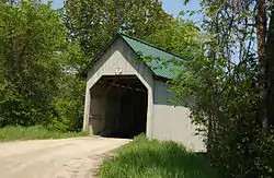 Best's Covered Bridge
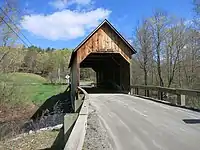 Bowers Covered Bridge
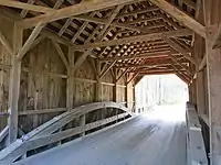 Construction detail of Bowers Bridge
Government
 West Windsor Office Building
 US Post Office on Highway 44
Notes
- U.S. Geological Survey Geographic Names Information System: Brownsville, Vermont. Retrieved on 07-04-2019.
Municipalities and communities of Windsor County, Vermont, United States | ||
|---|---|---|
| Towns | 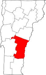 Map of Vermont highlighting Windsor County | |
| Villages | ||
| CDPs | ||
| Other communities | ||
| ||