National Register of Historic Places listings in Windsor County, Vermont
This is a list of the National Register of Historic Places listings in Windsor County, Vermont.
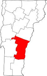
Location of Windsor County in Vermont
This is intended to be a complete list of the properties and districts on the National Register of Historic Places in Windsor County, Vermont, United States. Latitude and longitude coordinates are provided for many National Register properties and districts; these locations may be seen together in a map.[1]
There are 130 properties and districts listed on the National Register in the county, including 4 National Historic Landmarks.
- This National Park Service list is complete through NPS recent listings posted February 5, 2021.[2]
| Addison - Bennington - Caledonia - Chittenden - Essex - Franklin - Grand Isle - Lamoille - Orange - Orleans - Rutland - Washington - Windham - Windsor |
Current listings
| [3] | Name on the Register[4] | Image | Date listed[5] | Location | City or town | Description |
|---|---|---|---|---|---|---|
| 1 | Abbott Memorial Library | 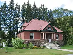 Abbott Memorial Library |
January 6, 2015 (#14001141) |
15 Library St. 43°39′54″N 72°32′21″W |
Pomfret | |
| 2 | Advent Camp Meeting Grounds Historic District | 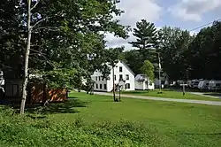 Advent Camp Meeting Grounds Historic District |
September 21, 2017 (#100001656) |
150 Advent Ln. 43°39′40″N 72°18′42″W |
Hartford | |
| 3 | Aiken Stand Complex | 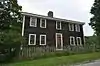 Aiken Stand Complex |
January 27, 1983 (#83003229) |
Jct Royalton Turnpike and Sayer Rd. 43°43′59″N 72°35′25″W |
Barnard | |
| 4 | Ascutney Mill Dam Historic District |  Ascutney Mill Dam Historic District |
January 9, 2007 (#06001236) |
55 and 57 Ascutney St. 43°28′45″N 72°23′44″W |
Windsor | |
| 5 | Ascutney State Park |  Ascutney State Park |
June 14, 2002 (#02000664) |
1826 Back Mountain Rd. 43°26′34″N 72°26′08″W |
Windsor | |
| 6 | Atherton Farmstead |  Atherton Farmstead |
March 1, 2002 (#02000119) |
31 Greenbush Rd. 43°24′52″N 72°32′49″W |
Cavendish | |
| 7 | Beaver Meadow School |  Beaver Meadow School |
June 7, 2013 (#13000374) |
246 Chapel Hill Rd. 43°45′50″N 72°22′19″W |
Norwich | |
| 8 | Beaver Meadow Union Chapel | 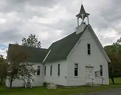 Beaver Meadow Union Chapel |
March 9, 1995 (#95000185) |
Northern side of Beaver Meadow Road 43°45′52″N 72°22′27″W |
Norwich | |
| 9 | Best's Covered Bridge | 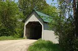 Best's Covered Bridge |
July 2, 1973 (#73000210) |
About 8 mi (13 km) west of Windsor off Vermont Route 44 43°27′19″N 72°30′58″W |
West Windsor | |
| 10 | Bethel Village Historic District | 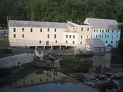 Bethel Village Historic District |
September 3, 1976 (#76000199) |
Both sides of S. Main, Main, N. Main, and Church Sts. • Boundary increase (listed May 24, 1990): Vermont Route 107 across the White River and north to the Central Vermont Railway tracks 43°49′51″N 72°38′02″W |
Bethel | |
| 11 | Black River Academy | 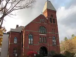 Black River Academy |
November 15, 1972 (#72000108) |
High St. 43°23′47″N 72°41′45″W |
Ludlow | |
| 12 | Augustus and Laura Blaisdell House | 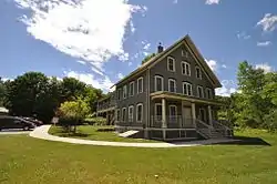 Augustus and Laura Blaisdell House |
January 29, 2014 (#13001132) |
517 Depot St. 43°16′02″N 72°35′24″W |
Chester | |
| 13 | Bowers Covered Bridge | 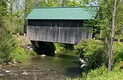 Bowers Covered Bridge |
August 28, 1973 (#73000211) |
Bible Hill Road over Mill Creek 43°27′42″N 72°29′29″W |
West Windsor | Washed off abutments by Hurricane Irene; rebuilt in 2012. |
| 14 | Theron Boyd Homestead | 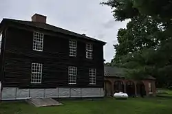 Theron Boyd Homestead |
May 20, 1993 (#93000381) |
Town Highway 6 43°39′08″N 72°26′46″W |
Hartford | |
| 15 | Bridge 15 | 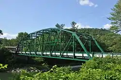 Bridge 15 |
August 19, 2008 (#08000792) |
F.A.S. Highway 177 43°46′55″N 72°27′36″W |
Sharon | |
| 16 | Bridgewater Corners Bridge | 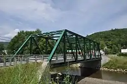 Bridgewater Corners Bridge |
October 29, 1992 (#92001525) |
Vermont Route 100A over the Ottauquechee River 43°35′12″N 72°39′25″W |
Bridgewater | |
| 17 | Bridgewater Woolen Mill | 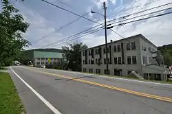 Bridgewater Woolen Mill |
July 6, 1976 (#76002240) |
U.S. Route 4 43°35′13″N 72°37′16″W |
Bridgewater | |
| 18 | Brigham Hill Historic District | March 5, 2020 (#100005025) |
172, 185, 189 & 211 Brigham Hill Rd. 43°44′01″N 72°19′18″W |
Norwich | ||
| 19 | Brook Farm | 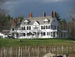 Brook Farm |
July 22, 1993 (#93000676) |
Twenty Mile Stream Rd. northwest of Cavendish 43°26′30″N 72°39′20″W |
Cavendish | |
| 20 | Twing Buckman House | 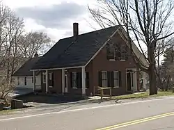 Twing Buckman House |
April 4, 1996 (#96000385) |
U.S. Route 5, approximately 0.25 miles (0.40 km) north of Chase Island 43°28′14″N 72°23′26″W |
Windsor | |
| 21 | Cavendish Universalist Church | 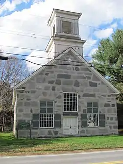 Cavendish Universalist Church |
April 24, 1973 (#73000252) |
Vermont Route 131 43°23′05″N 72°36′22″W |
Cavendish | |
| 22 | Chester Village Historic District | 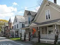 Chester Village Historic District |
August 8, 1985 (#85001739) |
Roughly bounded by Lovers Lane Brook, Maple St., the Williams River, Middle Branch, and Lovers Lane 43°15′54″N 72°36′04″W |
Chester | |
| 23 | Christian Street Rural Historic District | 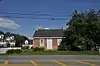 Christian Street Rural Historic District |
December 5, 2003 (#03001248) |
Christian St., Hemlock Ridge Dr., and Jericho St. 43°41′29″N 72°19′12″W |
Hartford | |
| 24 | Congregational Church of Ludlow | 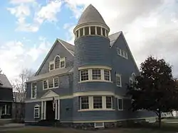 Congregational Church of Ludlow |
January 28, 2004 (#03001541) |
48 Pleasant St. 43°23′43″N 72°41′50″W |
Ludlow | |
| 25 | Coolidge State Park | 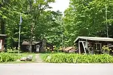 Coolidge State Park |
March 29, 2002 (#02000281) |
855 Coolidge State Park Rd. 43°33′08″N 72°41′39″W |
Plymouth | |
| 26 | Calvin Coolidge Homestead District | 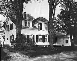 Calvin Coolidge Homestead District |
October 15, 1966 (#66000794) |
Off Vermont Route 100A 43°32′14″N 72°43′28″W |
Plymouth Notch | President Calvin Coolidge's birthplace and family home. |
| 27 | Cornish-Windsor Covered Bridge | 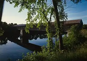 Cornish-Windsor Covered Bridge |
November 21, 1976 (#76000135) |
West of Cornish City 43°28′26″N 72°23′01″W |
Windsor | Extends into Cornish in Sullivan County, New Hampshire |
| 28 | Rev. George Daman House | 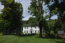 Rev. George Daman House |
June 22, 1989 (#89000759) |
Wyman Ln. 43°36′29″N 72°33′42″W |
Woodstock | |
| 29 | Damon Hall | 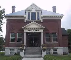 Damon Hall |
June 2, 1988 (#88000654) |
U.S. Route 5 and Vermont Route 12 43°32′29″N 72°24′01″W |
Hartland | |
| 30 | Dewey House | 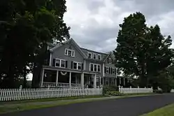 Dewey House |
August 27, 1999 (#99001051) |
173 Deweys Mills Rd. 43°38′30″N 72°24′19″W |
Hartford | |
| 31 | Wentworth and Diana Eldredge House | February 5, 2021 (#100006133) |
Address Restricted |
Norwich | ||
| 32 | Ezekiel Emerson Farm | 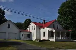 Ezekiel Emerson Farm |
November 29, 2001 (#01001284) |
Vermont Route 73 43°51′23″N 72°49′21″W |
Rochester | |
| 33 | Eureka Schoolhouse | 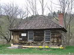 Eureka Schoolhouse |
March 11, 1971 (#71000074) |
470 Charlestown Rd. 43°16′12″N 72°26′52″W |
Goulds Mill | |
| 34 | Joseph Fessenden House | 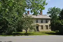 Joseph Fessenden House |
September 6, 2002 (#02000953) |
58 Bridge St. 43°48′54″N 72°32′50″W |
Royalton | |
| 35 | Fire District No. 2 Firehouse | 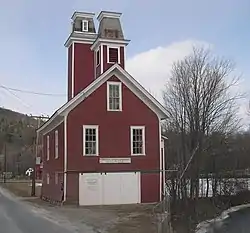 Fire District No. 2 Firehouse |
March 16, 2020 (#100005063) |
716 Depot St. 43°16′12″N 72°35′22″W |
Chester | |
| 36 | Fletcher-Fullerton Farm | 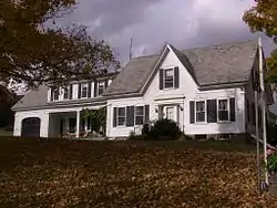 Fletcher-Fullerton Farm |
November 4, 2004 (#04001215) |
1390 Fletcher Schoolhouse Road 43°34′08″N 72°33′35″W |
Woodstock | |
| 37 | Fowler-Steele House | 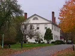 Fowler-Steele House |
June 17, 1982 (#82001710) |
N. Main St. 43°29′24″N 72°23′10″W |
Windsor | |
| 38 | Fox Stand | 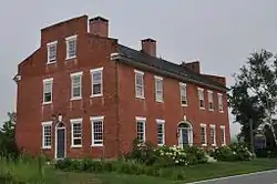 Fox Stand |
July 23, 2015 (#15000477) |
5615 VT 14 43°49′24″N 72°33′52″W |
Royalton | |
| 39 | Gate of the Hills | 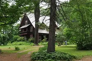 Gate of the Hills |
November 18, 1991 (#91001648) |
Junction of North and Royalton Hill Rds. 43°49′15″N 72°37′50″W |
Bethel | |
| 40 | Daniel Gay House | 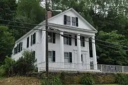 Daniel Gay House |
January 9, 1978 (#78000252) |
Vermont Route 107 43°46′42″N 72°41′52″W |
Stockbridge | Now the Belcher Library |
| 41 | Gilbert's Hill | 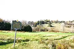 Gilbert's Hill |
March 18, 2019 (#100003524) |
1362 Barnard Rd. 43°38′50″N 72°32′21″W |
Woodstock | |
| 42 | Gilead Brook Bridge |  Gilead Brook Bridge |
October 11, 1990 (#90001492) |
Vermont Route 12 over Gilead Brook 43°52′25″N 72°38′52″W |
Bethel | |
| 43 | Glimmerstone | 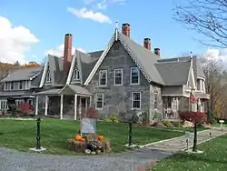 Glimmerstone |
November 14, 1978 (#78000253) |
Vermont Route 131 43°22′58″N 72°36′48″W |
Cavendish | |
| 44 | Goodrich Four Corners Historic District | June 26, 2019 (#100004111) |
929-987 Union Village, 18 Pattrell & 694 Goodrich Four Corners Rds. 43°45′19″N 72°16′43″W |
Norwich | ||
| 45 | Gould's Mill Bridge | 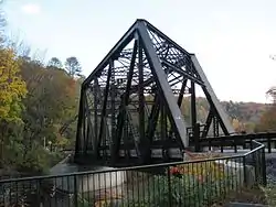 Gould's Mill Bridge |
February 1, 2006 (#05001589) |
Town Hwy. 66 (Paddock Rd.) over the Black River 43°16′22″N 72°27′16″W |
Springfield | |
| 46 | Greenwood House | 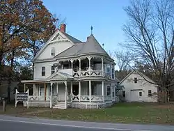 Greenwood House |
October 31, 1985 (#85003442) |
Vermont Route 103 43°15′28″N 72°35′14″W |
Chester | |
| 47 | Harrington House | 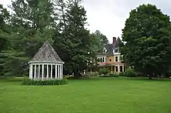 Harrington House |
March 16, 1983 (#83003230) |
River St. and Vermont Route 107 43°49′17″N 72°37′56″W |
Bethel | |
| 48 | Hartford Library | 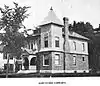 Hartford Library |
December 9, 1994 (#94001447) |
1587 Maple St. 43°39′41″N 72°20′35″W |
Hartford | |
| 49 | Hartford Village Historic District | 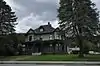 Hartford Village Historic District |
September 3, 1998 (#98001153) |
Roughly along Hartford Main, Summer and Christian Sts. 43°39′45″N 72°20′23″W |
Hartford | |
| 50 | Hartness House | 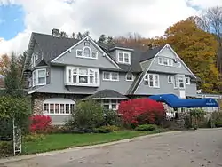 Hartness House |
December 20, 1978 (#78000254) |
30 Orchard St. 43°18′05″N 72°28′39″W |
Springfield | |
| 51 | Historic Crown Point Road | 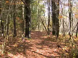 Historic Crown Point Road |
December 2, 1974 (#74000270) |
Off Vermont Route 131 43°23′29″N 72°30′12″W |
Weathersfield | The Crown Point Road spanned about a hundred miles when originally built. |
| 52 | Indian Stones | 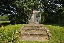 Indian Stones |
November 20, 1974 (#74000356) |
Vermont Route 106 43°26′47″N 72°32′07″W |
Reading | |
| 53 | Iron Bridge at Howard Hill Road | 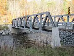 Iron Bridge at Howard Hill Road |
September 9, 1982 (#82001711) |
Howard Hill Rd. and Vermont Route 131 43°24′16″N 72°34′32″W |
Cavendish | The original 1890 structure was replaced in 2007 by the bridge in photo. |
| 54 | Jeffrey House | 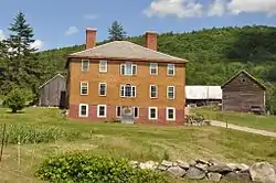 Jeffrey House |
June 13, 1974 (#74000271) |
North St. 43°16′44″N 72°35′51″W |
Chester | |
| 55 | Jericho Rural Historic District |  Jericho Rural Historic District |
November 8, 2001 (#01001228) |
Jericho St., Jericho Rd., Wallace Rd., Sugartop Rd., Joshua Rd. 43°42′17″N 72°22′32″W |
Hartford | |
| 56 | Wales N. Johnson House | 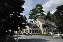 Wales N. Johnson House |
November 7, 1995 (#95001258) |
43 Senior Ln. 43°36′44″N 72°33′00″W |
Woodstock | Now the Jackson House Inn. |
| 57 | Juniper Hill Farm-Maxwell Evarts House |  Juniper Hill Farm-Maxwell Evarts House |
July 14, 1988 (#88001044) |
Juniper Hill Rd. 43°29′31″N 72°23′45″W |
Windsor | |
| 58 | Kendron Brook Bridge |  Kendron Brook Bridge |
August 27, 1992 (#92001037) |
Town Highway 65 (Densmore Hill Road) over Kendron Brook 43°34′53″N 72°30′55″W |
Woodstock | |
| 59 | The King Farm | 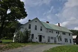 The King Farm |
January 31, 1997 (#97000026) |
King Farm Rd., 0.5 miles (0.80 km) north of its junction with U.S. Route 4 43°37′23″N 72°32′41″W |
Woodstock | |
| 60 | Lincoln Covered Bridge | 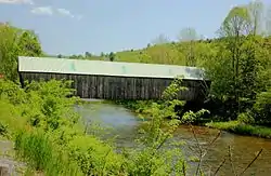 Lincoln Covered Bridge |
August 28, 1973 (#73000212) |
Southwest of Woodstock off U.S. Route 4 43°36′02″N 72°34′10″W |
Woodstock | |
| 61 | Lockwood-Boynton House | 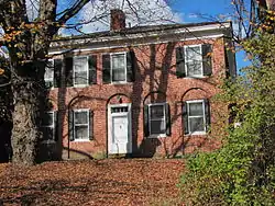 Lockwood-Boynton House |
May 4, 1982 (#82001712) |
1 School St. 43°19′59″N 72°31′36″W |
North Springfield | |
| 62 | Locust Creek House Complex | 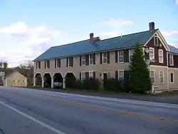 Locust Creek House Complex |
December 10, 1982 (#82001766) |
Vermont Route 12 43°48′32″N 72°39′04″W |
Bethel | |
| 63 | Ludlow Graded School | 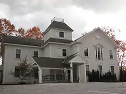 Ludlow Graded School |
November 29, 1979 (#79000276) |
High St. 43°23′48″N 72°41′52″W |
Ludlow | |
| 64 | Ludlow Village Historic District | 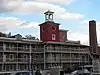 Ludlow Village Historic District |
January 9, 2007 (#06001235) |
Main St., Depot St. 43°23′53″N 72°41′59″W |
Ludlow | |
| 65 | Maple Hill Farm | March 16, 2020 (#100005062) |
65 Maple Hill Rd. 43°44′06″N 72°18′04″W |
Norwich | ||
| 66 | Charles Marsh Law Office | 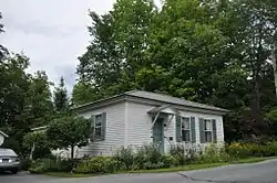 Charles Marsh Law Office |
December 9, 1994 (#94001449) |
72 Pleasant St. 43°37′36″N 72°30′23″W |
Woodstock | |
| 67 | George Perkins Marsh Boyhood Home | 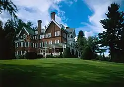 George Perkins Marsh Boyhood Home |
June 11, 1967 (#67000023) |
54 Elm St. 43°37′51″N 72°31′11″W |
Woodstock | Boyhood home of George Perkins Marsh, an American diplomat and philologist, an early environmentalist. Now in the Marsh-Billings-Rockefeller National Historical Park. |
| 68 | Joseph and Daniel Marsh House | 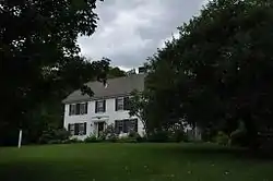 Joseph and Daniel Marsh House |
September 3, 1998 (#98001149) |
1119 Quechee Main Street 43°38′55″N 72°24′27″W |
Hartford | Now the Quechee Inn. |
| 69 | Marsh-Billings-Rockefeller National Historical Park | Marsh-Billings-Rockefeller National Historical Park |
August 26, 1992 (#03000282) |
Vermont Route 12 43°38′00″N 72°31′16″W |
Woodstock | Updated listing August 15, 2016. |
| 70 | Martin's Mill Covered Bridge | 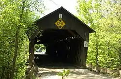 Martin's Mill Covered Bridge |
August 28, 1973 (#73000213) |
South of Hartland off U.S. Route 5 43°31′56″N 72°23′47″W |
Hartland | |
| 71 | McKenstry Manor | 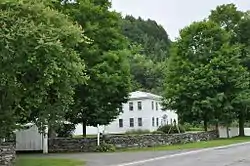 McKenstry Manor |
December 1, 1978 (#78000255) |
North of Bethel on Vermont Route 12 43°52′00″N 72°39′11″W |
Bethel | |
| 72 | Meeting House Farm | March 16, 2020 (#100005061) |
128 Union Village Rd. 43°43′42″N 72°18′36″W |
Norwich | ||
| 73 | Owen Moon Farm | 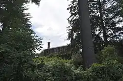 Owen Moon Farm |
January 27, 1983 (#83003231) |
South of South Woodstock off Vermont Route 106 43°33′18″N 72°31′59″W |
South Woodstock | |
| 74 | Gen. Lewis R. Morris House | 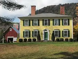 Gen. Lewis R. Morris House |
June 25, 1992 (#92000813) |
456 Old Connecticut River Rd. 43°17′23″N 72°24′37″W |
Springfield | |
| 75 | NAMCO Block | 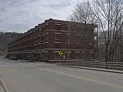 NAMCO Block |
November 14, 1991 (#91001615) |
1-17 Union St. 43°28′32″N 72°23′23″W |
Windsor | |
| 76 | Norwich Mid-Century Modern Historic District | 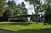 Norwich Mid-Century Modern Historic District |
June 25, 2018 (#100002604) |
Parts of Hopson, Pine Tree & Spring Pond Rds. 43°42′42″N 72°19′03″W |
Norwich | |
| 77 | Norwich Village Historic District | 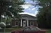 Norwich Village Historic District |
January 3, 1991 (#90002116) |
Main St. from south of Elm St. to Turnpike Rd. and adjacent portions of Elm, Church, Mechanic, Hazen and Cliff Sts. 43°42′56″N 72°18′38″W |
Norwich | |
| 78 | Old Christ Church | 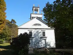 Old Christ Church |
March 6, 2008 (#08000159) |
Junction of Vermont Route 12 and Gilead Brook Rd. 43°52′30″N 72°38′51″W |
Bethel | |
| 79 | Old Constitution House | 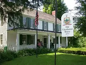 Old Constitution House |
March 11, 1971 (#71000075) |
16 N. Main St. 43°29′03″N 72°23′08″W |
Windsor | |
| 80 | Ottauquechee River Bridge | 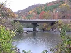 Ottauquechee River Bridge |
October 11, 1990 (#90001491) |
U.S. Route 5 over the Ottauquechee River 43°36′09″N 72°21′17″W |
Hartland | |
| 81 | Park Street School | October 7, 2020 (#100005653) |
60 Park St. 43°17′57″N 72°29′07″W |
Springfield | ||
| 82 | Parker Hill Rural Historic District |  Parker Hill Rural Historic District |
May 20, 1993 (#93000431) |
Parker Hill and Lower Parker Hill Rds. 43°13′25″N 72°28′46″W |
Springfield | Extends into Windham County |
| 83 | Aaron Jr. and Susan Parker Farm |  Aaron Jr. and Susan Parker Farm |
September 24, 2014 (#14000405) |
1715 Brook Road 43°25′11″N 72°36′36″W |
Cavendish | |
| 84 | Plymouth Historic District | 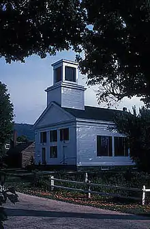 Plymouth Historic District |
December 12, 1970 (#70000084) |
Vermont Route 100A 43°32′30″N 72°42′51″W |
Plymouth | |
| 85 | Pollard Block | 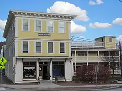 Pollard Block |
August 28, 2008 (#08000855) |
7 Depot St. 43°22′57″N 72°38′18″W |
Cavendish | |
| 86 | Progressive Market | 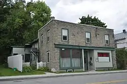 Progressive Market |
July 10, 1995 (#95000814) |
63 S. Main St. 43°38′46″N 72°19′09″W |
Hartford | |
| 87 | Quechee Gorge Bridge | 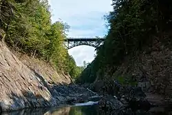 Quechee Gorge Bridge |
October 11, 1990 (#90001490) |
U.S. Route 4 over Quechee Gorge 43°38′16″N 72°24′32″W |
Hartford | |
| 88 | Quechee Historic Mill District | 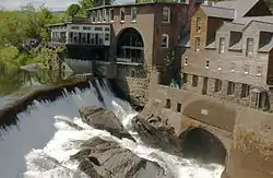 Quechee Historic Mill District |
July 3, 1997 (#97000747) |
Roughly along High, Quechee Main, River, and School Sts., and River, Waterman Hill, Deweys Mill, and Cemetery Rds. 43°38′50″N 72°25′07″W |
Hartford | |
| 89 | Isaac M. Raymond Farm | 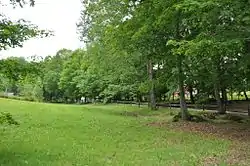 Isaac M. Raymond Farm |
April 1, 1993 (#93000242) |
Junction of Woodstock Town Highways 95 and 18 43°38′57″N 72°33′59″W |
Woodstock | Now called Uphill Farm. |
| 90 | Reading Town Hall | 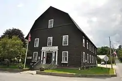 Reading Town Hall |
March 7, 1996 (#96000252) |
Junction of Vermont Route 106 and Pleasant St. 43°27′20″N 72°32′16″W |
Reading | |
| 91 | Robbins and Lawrence Armory and Machine Shop | 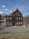 Robbins and Lawrence Armory and Machine Shop |
November 13, 1966 (#66000796) |
S. Main St. 43°28′29″N 72°23′23″W |
Windsor | Erected in 1846, an excellent example of 19th century American industrial architecture, and a site of the development of precision machinery. |
| 92 | Root School | 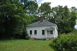 Root School |
June 10, 2013 (#13000375) |
987 Union Village Rd. 43°45′22″N 72°16′37″W |
Norwich | |
| 93 | Royalton Mill Complex | 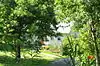 Royalton Mill Complex |
February 3, 1983 (#83003232) |
North of South Royalton on Town Rd. 12 43°49′54″N 72°30′56″W |
South Royalton | |
| 94 | Saddlebow Farm | 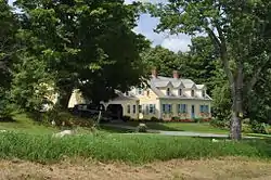 Saddlebow Farm |
November 14, 2002 (#02001345) |
2477 Gold Coast Rd. 43°36′54″N 72°37′19″W |
Bridgewater | |
| 95 | St. Pauls's Episcopal Church | 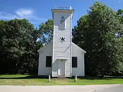 St. Pauls's Episcopal Church |
March 2, 2001 (#01000214) |
Junction of Bridge St. and Vermont Route 14 43°48′55″N 72°32′48″W |
Royalton | |
| 96 | Simons' Inn |  Simons' Inn |
March 2, 1979 (#79000233) |
Southwest of Andover on Vermont Route 11 43°15′28″N 72°43′01″W |
Andover | |
| 97 | Slayton-Morgan Historic District | June 24, 2010 (#91001944) |
Address Restricted |
Woodstock | ||
| 98 | South Reading Schoolhouse | 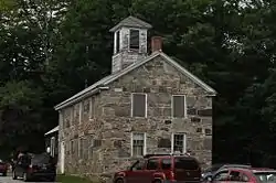 South Reading Schoolhouse |
February 3, 1983 (#83003233) |
Felchville-Tyson's Corner Rd. 43°28′34″N 72°35′41″W |
South Reading | |
| 99 | South Royalton Historic District | 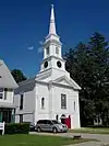 South Royalton Historic District |
September 3, 1976 (#76000200) |
East of Royalton on Vermont Route 14 43°49′17″N 72°31′15″W |
South Royalton | |
| 100 | South Woodstock Village Historic District | 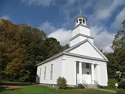 South Woodstock Village Historic District |
August 12, 1982 (#82001713) |
Both sides of Vermont Route 106, Town Highway 61, and Church Hill Rd. 43°33′48″N 72°31′57″W |
Woodstock | |
| 101 | Southview Housing Historic District |  Southview Housing Historic District |
November 8, 2007 (#07001171) |
1-107 Stanley Rd. 43°17′06″N 72°28′35″W |
Springfield | |
| 102 | Spaulding Bridge | 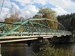 Spaulding Bridge |
January 11, 2006 (#05001522) |
Mill St. 43°22′57″N 72°36′31″W |
Cavendish | |
| 103 | Zachariah Spaulding Farm | 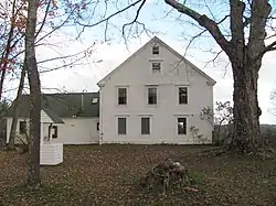 Zachariah Spaulding Farm |
November 4, 1993 (#93001175) |
Town Highway 38 south of the Ludlow town center 43°22′53″N 72°41′29″W |
Ludlow | |
| 104 | Spencer Hollow School | 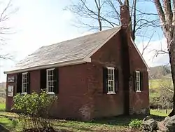 Spencer Hollow School |
September 17, 2012 (#12000803) |
50 Spencer Hollow Rd. 43°17′51″N 72°25′52″W |
Springfield | |
| 105 | Springfield Downtown Historic District | 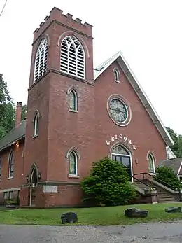 Springfield Downtown Historic District |
August 11, 1983 (#83003234) |
Roughly bounded by the Black River and Mineral, Pearl, Main, and Valley Sts. • Boundary increase (listed September 11, 1986): Roughly the Brookline Apartments on Wall St., Park St., and along the Black River 43°18′04″N 72°29′05″W |
Springfield | |
| 106 | Stellafane Observatory | 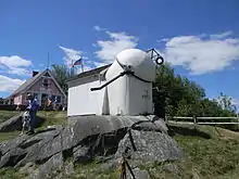 Stellafane Observatory |
November 7, 1977 (#77000107) |
South of North Springfield off Breezy Hill Rd. 43°16′41″N 72°31′10″W |
North Springfield | Contains original clubhouse of the Springfield Telescope Makers, Inc. (1924), and the first large optical telescope (1930) built and owned by that kind of amateur society. |
| 107 | Stockbridge Common Historic District | 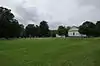 Stockbridge Common Historic District |
May 24, 1990 (#90000800) |
Area around Stockbridge Common, including Maplewood Cemetery 43°47′12″N 72°45′19″W |
Stockbridge | |
| 108 | Stockbridge Four Corners Bridge | 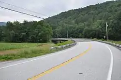 Stockbridge Four Corners Bridge |
November 14, 1991 (#91001611) |
Vermont Route 100 over the White River 43°46′56″N 72°45′30″W |
Stockbridge | Demolished 2009 and replaced by modern bridge. |
| 109 | Walter and Sylvia Stockmayer House | September 23, 2020 (#100005643) |
48 Overlook Dr. 43°43′37″N 72°18′15″W |
Norwich | ||
| 110 | Stone Village Historic District | 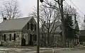 Stone Village Historic District |
May 17, 1974 (#74000329) |
Both sides of Vermont Route 103 43°16′24″N 72°35′35″W |
Chester | |
| 111 | Jedediah Strong II House | 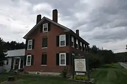 Jedediah Strong II House |
August 13, 1974 (#74000272) |
Quechee Main St. and Dewey's Mills Rd. 43°38′44″N 72°24′02″W |
Hartford | |
| 112 | David Sumner House | 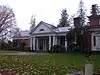 David Sumner House |
March 2, 1989 (#89000027) |
U.S. Route 5 43°32′24″N 72°23′56″W |
Hartland | |
| 113 | Taftsville Covered Bridge | .jpg.webp) Taftsville Covered Bridge |
August 28, 1973 (#73000214) |
East of Woodstock off U.S. Route 4 43°38′23″N 72°28′05″W |
Woodstock | |
| 114 | Taftsville Historic District | 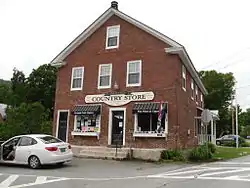 Taftsville Historic District |
August 2, 2001 (#01000824) |
Portions of U.S. Route 4, Upper River Rd., Quechee Main St., all Butternut Ln., Happy Valley Rd., Sugar Hill Rd. 43°37′46″N 72°28′26″W |
Hartford | |
| 115 | Terraces Historic District |  Terraces Historic District |
July 6, 2012 (#12000410) |
22-60 Mapelwood Terr., 2-364 Fairview Terr., 12-249 Hillcrest Terr., 82, 176 Forest Hills Ave. 43°39′01″N 72°19′30″W |
Hartford | |
| 116 | Upper Falls Covered Bridge | 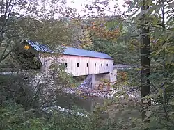 Upper Falls Covered Bridge |
August 28, 1973 (#73000215) |
North of Perkinsville off Vermont Route 131 43°23′55″N 72°31′21″W |
Perkinsville | |
| 117 | Weathersfield Center Historic District | 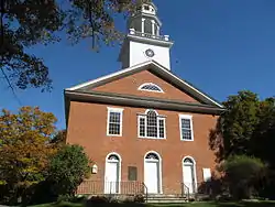 Weathersfield Center Historic District |
June 30, 1980 (#80000345) |
Center Rd. 43°22′43″N 72°28′05″W |
Weathersfield Center | |
| 118 | West Hartford Bridge | 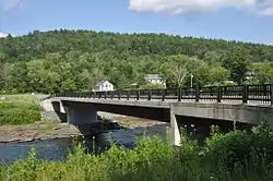 West Hartford Bridge |
October 29, 1992 (#92001524) |
Town Highway 14 at Vermont Route 14 over the White River 43°42′44″N 72°25′06″W |
Hartford | Truss bridge, replaced by modern bridge in 2006. |
| 119 | West Hartford Village Historic District | 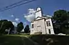 West Hartford Village Historic District |
December 15, 2004 (#04001368) |
Vermont Route 14, Harper Savage Ln., Tigertown Rd., and Stetson Rd. 43°42′59″N 72°24′58″W |
Hartford | |
| 120 | West Woodstock Bridge | 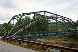 West Woodstock Bridge |
August 27, 1992 (#92001038) |
Town Highway 50 over the Ottauquechee River 43°36′51″N 72°32′36″W |
West Woodstock | |
| 121 | Weston Village Historic District | 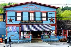 Weston Village Historic District |
August 29, 1985 (#85001934) |
Main, Park, and School Sts., Lawrence Hill, Landgrove, and Trout Club Rds., Mill Lane, and Chester Mountain Rd. 43°17′30″N 72°47′40″W |
Weston | |
| 122 | White River Junction Historic District | 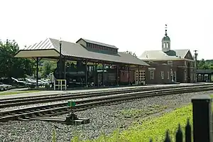 White River Junction Historic District |
August 22, 1980 (#80000390) |
Railroad Row, Main, Currier, Bridge, and Gates Sts.; also N. Main St., S. Main St. Bridge St., Gates St., and Church St.; also Currier St. & Maple St. 43°38′53″N 72°19′09″W |
Hartford | Second and third address lists represent boundary increases approved December 20, 2002 and December 10, 2019 |
| 123 | Wilder Village Historic District | 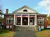 Wilder Village Historic District |
November 22, 1999 (#99001396) |
Portions of Norwich, Passumpsic, and Horseshoe Aves., Chestnut, Gillette, Fern, Hawthorn, Locust and Division Sts. 43°40′30″N 72°18′31″W |
Hartford | |
| 124 | John Wilder House | 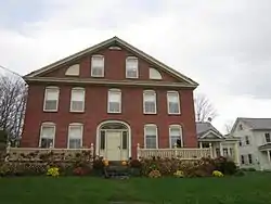 John Wilder House |
November 10, 1983 (#83004231) |
Lawrence Hill Rd. 43°17′32″N 72°47′43″W |
Weston | |
| 125 | Wilgus State Park | 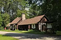 Wilgus State Park |
March 29, 2002 (#02000282) |
3985 U.S. Route 5 43°23′27″N 72°24′38″W |
Weathersfield | |
| 126 | Willard Covered Bridge |  Willard Covered Bridge |
August 28, 1973 (#73000216) |
Mill Rd. across the Ottauquechee River 43°35′37″N 72°21′01″W |
Hartland | |
| 127 | Windsor House | 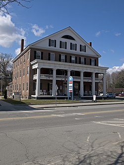 Windsor House |
December 29, 1971 (#71000060) |
N. Main St., north of the junction of Main and State Sts. 43°28′51″N 72°23′11″W |
Windsor | |
| 128 | Windsor Village Historic District | 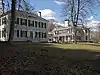 Windsor Village Historic District |
April 23, 1975 (#75000212) |
Area centered around Main, Depot Ave., State St., and Court Sq. • Boundary increase (listed July 25, 1997, refnum 97000828): Along Phelps Ct. and State St. • Boundary increase (listed December 1, 2014, refnum 14001036): Along Main & State Sts., Village Green, Depot Ave., Connecticut R., Paradise Park |
Windsor | Second and third set of addresses represents boundary increases |
| 129 | Woodstock Village Historic District | 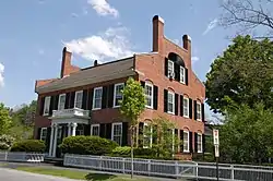 Woodstock Village Historic District |
January 22, 1973 (#73000274) |
Along the Ottauquechee River 43°37′33″N 72°30′59″W |
Woodstock | |
| 130 | Woodstock Warren Through Truss Bridge |  Woodstock Warren Through Truss Bridge |
August 18, 1992 (#92000987) |
Town Highway 24 across the Ottauquechee River 43°36′01″N 72°35′22″W |
Woodstock | Swept away by Hurricane Irene in August 2011 |
See also
| Wikimedia Commons has media related to National Register of Historic Places in Windsor County, Vermont. |
References
- The latitude and longitude information provided in this table was derived originally from the National Register Information System, which has been found to be fairly accurate for about 99% of listings. Some locations in this table may have been corrected to current GPS standards.
- "National Register of Historic Places: Weekly List Actions". National Park Service, United States Department of the Interior. Retrieved on February 5, 2021.
- Numbers represent an alphabetical ordering by significant words. Various colorings, defined here, differentiate National Historic Landmarks and historic districts from other NRHP buildings, structures, sites or objects.
- "National Register Information System". National Register of Historic Places. National Park Service. April 24, 2008.
- The eight-digit number below each date is the number assigned to each location in the National Register Information System database, which can be viewed by clicking the number.
| Topics | |
|---|---|
| Lists by state |
|
| Lists by insular areas | |
| Lists by associated state | |
| Other areas | |
| Related | |
| |
Municipalities and communities of Windsor County, Vermont, United States | ||
|---|---|---|
| Towns | Map of Vermont highlighting Windsor County | |
| Villages | ||
| CDPs | ||
| Other communities | ||
| ||
This article is issued from Wikipedia. The text is licensed under Creative Commons - Attribution - Sharealike. Additional terms may apply for the media files.