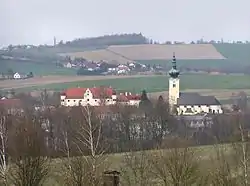
Buchkirchen
Buchkirchen is a municipality in the district of Wels-Land in the Austrian state of Upper Austria.
Buchkirchen | |
|---|---|
 | |
 Coat of arms | |
 Buchkirchen Location within Austria | |
| Coordinates: 48°13′26″N 14°01′12″E | |
| Country | Austria |
| State | Upper Austria |
| District | Wels-Land |
| Government | |
| • Mayor | Regina Rieder (ÖVP) |
| Area | |
| • Total | 32.17 km2 (12.42 sq mi) |
| Elevation | 346 m (1,135 ft) |
| Population (2018-01-01)[2] | |
| • Total | 4,038 |
| • Density | 130/km2 (330/sq mi) |
| Time zone | UTC+1 (CET) |
| • Summer (DST) | UTC+2 (CEST) |
| Postal code | 4611 |
| Area code | 0 72 42 |
| Vehicle registration | WL |
| Website | www.buchkirchen.at |
Geography
Buchkirchen lies in the Hausruckviertel. About 10.9% of the municipality is forest, and 76.9% is farmland.
Neighbouring towns and villages
Places adjacent to Buchkirchen | |
|---|---|

Parts of Buchkirchen
Those parts are called Ortschaften in German:
Buchkirchen, Elend, Ennsberg, Epping, Hörling, Haberfelden, Hartberg, Hochscharten, Holzwiesen, Hundsham, Hupfau, Kandlberg, Lachgraben, Luckermair, Mistelbach bei Wels, Niedergrafing, Niederhocherenz, Niederlaab, Obergrafing, Oberhocherenz, Oberperwend, Oberprisching, Ottenham, Radlach, Öhnerhäuser, Ötzing, Schickenhäuser, Schnadt, Sommerfeld, Spengenedt, Unterholz, Wörist, Wolfsgrub.
History
In 1179 Buchkirchen was mentioned in a document of Pope Alexander III. In those years Buchkirchen was named as "Puechkirchen".
Population
| Year | Pop. | ±% |
|---|---|---|
| 1991 | 3,187 | — |
| 2001 | 3,648 | +14.5% |
Sights
- The church Pfarrkirche Buchkirchen
- The church Filialkirche Mistelbach
- The castle Schloss Mistelbach (Schloss = German for Castle)The castle is now a school called Fachschule ÖKO Wirtschaft und design
References
- "Dauersiedlungsraum der Gemeinden Politischen Bezirke und Bundesländer - Gebietsstand 1.1.2018". Statistics Austria. Retrieved 10 March 2019.
- "Einwohnerzahl 1.1.2018 nach Gemeinden mit Status, Gebietsstand 1.1.2018". Statistics Austria. Retrieved 9 March 2019.
| Wikimedia Commons has media related to Buchkirchen. |
| Authority control |
|---|