Buck Township, Edgar County, Illinois
Buck Township is one of fifteen townships in Edgar County, Illinois, USA. As of the 2010 census, its population was 307 and it contained 145 housing units.[2] Buck Township was originally named Pilot Grove Township, but the name was changed on May 9, 1857.
Buck Township | |
|---|---|
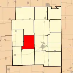 Location in Edgar County | |
 Edgar County's location in Illinois | |
| Coordinates: 39°38′29″N 87°49′36″W | |
| Country | United States |
| State | Illinois |
| County | Edgar |
| Established | November 4, 1856 |
| Area | |
| • Total | 34.29 sq mi (88.8 km2) |
| • Land | 34.29 sq mi (88.8 km2) |
| • Water | 0 sq mi (0 km2) 0% |
| Elevation | 682 ft (208 m) |
| Population (2010) | |
| • Estimate (2016)[1] | 291 |
| • Density | 9/sq mi (3/km2) |
| Time zone | UTC-6 (CST) |
| • Summer (DST) | UTC-5 (CDT) |
| ZIP codes | 61917, 61933, 61944, 61949 |
| FIPS code | 17-045-09213 |
Geography
According to the 2010 census, the township has a total area of 34.29 square miles (88.8 km2), all land.[2]
Cities, towns, villages
Extinct towns
- Mays
Major highways
School districts
- Kansas Community Unit School District 3
- Paris Community Unit School District 4
- Shiloh Community Unit School District 1
Political districts
- Illinois' 15th congressional district
- State House District 109
- State Senate District 55
References
- "Buck Township, Edgar County, Illinois". Geographic Names Information System. United States Geological Survey. Retrieved 2010-01-10.
- United States Census Bureau 2007 TIGER/Line Shapefiles
- United States National Atlas
- "Population and Housing Unit Estimates". Retrieved June 9, 2017.
- "Population, Housing Units, Area, and Density: 2010 - County -- County Subdivision and Place -- 2010 Census Summary File 1". United States Census. Archived from the original on 2020-02-12. Retrieved 2013-05-28.
- "Census of Population and Housing". Census.gov. Retrieved June 4, 2016.
External links
Places adjacent to Buck Township, Edgar County, Illinois | |
|---|---|
Municipalities and communities of Edgar County, Illinois, United States | ||
|---|---|---|
| Cities | Map of Illinois highlighting Edgar County | |
| Villages | ||
| Townships | ||
| Unincorporated communities | ||
| Footnotes | ‡This populated place also has portions in an adjacent county or counties | |
| ||
This article is issued from Wikipedia. The text is licensed under Creative Commons - Attribution - Sharealike. Additional terms may apply for the media files.