Burkau
Burkau (Sorbian: Porchow) is a municipality in the east of Saxony, in the district of Bautzen in Germany.
Burkau | |
|---|---|
Aerial panorama of the village | |
.svg.png.webp) Coat of arms | |
Location of Burkau within Bautzen district  | |
 Burkau 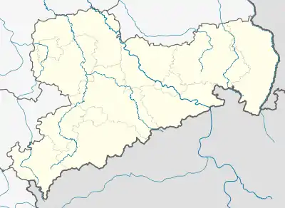 Burkau | |
| Coordinates: 51°11′N 14°11′E | |
| Country | Germany |
| State | Saxony |
| District | Bautzen |
| Subdivisions | 9 |
| Government | |
| • Mayor | Sebastian Hein (CDU) |
| Area | |
| • Total | 31.83 km2 (12.29 sq mi) |
| Elevation | 231 m (758 ft) |
| Population (2019-12-31)[1] | |
| • Total | 2,605 |
| • Density | 82/km2 (210/sq mi) |
| Time zone | UTC+01:00 (CET) |
| • Summer (DST) | UTC+02:00 (CEST) |
| Postal codes | 01906 |
| Dialling codes | 035953 |
| Vehicle registration | BZ, BIW, HY, KM |
| Website | www.gemeinde-burkau.de |
Geography
Burkau is in the northern part of the Bautzen district in a wood rich region in Upper Lusatia. It is about 6 km away - in northern direction - from the city of Bischofswerda and about 16 km - in western direction - from the main city of the district - Bautzen. The inner German motorway A4 between Dresden and Görlitz is near the community and got two direct connections with it. The source of the Klosterwasser/Klóšterska woda is located in territory of Burkau/Porchow. Nearby in the hills of the western Lusatia there is the source of the Schwarze Elster - one of the most important rivers of this region.
History
In 1164 the village of Burkau has been mentioned for the first time in document - other sources say it happened some hundred years later in 1312 - that is why the real age of it is still not known. The administrative community that exists today has been formed in 1994 when three formally independent communities decided to unify - those were "Burkau" (Porchow), "Uhyst am Taucher" (Horni Wujězd) and "Kleinhänchen" (Mały Wosyk) with all their smaller parts: "Auschkowitz" (Wučkecy), Großhänchen" (Wulki Wosyk), "Jiedlitz (Jědlica), "Neuhof" (Nowy Dwór), "Pannewitz" (Panecy) and "Taschendorf" (Ledźborecy).
Sights
The sights of the community are an old manor in Pannewitz, the stone-mill and the "Jiedlitzer Buchholzmühle" in Bocka and the church of Uhyst of the year 1801, now a road church in classic style.
References
- "Bevölkerung des Freistaates Sachsen nach Gemeinden am 31. Dezember 2019". Statistisches Landesamt des Freistaates Sachsen (in German). July 2020.
External links
- Gemeinde Burkau
- Autobahnkirche Uhyst a. T. (motorway-church Uhyst a. T.)
| Authority control |
|---|
