Malvern, Victoria
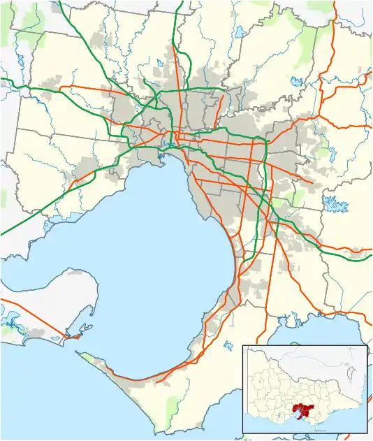
Malvern (/ˈmɔːlvən/) is an inner suburb of Melbourne, Victoria, Australia, 8 km south-east of Melbourne's Central Business District, located within the City of Stonnington local government area. Malvern recorded a population of 10,066 at the 2016 Census.
| Malvern Melbourne, Victoria | |||||||||||||||
|---|---|---|---|---|---|---|---|---|---|---|---|---|---|---|---|
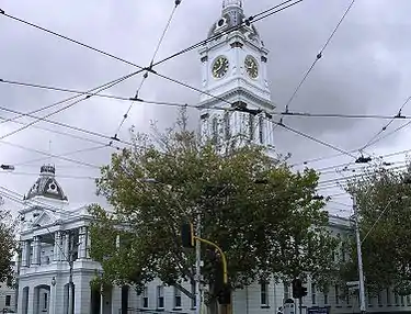 Malvern Town Hall | |||||||||||||||
 Malvern | |||||||||||||||
| Coordinates | 37.857°S 145.036°E | ||||||||||||||
| Population | 10,066 (2016)[1] | ||||||||||||||
| • Density | 3,470/km2 (8,990/sq mi) | ||||||||||||||
| Established | 1835 | ||||||||||||||
| Postcode(s) | 3144 | ||||||||||||||
| Area | 2.9 km2 (1.1 sq mi) | ||||||||||||||
| Location | 8 km (5 mi) from Melbourne | ||||||||||||||
| LGA(s) | City of Stonnington | ||||||||||||||
| State electorate(s) | Malvern | ||||||||||||||
| Federal Division(s) | Higgins | ||||||||||||||
| |||||||||||||||
History
The area of Malvern was first settled by Europeans in 1835.
John Gardiner was one of its first European settlers.[2] A small hamlet known as "Gardiners Creek" (1851 Melbourne Postal Directory) was settled, but it diminished with the gold rush. The nearby creek was also named Gardiners Creek. Gardiners Creek Road (now Toorak Road) ran from South Yarra, east to the junction of Gardiners Creek and onto the Gardiner Homestead, which is now the site of Scotch College.
In the 1860s the Gardiners Creek Roads Board was the forerunner of the Gardiners Creek Shire that then became Malvern Council.
Malvern Post Office opened on 1 January 1860 on Glenferrie Road, near Malvern Road. In 1892 this was renamed Malvern North, when a new Malvern office on Glenferrie Road, near Wattletree Road, replaced the Malvern Railway Station office.[3]
The then shire hall (later town hall) was built in 1886, on the corner of Glenferrie Road and High Street and later extended.
Prahran and Malvern Tramways Trust ran their first car out of Malvern depot on 30 May 1910.
Malvern is the original home of Malvern Star, once Australia's largest and most well-known bicycle manufacturer.[4]
Attractions
The main shopping attraction is Malvern Central, home to David Jones, Woolworths and BWS as well as forty other stores, mostly fashion stores like Cotton On Kids. Glenferrie Rd is also Malvern's main shopping attraction, which has shops like Coles, Dan Murphy's, several bookstores including Readings and Jeffrey's, several banks including NAB, Westpac, Commonwealth Bank, ANZ and Bank Of Melbourne, as well as a wide variety of restaurants, shops and boutiques.
There are several Victorian parks and gardens in Malvern, including Malvern Gardens, in Spring Road. This park has a beautiful fountain which was built on the site of a natural spring. The water used to flow naturally, but as the land was developed, the water feeding the spring was interrupted, and the fountain is now run by electricity.
The Malvern Town Hall, in the Second Empire style, is where the Stonnington City Council meets and is opposite the corporate headquarters known as the Stonnington City Centre.
Significant heritage buildings listed on the Victorian Heritage Register include Stonington mansion (1890), Malvern tram depot, the former ES&A Bank (on the corner of Glenferrie Road and High Street) and the Malvern railway station.
Other significant buildings include St Joseph's Parish Church (Roman Catholic) and De La Salle College tower building. There is also an Anglican Parish Church dedicated to St George and the Malvern Presbyterian Church.
The Malvern Police Station is located at 288 Glenferrie Rd, Malvern VIC 3144 opposite the Council and next to the Town Hall. Its current fleet includes two Toyota Klugers, two Holden VF Commodores, one Holden VF Station Wagon, one Holden VF Divisional Van, one 2018 Holden Colorado Divisional Van and One Holden ZB Station Wagon. Its Sister Station is Prahran Police Station located at 396 Malvern Rd, Prahran VIC 3181
Transport
The Malvern tram depot, located on Glenferrie Road (off Coldbo Rd, Armadale), provides trams for the various routes which service Malvern.
Malvern Train Station is a busy station, on the Frankston, Pakenham and Cranbourne lines, which has four platforms, 3 of which are in full opertation. Its located on Station St, Malvern (off Glenferrie Rd). In addition, Tooronga station also services the northern section of the suburb, on the Glen Waverley line.
Schools
- De La Salle College, Malvern, 1312–1326 High St, with a second campus at 9 Northbrook Avenue, Malvern
- Malvern Primary School, Tooronga Road
- St Joseph's Primary School Malvern, 49 Stanhope St
- Malvern Central School, Spring Road (Year 3–6) And Park St (Prep – Year 2)
Notable citizens
- Norman Banks – radio broadcaster
- Rupert Betheras – former AFL Collingwood footballer, grew up in East Malvern and attended Lloyd Street Central School and De La Salle College, Malvern.
- Andrew Bolt – political commentator
- Andrea Bresciani – Italian-born cartoonist and animator lived in Malvern in his later years and died there in 2006.[5]
- Walter Crawford – first-class cricketer and British colonial official
- Katya Crema – skier cross and Olympian
- John Mark Davies – president of the Victorian Legislative Council from 1910–1919 and original owner of Malvern House (Valentines).
- Jason Donovan – actor and singer
- Robert Doyle – 103rd Lord Mayor of Melbourne, former Member for Malvern and former Leader of the Opposition in the Victorian Legislative Assembly.
- Jack Dyer – captain of Richmond Football Club, attended De La Salle College, Malvern.
- Colin Egar – former Test cricket umpire, born in Malvern in 1928.
- Tom Hafey – Australian rules (VFL) player and coach, Hafey attended Lloyd Street Central School (now Lloyd Street Primary) in East Malvern.
- Harold Holt – 17th Prime Minister of Australia from 1966 – 1967 and the namesake of the Harold Holt Memorial Swimming Centre, a swimming pool complex in neighbouring Glen Iris.
- * Mack Horton – Australian Swimming Champion. 2016 Rio Olympics 400m Gold Medalist, 2018 Gold Coast Commonwealth Games 400m Gold Medalist, 2017 Recipient of The Order of Australia Medal.
- Gertrude Johnson – soprano and founder of the National Theatre, died in Malvern in 1973.
- John Landy – former track and field athlete and the 26th Governor of Victoria. Attended school at Malvern Memorial Grammar School, and trained for his 1957 four-minute mile around Central Park, Malvern.
- Stephanie McIntosh – actor and singer
- Sir Robert Menzies – former Prime Minister of Australia, lived in Haverbrack Avenue, Malvern and has been commemorated in the naming of the Robert Menzies Reserve, bounded by Elizabeth Street, Henderson Avenue and Toorak Road in Malvern.
- Hubert Opperman – cyclist and politician, who was once employed by Malvern Star Cycles, a tiny cycle shop in Malvern.
- Lydia Schiavello – cast member of reality television series The Real Housewives of Melbourne.
- Bruce Small – businessman and former owner of bicycle manufacturer Malvern Star
- Jesse Spencer – actor (Neighbours, House), attended Malvern Central School in the 1980s.
- Angela Thirkell – English novelist, lived at 4 Grace St. Malvern from 1919-1929.
- Lindsay Thompson – 40th Premier of Victoria from 1981 to 1982 and former Member for Malvern.
Gallery
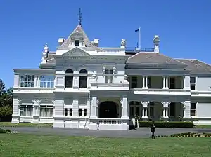 Stonington mansion after which the City of Stonnington was named.
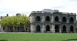 The Valentine's Mansion (now Caulfield Grammar School - Malvern Campus).
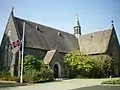 St George's Anglican Parish Church
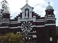 St Joseph's RC Parish Church
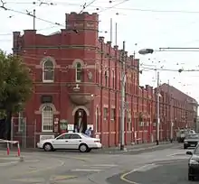 Malvern Tram Depot (Glenferrie Rd Malvern off Coldblo Road, Armadale)
- Stonnington City Centre, which includes Stonnington Council, Malvern Town Hall & Malvern Police Station
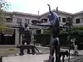 Sculptures in the City Square
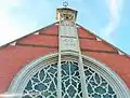
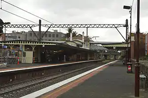 Malvern Railway Station
See also
- City of Malvern – Malvern was previously within this former local government area.
References
- Australian Bureau of Statistics (27 June 2017). "Malvern (State Suburb)". 2016 Census QuickStats. Retrieved 21 September 2017.

- Leslie J. Wilmoth, 'Gardiner, John (1798–1878)', Australian Dictionary of Biography, Volume 1, MUP, 1966, p. 425.
- Premier Postal History, Post Office List, retrieved 11 April 2008
- Canberra Bicycle Museum "Archived copy". Archived from the original on 31 March 2008. Retrieved 19 March 2008.CS1 maint: archived copy as title (link)
- AustLit. "Bresciani, Andrea". Retrieved 13 September 2016 (subscription required for full access).
External links
| Wikimedia Commons has media related to Malvern, Victoria. |