Butterfield Township, Michigan
Butterfield Township is a civil township of Missaukee County in the U.S. state of Michigan. As of the 2010 census, the township population was 489.
Butterfield Township, Michigan | |
|---|---|
%252C_MI.jpg.webp) Butterfield Township Hall | |
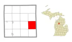 Location within Missaukee County | |
 Butterfield Township Location within the state of Michigan  Butterfield Township Butterfield Township (the United States) | |
| Coordinates: 44°17′53″N 84°55′14″W | |
| Country | United States |
| State | Michigan |
| County | Missaukee |
| Government | |
| • Supervisor | Mike Rockey |
| • Clerk | Marilyn Myers |
| Area | |
| • Total | 36.02 sq mi (93.3 km2) |
| • Land | 35.40 sq mi (91.7 km2) |
| • Water | 0.62 sq mi (1.6 km2) |
| Elevation | 1,132 ft (345 m) |
| Population (2010) | |
| • Total | 489 |
| • Density | 13.8/sq mi (5.3/km2) |
| Time zone | UTC-5 (Eastern (EST)) |
| • Summer (DST) | UTC-4 (EDT) |
| ZIP code(s) | |
| Area code(s) | 231 |
| FIPS code | 26-12200[1] |
| GNIS feature ID | 1626015[2] |
Communities
- Butterfield is a small unincorporated community in the southeast portion of the township at 44°16′40″N 84°57′12″W.[3] It is approximately three and a half miles south of Merritt on County Road 565 and the eastern terminus of County Road 584. A rural post office operated from October 30, 1895 until October 31, 1922.[4] [5]
- Merritt is an unincorporated community in the northern part of the township on County Road 565 just south of M-55 at 44°19′47″N 84°56′41″W.[6]
- Edson Corners 44°17′30″N 84°53′22″W was a community and former post office in the township on the Muskegon River. It was named for Edson Witherell. The post office operated from August 21, 1878, until March 15, 1900.[7] [5]
- The community of Falmouth is to the southwest, and the Falmouth post office with ZIP code 49632 also serves the southern portion Butterfield Township.[8]
Geography
According to the United States Census Bureau, the township has a total area of 36.02 square miles (93.29 km2), of which 35.40 square miles (91.69 km2) is land and 0.62 square miles (1.61 km2) (1.72%) is water.[9]
The Muskegon River flows through the township.
Highways
Demographics
As of the census[1] of 2000, there were 548 people, 211 households, and 155 families residing in the township. The population density was 15.3 per square mile (5.9/km2). There were 388 housing units at an average density of 10.8 per square mile (4.2/km2). The racial makeup of the township was 97.63% White, 0.18% African American, 0.55% Native American, 0.18% Asian, and 1.46% from two or more races. Hispanic or Latino of any race were 0.18% of the population.
There were 211 households, out of which 31.3% had children under the age of 18 living with them, 59.7% were married couples living together, 10.4% had a female householder with no husband present, and 26.5% were non-families. 21.8% of all households were made up of individuals, and 8.1% had someone living alone who was 65 years of age or older. The average household size was 2.60 and the average family size was 2.97.
In the township the population was spread out, with 25.2% under the age of 18, 7.8% from 18 to 24, 27.7% from 25 to 44, 25.9% from 45 to 64, and 13.3% who were 65 years of age or older. The median age was 40 years. For every 100 females, there were 98.6 males. For every 100 females age 18 and over, there were 101.0 males.
The median income for a household in the township was $37,188, and the median income for a family was $40,357. Males had a median income of $27,375 versus $21,250 for females. The per capita income for the township was $16,993. About 7.1% of families and 8.8% of the population were below the poverty line, including 13.8% of those under age 18 and 7.0% of those age 65 or over.
Notes
- "U.S. Census website". United States Census Bureau. Retrieved 2008-01-31.
- U.S. Geological Survey Geographic Names Information System: Butterfield Township, Michigan
- U.S. Geological Survey Geographic Names Information System: Butterfield
- U.S. Geological Survey Geographic Names Information System: Butterfield Post Office (historical)
- Romig, Walter (1986) [1973]. Michigan Place Names. Detroit, Michigan: Wayne State University Press. ISBN 0-8143-1838-X.
- U.S. Geological Survey Geographic Names Information System: Merritt
- U.S. Geological Survey Geographic Names Information System: Edson Corners Post Office (historical)
- 49632 5-Digit ZCTA, 496 3-Digit ZCTA - Reference Map - American FactFinder, U.S. Census Bureau, 2000 census
- "Michigan: 2010 Population and Housing Unit Counts 2010 Census of Population and Housing" (PDF). 2010 United States Census. United States Census Bureau. September 2012. p. 34 Michigan. Retrieved July 22, 2020.
- Michigan Highways Master List: 1918-Present
Municipalities and communities of Missaukee County, Michigan, United States | ||
|---|---|---|
| Cities | 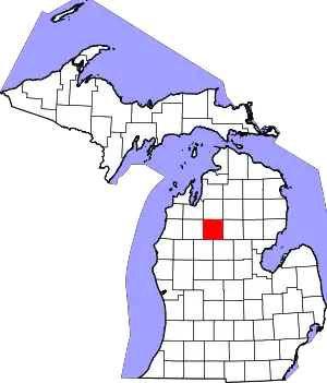 Map of Michigan highlighting Missaukee County.svg | |
| Civil townships | ||
| CDP | ||
| Unincorporated communities | ||
| ||