Holland Township, Missaukee County, Michigan
Holland Township is a civil township of Missaukee County in the U.S. state of Michigan. The population was 248 at the 2010 census.
Holland Township | |
|---|---|
%252C_MI.jpg.webp) Holland Township Hall | |
%252C_MI.png.webp) Location within Missaukee County | |
 Holland Township Location within the state of Michigan  Holland Township Holland Township (the United States) | |
| Coordinates: 44°12′34″N 84°54′48″W | |
| Country | United States |
| State | Michigan |
| County | Missaukee |
| Government | |
| • Supervisor | Carl Vandenboss |
| • Clerk | Donna Bode |
| Area | |
| • Total | 35.90 sq mi (93.0 km2) |
| • Land | 35.62 sq mi (92.3 km2) |
| • Water | 0.28 sq mi (0.7 km2) |
| Elevation | 630 ft (192 m) |
| Population (2010) | |
| • Total | 248 |
| • Density | 6.96/sq mi (2.69/km2) |
| Time zone | UTC-5 (Eastern (EST)) |
| • Summer (DST) | UTC-4 (EDT) |
| ZIP code(s) | |
| Area code(s) | 231 |
| FIPS code | 26-38660[1] |
| GNIS feature ID | 1626479[2] |
Communities
- Moddersville is a small unincorporated community in the township at 44°13′13″N 84°57′09″W.[3] The first settlers here, the White family, arrived in 1875 but later moved away. Wynand Modders and his family moved here in 1878 and were soon followed by others, many of whom, like the Modders, were from the Netherlands. When a post office was established on August 6, 1890, it was named for the Modders and Wynand became the first postmaster. The office was discontinued on October 31, 1934.[4] [5] In the 1920s, Moddersville was on the route of M-74.[6]
- Dolph is a small historical locale in the northeast of the township along the Muskegon River at 44°14′00″N 84°52′45″W.[7] It was named for storekeeper Charles L. Dolph, who became the first postmaster on April 13, 1898. The post office was discontinued on June 15, 1926.[8] [5]
Geography
According to the United States Census Bureau, the township has a total area of 35.90 square miles (92.98 km2), of which 35.62 square miles (92.26 km2) is land and 35.28 square miles (91.37 km2) (0.78%) is water.[9]
Portions of the Muskegon River flow through Holland Township.
Demographics
As of the census of 2000, there were 223 people, 95 households, and 68 families residing in the township.[1] The population density was 6.2 per square mile (2.4/km2). There were 264 housing units at an average density of 7.4 per square mile (2.8/km2). The racial makeup of the township was 99.55% White, and 0.45% from two or more races. Hispanic or Latino of any race were 1.35% of the population.
There were 95 households, out of which 25.3% had children under the age of 18 living with them, 65.3% were married couples living together, 4.2% had a female householder with no husband present, and 27.4% were non-families. 24.2% of all households were made up of individuals, and 13.7% had someone living alone who was 65 years of age or older. The average household size was 2.35 and the average family size was 2.74.
In the township the population was spread out, with 19.7% under the age of 18, 7.2% from 18 to 24, 29.1% from 25 to 44, 26.5% from 45 to 64, and 17.5% who were 65 years of age or older. The median age was 41 years. For every 100 females, there were 104.6 males. For every 100 females age 18 and over, there were 101.1 males.
The median income for a household in the township was $31,000, and the median income for a family was $31,500. Males had a median income of $36,875 versus $20,625 for females. The per capita income for the township was $16,200. About 10.7% of families and 11.9% of the population were below the poverty line, including 15.2% of those under the age of eighteen and 16.3% of those 65 or over.
References
- "U.S. Census website". United States Census Bureau. Retrieved 2008-01-31.
- U.S. Geological Survey Geographic Names Information System: Holland Township, Missaukee County, Michigan
- U.S. Geological Survey Geographic Names Information System: Moddersville, Michigan
- U.S. Geological Survey Geographic Names Information System: Moddersville Post Office (historical)
- Romig, Walter (1986) [1973]. Michigan Place Names. Detroit, Michigan: Wayne State University Press. ISBN 0-8143-1838-X.
- Michigan Highways Master List: 1918-Present
- U.S. Geological Survey Geographic Names Information System: Dolph, Michigan
- U.S. Geological Survey Geographic Names Information System: Dolph Post Office (historical)
- "Michigan: 2010 Population and Housing Unit Counts 2010 Census of Population and Housing" (PDF). 2010 United States Census. United States Census Bureau. September 2012. p. 34 Michigan. Retrieved July 22, 2020.
Municipalities and communities of Missaukee County, Michigan, United States | ||
|---|---|---|
| Cities | 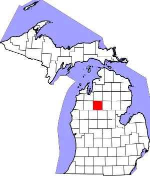 Map of Michigan highlighting Missaukee County.svg | |
| Civil townships | ||
| CDP | ||
| Unincorporated communities | ||
| ||