Caldwell Township, Michigan
Caldwell Township is a civil township of Missaukee County in the U.S. state of Michigan. The population was 1,317 at the 2010 census.
Caldwell Township, Michigan | |
|---|---|
%252C_MI.jpg.webp) Caldwell Township Hall | |
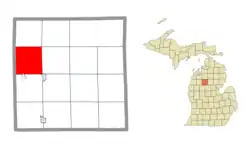
 Location within Missaukee County and an administered portion of the Jennings CDP (pink) | |
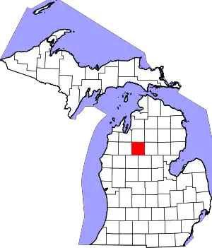
 Caldwell Township Location within the state of Michigan  Caldwell Township Caldwell Township (the United States) | |
| Coordinates: 44°22′35″N 85°15′28″W | |
| Country | United States |
| State | Michigan |
| County | Missaukee |
| Established | 1872 |
| Government | |
| • Supervisor | Mike Lutke |
| • Clerk | Shelley Sloat |
| Area | |
| • Total | 35.59 sq mi (92.2 km2) |
| • Land | 34.21 sq mi (88.6 km2) |
| • Water | 1.38 sq mi (3.6 km2) |
| Elevation | 1,273 ft (388 m) |
| Population (2010) | |
| • Total | 1,317 |
| • Density | 38.5/sq mi (14.9/km2) |
| Time zone | UTC-5 (Eastern (EST)) |
| • Summer (DST) | UTC-4 (EDT) |
| ZIP code(s) | |
| Area code(s) | 231 |
| FIPS code | 26-12440[1] |
| GNIS feature ID | 1626018[2] |
History


It was originally named Quilna Township but was renamed to its current name in 1873.[3]
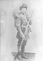
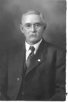
The township was organized in 1872. It was named by the legislature after Thomas T. Caldwell and his brother John Caldwell.[4] They both purchased large homesteads in the township from the government shortly after the American Civil War.[5] The land was selected because of the large quantity of old growth white pine. Their timber provided lumber for construction of nearby Lake City, Manton, and Cadillac.
Thomas ran in the first county election of 1871. John married Martha Babcock in the township on June 29, 1873. They raised 3 children on their Caldwell township homestead: Florence, Leona, and Frank.
In 1904 the small town of Arlene had a general store and post office which operated there until 1906.[6]
The Caldwell cemetery is near Arlene in Caldwell Township.
Geography
According to the United States Census Bureau, the township has a total area of 35.59 square miles (92.18 km2), of which 34.21 square miles (88.60 km2) is land and 1.38 square miles (3.57 km2) (3.88%) is water.[7]
The northernmost shores of Lake Missaukee extend into Caldwell Township.
Highways
Demographics
As of the census[1] of 2000, there were 1,363 people, 523 households, and 369 families residing in the township. The population density was 39.6 per square mile (15.3/km2). There were 838 housing units at an average density of 24.3 per square mile (9.4/km2). The racial makeup of the township was 96.70% White, 0.73% Native American, 1.03% from other races, and 1.54% from two or more races. Hispanic or Latino of any race were 1.17% of the population.
There were 523 households, out of which 33.8% had children under the age of 18 living with them, 54.1% were married couples living together, 11.7% had a female householder with no husband present, and 29.4% were non-families. 23.9% of all households were made up of individuals, and 11.1% had someone living alone who was 65 years of age or older. The average household size was 2.56 and the average family size was 3.04.
In the township the population was spread out, with 27.9% under the age of 18, 7.5% from 18 to 24, 27.7% from 25 to 44, 22.2% from 45 to 64, and 14.7% who were 65 years of age or older. The median age was 36 years. For every 100 females, there were 96.1 males. For every 100 females age 18 and over, there were 92.0 males.
The median income for a household in the township was $31,719, and the median income for a family was $35,214. Males had a median income of $28,558 versus $21,719 for females. The per capita income for the township was $14,674. About 15.5% of families and 19.4% of the population were below the poverty line, including 26.0% of those under age 18 and 14.8% of those age 65 or over. Caldwell township's population was 1,423 people as of 2007. It has had a population growth of 4.40 percent since 2000. The median home cost is $128,900. Caldwell township's cost of living is 19.81% lower than the U.S. average.[8]
References
- "U.S. Census website". United States Census Bureau. Retrieved 2008-01-31.
- U.S. Geological Survey Geographic Names Information System: Caldwell Township, Michigan
- Walter Romig, Michigan Place Names, p. 93
- Biographical History of Northern Michigan 1905 by B. F. Bowen, page 685. Original at University of Michigan
- Thomas's (141 acres) Homestead Certificate 1172 and John's (101 acres) Homestead Certificate 22451 signed by Ulysses S. Grant. The homesteads were located at the southeast and southwest corners of Rhoby Road and Lucas Road.
- Caldwell Township, Michigan 49663
- "Michigan: 2010 Population and Housing Unit Counts 2010 Census of Population and Housing" (PDF). 2010 United States Census. United States Census Bureau. September 2012. p. 34 Michigan. Retrieved July 22, 2020.
- Quick Facts of Caldwell Township, Michigan
