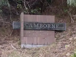
Camborne, New Zealand
Camborne, New Zealand is a hilltop and seaside suburb of Porirua.
Camborne | |
|---|---|
Suburb | |
 | |
 Camborne | |
| Coordinates: 41.089683°S 174.873573°E | |
| Country | New Zealand |
| Local authority | Porirua City |
| Population (2013) | |
| • Total | 2,583 |
| Pukerua Bay | ||
| Plimmerton |
|
Porirua Harbour |
| Mana |
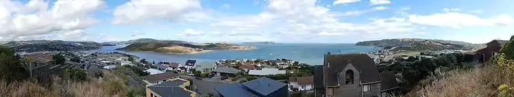
Camborne covers an area of 0.84 km², including a land area of 0.84 km².[1] Most of the suburb is a short walk from Porirua Harbour, and many homes have views of the harbour, neighbouring hills, the sea and Mana Island.[2]
History
Camborne was developed over a 35-year period from the 1960s, initially by an investment company headed by a Mr Arthur Cornish. It was named after Camborne, Cornwall. Most of its street names are of Cornish origin, but its main street, Pope Street, is named after William George Pope (known as Bob), who was an honoured former resident of the adjoining suburb of Plimmerton.[3]
The estimated population of Camborne reached 1,560 in 1996, 1,660 in 2001 and 1,710 in 2006. It dropped to 950 in 2013, and rose to 990 in 2018.[4]
The Paremata Residents Association includes members from Camborne.[5]
Demography
Camborne has an estimated population of 2,070.
It had a population density of 2,478.78 people per km² in 2019.[6]
As of the 2018 census, the median age was 30.7, the median income was $51,400, 19.2% of people earned over $100,00, 35.6% had a Bachelor's Degree or higher, and 2.9% of the workforce was unemployed.[4]
Ethnically, the population was 89.4% New Zealand European, 9.5% Māori, 6.7% Asian, 2.8% Pacific peoples, and 3.6% of people identified with other ethnicities; 21% of people were born overseas.[4]
Religiously, the population was 55.1% non-religious and 34.4% Christian, with small Buddhist, Hindu and Muslim populations.[4]
Economy
In 2018, 11.5% of the workforce worked in construction, 9.0% worked in education, 8.7% worked in healthcare, 3.8% worked in manufacturing, 3.8% worked in hospitality, and 2.8% worked in transport.[4]
Camborne does not have its own shops, but is within walking distance of the Plimmerton and Mana shopping centres, and within driving distancew of the Porirua and Wellington city centres.
Transportation
As of 2018, among those who commute to work, 71.0% drove a car, 11.3% rode in a car, 2.7% used a bike, and 2.7% walked or ran. No one used public transport.[4]
References
- "Statistical Area 2 2018 (generalised) GIS" (Data table). stats.govt.nz. Statistics New Zealand.
- "Porirua City - Drivers of population change". idnz.co.nz. ID Community.
- "Plimmerton and Camborne Signpost Stories – Library, Porirua City, NZ". www.porirualibrary.org.nz. Archived from the original on 2019-01-18. Retrieved 2019-01-15.
- "Place Summary - Camborne". Stats NZ. Statistics New Zealand.
- "Welcome to the Paremata Residents Association Web Site". paremataresidents.co.nz. Paremata Residents Association.
- "Provisional Statistics". stats.govt.nz. Statistics New Zealand.