Cape Petersen
Cape Petersen (71°54′S 101°27′W) is a rounded ice-covered cape on the north side of Thurston Island, about 18 nautical miles (33 km) east-northeast of Cape Flying Fish. Delineated from air photos taken by U.S. Navy Operation Highjump in December 1946. Named by Advisory Committee on Antarctic Names (US-ACAN) for Carl O. Petersen, radio engineer with the Byrd Antarctic Expedition in 1928-30 and 1933–35.

Cape Petersen
Location of Cape Petersen in Antarctica
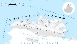
Map of Thurston Island.
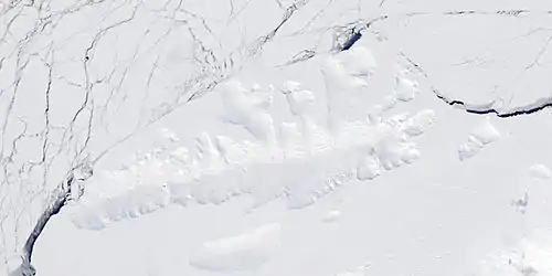
Satellite image of Thurston Island.
Maps
- Thurston Island – Jones Mountains. 1:500000 Antarctica Sketch Map. US Geological Survey, 1967.
- Antarctic Digital Database (ADD). Scale 1:250000 topographic map of Antarctica. Scientific Committee on Antarctic Research (SCAR). Since 1993, regularly upgraded and updated.
![]() This article incorporates public domain material from the United States Geological Survey document: "Cape Petersen". (content from the Geographic Names Information System)
This article incorporates public domain material from the United States Geological Survey document: "Cape Petersen". (content from the Geographic Names Information System) ![]()
| General |
| .svg.png.webp) |
|---|---|---|
| Regions | ||
| Waterways | ||
| Famous explorers | ||
This article is issued from Wikipedia. The text is licensed under Creative Commons - Attribution - Sharealike. Additional terms may apply for the media files.
