Carnkie, Redruth
Carnkie is a village in west Cornwall, England, United Kingdom. It is situated approximately one and a half miles south west of Redruth.[1] It is in the civil parish of Carn Brea.
| Carnkie | |
|---|---|
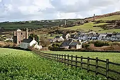 View from the lower southern slope of Carn Brea, looking towards Carnkie | |
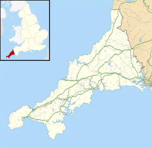 Carnkie Location within Cornwall | |
| OS grid reference | SW687399 |
| Shire county | |
| Region | |
| Country | England |
| Sovereign state | United Kingdom |
| Post town | REDRUTH |
| Postcode district | TR16 |
| Dialling code | 01209 |
| Police | Devon and Cornwall |
| Fire | Cornwall |
| Ambulance | South Western |
| UK Parliament | |
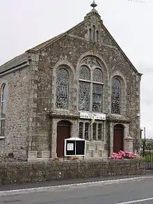
The village is built largely along the Great Flat Lode (a massive mineral trail that was extensively mined), and is surrounded by numerous derelict mine buildings, most of which were built by the mining magnate, Lord de Dunstanville and Basset. There is a Methodist chapel building at the centre of the village which closed in 2010. The Methodist congregation now meet at Carnkie Village Hall every Sunday at 10:30am and in May 2015 celebrated their 5th year since moving.
Vehicular access to Carn Brea is gained through Carnkie, at the summit can be found a monument dedicated to Lord de Dunstanville and Basset, and Carn Brea Castle, originally believed to be a hunting lodge, but which these days serves as a restaurant.
References
- Ordnance Survey One-inch Map of Great Britain; Land's End, sheet 189. 1961
Cornwall Portal | |
| Unitary authorities | |
| Major settlements |
|
| Rivers | |
| Topics | |