Carrigart
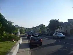
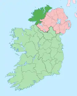
Carraig Airt[2] (anglicised as Carrigart or Carrickart[3]) is a small Gaeltacht village in the barony of Kilmacrennan to the north of County Donegal, Ireland. The village is on the R245 route between Letterkenny and Creeslough. Situated as it is at the base of the Rosguill peninsula, in one of the more remote but most scenic parts of the country, the village provides services for a large hinterland, with a supermarket with banking facilities, a post office, a doctor's surgery and a barracks manned part-time by the Garda Síochána. Carrigart has a public park that borders the shoreline behind the houses on the main street. Designed by Angela Gallagher, it is maintained by the Tidy Towns Committee and has won several awards. The village and its environs remain largely agricultural, relying on passing trade and tourism during the summer months. In common with the rest of this part of Donegal, Carrigart has many second homes, owned especially by Northern Irish holiday makers.
Carraig Airt
Carrigart | |
|---|---|
Village | |
 Carrigart Main Street | |
 Carraig Airt Location in Ireland | |
| Coordinates: 55°10′37″N 7°47′38″W | |
| Country | Ireland |
| Province | Ulster |
| County | County Donegal |
| Population (2016)[1] | |
| • Total | 222 |
| Area code(s) | 074, +00 353 74 |
| Irish Grid Reference | B847228 |
| Carraig Airt is the only official name. The anglicized spelling Carrigart has no official status. | |
The village, which celebrated its centenary in 2002, although there is evidence of Carrigart's existence for longer than that, originally formed part of the estates of the Earls of Leitrim, nearby Mulroy House being one of their seats. William Clements, 3rd Earl of Leitrim, was assassinated in nearby Cratlagh wood in 1878 by men from the neighbouring peninsula of Fanad.
In the 18th and 19th centuries, Carrigart had a fair day on 21 June.[4] The town now hosts a festival that runs from 8 to 14 August.
The official name given to Carrigart is Carraig Airt but it has also been translated as Ceathrú Fhiodhghoirt, meaning Quarterland of the Wood of the Field [5]
See also
References
- "Census 2016 Sapmap Area: Settlements Carraig Airt". Central Statistics Office (Ireland). Retrieved 6 June 2018.
- Placenames (Ceantair Ghaeltachta) Order 2004.
- "Carraig Airt/Carrickart". Placenames Database of Ireland. Government of Ireland - Department of Arts, Heritage and the Gaeltacht and Dublin City University. Retrieved 10 June 2018.
- Statistical Survey of the County of Donegal with Observations on the Means of Improvement, Drawn up in the year 1801, For the consideration and under the direction of The Dublin Society, by James McParlan M.D.
- Deirdre and Laurence Flanagan, Irish Place Names, Gill & Macmillan, 2002.

