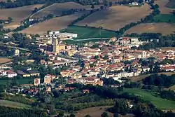
Castelraimondo
Castelraimondo is a comune (municipality) in the Province of Macerata in the Italian region Marche, located about 60 kilometres (37 mi) southwest of Ancona and about 35 kilometres (22 mi) southwest of Macerata.
Castelraimondo | |
|---|---|
| Comune di Castelraimondo | |
 Castelraimondo | |
 Coat of arms | |
Location of Castelraimondo 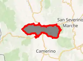
| |
 Castelraimondo Location of Castelraimondo in Italy 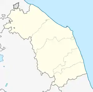 Castelraimondo Castelraimondo (Marche) | |
| Coordinates: 43°13′N 13°3′E | |
| Country | Italy |
| Region | Marche |
| Province | Macerata (MC) |
| Frazioni | Crispiero, Castel S.Maria, Rustano, Brondoleto, Collina, S.Angelo, Carsignano |
| Government | |
| • Mayor | Renzo Marinelli |
| Area | |
| • Total | 44.9 km2 (17.3 sq mi) |
| Elevation | 305 m (1,001 ft) |
| Population (28 February 2017)[2] | |
| • Total | 4,534 |
| • Density | 100/km2 (260/sq mi) |
| Demonym(s) | Castelraimondesi |
| Time zone | UTC+1 (CET) |
| • Summer (DST) | UTC+2 (CEST) |
| Postal code | 62022 |
| Dialing code | 0737 |
| Website | Official website |
Castelraimondo borders the following municipalities: Camerino, Fiuminata, Gagliole, Matelica, Pioraco, San Severino Marche, Serrapetrona. The main sights is the Cassero, a watchtower built by the Da Varano lords of Camerino in medieval times.
Main sights
The town contains the following churches:
- San Biagio.
- San Lorenzo a Brondoleto.
- San Martino a Rustano.
- San Michele Arcangelo a Sant’Angelo.
- Santa Maria Assunta a Collina.
References
- "Superficie di Comuni Province e Regioni italiane al 9 ottobre 2011". Istat. Retrieved 16 March 2019.
- All demographics and other statistics: Italian statistical institute Istat.
| Authority control |
|---|
This article is issued from Wikipedia. The text is licensed under Creative Commons - Attribution - Sharealike. Additional terms may apply for the media files.