Montelupone
Montelupone is a comune (municipality) in the Province of Macerata in the Italian region Marche, located about 30 kilometres (19 mi) south of Ancona and about 11 kilometres (7 mi) northeast of Macerata.
Montelupone | |
|---|---|
| Comune di Montelupone | |
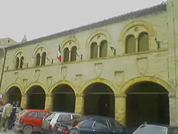 Palazzo dei Priori. | |
 Coat of arms | |
Location of Montelupone 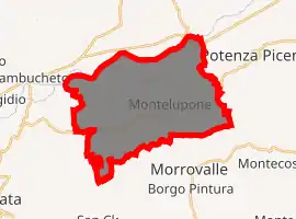
| |
 Montelupone Location of Montelupone in Italy 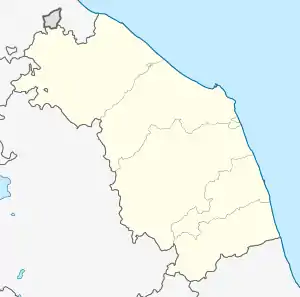 Montelupone Montelupone (Marche) | |
| Coordinates: 43°21′N 13°34′E | |
| Country | Italy |
| Region | Marche |
| Province | Macerata (MC) |
| Frazioni | San Firmano |
| Government | |
| • Mayor | Rolando Pecora |
| Area | |
| • Total | 32.67 km2 (12.61 sq mi) |
| Elevation | 272 m (892 ft) |
| Population (30 November 2017)[2] | |
| • Total | 3,590 |
| • Density | 110/km2 (280/sq mi) |
| Demonym(s) | Monteluponesi |
| Time zone | UTC+1 (CET) |
| • Summer (DST) | UTC+2 (CEST) |
| Postal code | 62010 |
| Dialing code | 0733 |
| Patron saint | St. Firmanus |
| Website | Official website |
Montelupone borders the following municipalities: Macerata, Montecosaro, Morrovalle, Potenza Picena, Recanati.
Main sights
- San Firmano Abbey, a Romanesque monastery, founded in the late 9th century AD. The sacristy houses a terracotta by Ambrogio della Robbia.
- Medieval gates
- Palazzo del Podestà and Civic Tower
- Civic Gallery
- Church of Santa Chiara
- Collegiate church
- Church of San Francesco
- Church of Pietà (15th century)
References
- "Superficie di Comuni Province e Regioni italiane al 9 ottobre 2011". Istat. Retrieved 16 March 2019.
- All demographics and other statistics: Italian statistical institute Istat.
External links
| Authority control |
|---|
This article is issued from Wikipedia. The text is licensed under Creative Commons - Attribution - Sharealike. Additional terms may apply for the media files.