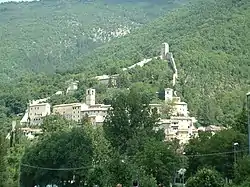
Castelsantangelo sul Nera
Castelsantangelo sul Nera is a comune (municipality) in the Province of Macerata in the Italian region of Marche, located about 90 kilometres (56 mi) southwest of Ancona and about 50 kilometres (31 mi) southwest of Macerata. The source of the Nera River is located in the communal territory.
Castelsantangelo sul Nera | |
|---|---|
| Comune di Castelsantangelo sul Nera | |
 | |
 Coat of arms | |
Location of Castelsantangelo sul Nera 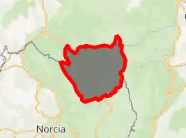
| |
 Castelsantangelo sul Nera Location of Castelsantangelo sul Nera in Italy 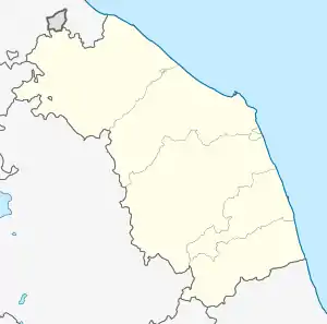 Castelsantangelo sul Nera Castelsantangelo sul Nera (Marche) | |
| Coordinates: 42°54′N 13°9′E | |
| Country | Italy |
| Region | Marche |
| Province | Macerata (MC) |
| Frazioni | Gualdo, Macchie, Nocelleto, Nocria, Pian dell'Arco, Rapegna, Spina di Gualdo, Vallinfante |
| Government | |
| • Mayor | Mauro Falcucci |
| Area | |
| • Total | 71.2 km2 (27.5 sq mi) |
| Elevation | 760 m (2,490 ft) |
| Population (31 December 2015)[2] | |
| • Total | 281 |
| • Density | 3.9/km2 (10/sq mi) |
| Demonym(s) | Castellani |
| Time zone | UTC+1 (CET) |
| • Summer (DST) | UTC+2 (CEST) |
| Postal code | 62030 |
| Dialing code | 0737 |
| Patron saint | St. Stephen |
| Saint day | 26 December |
References
- "Superficie di Comuni Province e Regioni italiane al 9 ottobre 2011". Istat. Retrieved 16 March 2019.
- All demographics and other statistics: Italian statistical institute Istat.
| Authority control |
|
|---|
This article is issued from Wikipedia. The text is licensed under Creative Commons - Attribution - Sharealike. Additional terms may apply for the media files.