Cebolla, New Mexico
Cebolla is an unincorporated community located in Rio Arriba County, New Mexico, United States. Cebolla is located on U.S. Route 84, 44 miles (71 km) northwest of Española. Cebolla has a post office with ZIP code 87518.[2][3] Cebolla was settled circa 1800 and named after the valley. Sheep that grazed in the valley were fond of eating the wild onions, and shepherds dubbed it El Valle de Cebolla. The Rio Cebolla flows through the village.[4]
Cebolla | |
|---|---|
 Cebolla Location within the state of New Mexico  Cebolla Cebolla (the United States) | |
| Coordinates: 36°32′18″N 106°29′11″W | |
| Country | United States |
| State | New Mexico |
| County | Rio Arriba |
| Elevation | 7,641 ft (2,329 m) |
| Time zone | UTC-7 (Mountain (MST)) |
| • Summer (DST) | UTC-6 (MDT) |
| Area code(s) | 575 |
| GNIS feature ID | 923578[1] |
References
- "Cebolla". Geographic Names Information System. United States Geological Survey.
- "Postmaster Finder - Post Offices by ZIP Code". United States Postal Service. Retrieved November 9, 2014.
- United States Postal Service. "USPS - Look Up a ZIP Code". Retrieved November 9, 2014.
- Julyan, Robert (1996). The Place Names of New Mexico. University of New Mexico Press. p. 70. ISBN 0826316891.
Municipalities and communities of Rio Arriba County, New Mexico, United States | ||
|---|---|---|
| City | 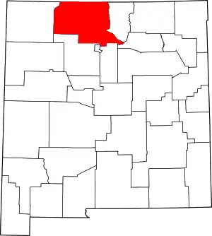 Map of New Mexico highlighting Rio Arriba County | |
| Village | ||
| CDPs |
| |
| Other unincorporated communities | ||
| Ghost towns and former settlements | ||
| Indian reservations | ||
| Footnotes | ‡This populated place also has portions in an adjacent county or counties | |
| ||
This article is issued from Wikipedia. The text is licensed under Creative Commons - Attribution - Sharealike. Additional terms may apply for the media files.