Rio Arriba County, New Mexico
Rio Arriba County is a county in the U.S. state of New Mexico. As of the 2010 census, the population was 40,246.[1] Its county seat is Tierra Amarilla.[2] Its northern border is the Colorado state line.
Rio Arriba County | |
|---|---|
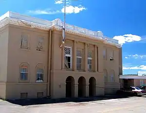 Rio Arriba County Courthouse, Isaac Rapp, architect, 1916-17 | |
 Seal | |
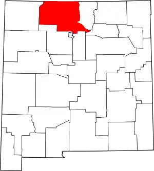 Location within the U.S. state of New Mexico | |
 New Mexico's location within the U.S. | |
| Coordinates: 36°31′N 106°42′W | |
| Country | |
| State | |
| Founded | 1852 |
| Named for | location on the upper Rio Grande (río arriba means "upriver" in Spanish) |
| Seat | Tierra Amarilla |
| Largest city | Española |
| Area | |
| • Total | 5,896 sq mi (15,270 km2) |
| • Land | 5,861 sq mi (15,180 km2) |
| • Water | 35 sq mi (90 km2) 0.6%% |
| Population | |
| • Estimate (2019) | 38,921 |
| • Density | 6.9/sq mi (2.7/km2) |
| Time zone | UTC−7 (Mountain) |
| • Summer (DST) | UTC−6 (MDT) |
| Congressional district | 3rd |
| Website | www |
Rio Arriba County comprises the Española, NM Micropolitan Statistical Area, which is also included in the Albuquerque-Santa Fe-Las Vegas, NM Combined Statistical Area.
History
The county was one of nine originally created for the Territory of New Mexico in 1852. Originally extending west to the California line, it included the site of present-day Las Vegas, Nevada.[3] The county seat was initially sited at San Pedro de Chamita, and shortly afterwards at Los Luceros. In 1860 the seat was moved to Plaza del Alcalde. Since 1880 Tierra Amarilla has been the county seat.[4]
The Battle of Embudo Pass took place in the southern part of the county during the Mexican–American War in January 1847.
Geography
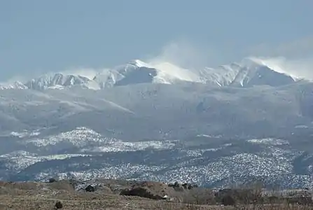
According to the U.S. Census Bureau, the county has a total area of 5,896 square miles (15,270 km2), of which 5,861 square miles (15,180 km2) are land and 35 square miles (91 km2) (0.6%) are water.[5] It is the fifth-largest county in New Mexico by area. The highest point in the county is the summit of Truchas Peak at 13,102 feet (3,993 m).
The county acquired its present proportions after the creation of San Juan County and other adjustments.[4]
Adjacent counties
- Taos County - east
- Mora County - southeast
- Santa Fe County - south
- Los Alamos County - south
- Sandoval County - south
- San Juan County - west
- Archuleta County, Colorado - north
- Conejos County, Colorado - north
National protected areas
Demographics
| Historical population | |||
|---|---|---|---|
| Census | Pop. | %± | |
| 1910 | 16,624 | — | |
| 1920 | 19,552 | 17.6% | |
| 1930 | 21,381 | 9.4% | |
| 1940 | 25,352 | 18.6% | |
| 1950 | 24,997 | −1.4% | |
| 1960 | 24,193 | −3.2% | |
| 1970 | 25,170 | 4.0% | |
| 1980 | 29,282 | 16.3% | |
| 1990 | 34,365 | 17.4% | |
| 2000 | 41,190 | 19.9% | |
| 2010 | 40,246 | −2.3% | |
| 2019 (est.) | 38,921 | [6] | −3.3% |
| U.S. Decennial Census[7] 1790-1960[8] 1900-1990[9] 1990-2000[10] 2010-2016[1] | |||
2000 census
As of the 2000 census,[11] there were 41,190 people, 15,044 households, and 10,816 families living in the county. The population density was 7 people per square mile (3/km2). There were 18,016 housing units at an average density of 3 per square mile (1/km2). The racial makeup of the county was 56.62% White, 0.35% Black or African American, 13.88% Native American, 0.14% Asian, 0.11% Pacific Islander, 25.62% from other races, and 3.28% from two or more races. 72.89% of the population were Hispanic or Latino of any race.
There were 15,044 households, out of which 36.90% had children under the age of 18 living with them, 48.80% were married couples living together, 15.90% had a female householder with no husband present, and 28.10% were non-families. 23.50% of all households were made up of individuals, and 7.80% had someone living alone who was 65 years of age or older. The average household size was 2.71 and the average family size was 3.19.
In the county, the population was spread out, with 28.60% under the age of 18, 8.90% from 18 to 24, 28.80% from 25 to 44, 22.90% from 45 to 64, and 10.90% who were 65 years of age or older. The median age was 34 years. For every 100 females there were 98.00 males. For every 100 females age 18 and over, there were 97.70 males.
The median income for a household in the county was $29,429, and the median income for a family was $32,901. Males had a median income of $26,897 versus $22,223 for females. The per capita income for the county was $14,263. About 16.60% of families and 20.30% of the population were below the poverty line, including 23.30% of those under age 18 and 22.90% of those age 65 or over.
2010 census
As of the 2010 census, there were 40,246 people, 15,768 households, and 10,477 families living in the county.[12] The population density was 6.9 inhabitants per square mile (2.7/km2). There were 19,638 housing units at an average density of 3.4 per square mile (1.3/km2).[13] The racial makeup of the county was 51.6% white, 16.0% American Indian, 0.5% black or African American, 0.4% Asian, 28.0% from other races, and 3.3% from two or more races. Those of Hispanic or Latino origin made up 71.3% of the population.[12]
The largest ancestry groups were:[14]
- 20.6% Mexican
- 15.5% Spanish
- 4.5% German
- 3.2% English
- 2.7% Irish
- 1.7% French
- 1.5% Navajo
- 1.2% Scottish
Of the 15,768 households, 33.6% had children under the age of 18 living with them, 42.3% were married couples living together, 16.0% had a female householder with no husband present, 33.6% were non-families, and 28.2% of all households were made up of individuals. The average household size was 2.53 and the average family size was 3.09. The median age was 39.0 years.[12]
The median income for a household in the county was $41,437 and the median income for a family was $47,840. Males had a median income of $39,757 versus $31,657 for females. The per capita income for the county was $19,913. About 15.7% of families and 19.7% of the population were below the poverty line, including 20.6% of those under age 18 and 18.3% of those age 65 or over.[15]
Politics
From New Mexico's statehood to the early 1940s Rio Arriba was a traditional Republican county. That would later change and the county would become a Democratic stronghold from the 1960s to the present day. The last Republican presidential candidate to carry the county was Dwight D. Eisenhower in 1956.[16] No Republican candidate for governor has won the county since at least 1966.[17]
| Year | Republican | Democratic | Third parties |
|---|---|---|---|
| 2016 | 24.2% 3,599 | 64.5% 9,592 | 11.3% 1,687 |
| 2012 | 22.1% 3,397 | 74.7% 11,465 | 3.1% 481 |
| 2008 | 24.1% 4,086 | 75.0% 12,703 | 0.9% 151 |
| 2004 | 34.3% 5,149 | 65.0% 9,753 | 0.7% 97 |
| 2000 | 28.9% 3,495 | 67.5% 8,169 | 3.6% 433 |
| 1996 | 22.6% 2,551 | 70.5% 7,965 | 7.0% 789 |
| 1992 | 23.2% 2,680 | 67.9% 7,832 | 8.9% 1,030 |
| 1988 | 28.5% 3,024 | 70.6% 7,503 | 0.9% 99 |
| 1984 | 36.9% 4,116 | 62.3% 6,938 | 0.8% 92 |
| 1980 | 35.8% 3,794 | 59.0% 6,245 | 5.2% 552 |
| 1976 | 30.8% 3,213 | 68.2% 7,125 | 1.1% 111 |
| 1972 | 42.7% 4,351 | 55.3% 5,642 | 2.0% 202 |
| 1968 | 43.2% 3,935 | 52.7% 4,799 | 4.1% 368 |
| 1964 | 29.8% 2,906 | 69.6% 6,787 | 0.7% 64 |
| 1960 | 37.3% 3,716 | 62.7% 6,250 | 0.0% 3 |
| 1956 | 51.5% 4,566 | 48.4% 4,291 | 0.0% 3 |
| 1952 | 48.7% 4,336 | 51.3% 4,564 | 0.1% 5 |
| 1948 | 47.3% 4,273 | 52.6% 4,753 | 0.2% 17 |
| 1944 | 48.2% 3,532 | 51.8% 3,792 | 0.0% 3 |
| 1940 | 46.4% 4,289 | 53.6% 4,952 | 0.1% 6 |
| 1936 | 46.5% 4,093 | 53.3% 4,691 | 0.2% 18 |
| 1932 | 35.0% 2,880 | 64.9% 5,337 | 0.2% 12 |
| 1928 | 62.7% 4,109 | 37.3% 2,444 | 0.1% 4 |
| 1924 | 56.2% 3,707 | 41.5% 2,734 | 2.3% 150 |
| 1920 | 66.0% 3,986 | 34.0% 2,056 | |
| 1916 | 56.6% 1,992 | 43.4% 1,528 | 0.0% 1 |
| 1912 | 58.3% 1,549 | 37.8% 1,004 | 4.0% 106 |
It is located in New Mexico's 3rd congressional district, which has a Cook Partisan Voting Index rating of D+7 and is represented by Democrat Ben R. Luján. In the New Mexico legislature it is represented by Representatives Christine Chandler (District 43), Susan Herrera (District 41), Derrick Lente (District 65), and Joseph Sanchez (District 40), and by Senators Richard C. Martinez (District 5), Carlos Cisneros (District 6), and Benny Shendo, Jr. (District 22).[19]
Current commissioners are:
| District | Name | Party | First elected | Term ends |
|---|---|---|---|---|
| District 1 | Leo Jaramillo | Democratic | 2018 | 2024 |
| District 2 | James J. Martinez | Democratic | 2018 | 2022 |
| District 3 | Danny Garcia | Democratic | 2012 | 2020 |
Sheriff Thomas "Tommy" R. Rodella
Tommy Rodella was first appointed to fill a vacant position on Rio Arriba County Magistrate Court by Governor Bill Richardson. Richardson asked for Rodella's resignation just 4 months later after Rodella went to the county jail in Tierra Amarilla to seek the release of an acquaintance suspected of drunken driving. Rodella refused to step down and was reelected to his judicial post in 2006. He was then removed from the bench in May 2008 by the New Mexico Supreme Court for misconduct.[20]
In 2010 Rodella was elected Sheriff of Rio Arriba County. He defeated many primary candidates, including then Rio Arriba Deputy James Lujan, for the Democratic Party nomination and then ran unopposed in the general election. As Sheriff Rodella fired Deputy Lujan over allegations the deputy had interfered in a DWI case. Lujan then won a lawsuit against the county to be reinstated as a deputy in 2014.[20][21]
On August 15, 2014 Rio Arriba County Sheriff Thomas R. Rodella and his son, Thomas R. Rodella, Jr., were arrested by the FBI on a federal indictment charging them with civil rights, firearms, and falsification of documents charges. The charges were related to a road rage incident where the Sheriff Rodella and his son had assaulted a local resident.[22] Sheriff Rodella was convicted in September 2014 of unreasonable use of force, unlawful arrest and using a firearm during a crime of violence. He is currently serving a 10-year sentence in a federal prison in Seagoville, Texas.[20][21] Sheriff Rodella was then defeated in his 2014 primary race to retain his office by Rio Arriba Sheriffs Deputy James Lujan.[21]
Sheriff James Lujan
After defeating Sherriff Rodella in the Democratic primary James Lujan was to run unopposed in the general election. Instead of waiting until the January inauguration Rio Arriba County Commission chose Lujan to finish out Rodella's term. He was sworn into office in early October 2014.[21]
On Thursday, May 21, 2020, Rio Arriba Sheriff, James Lujan, was arrested and charged with two counts of obstructing an officer.[23] James Lujan was served a search warrant prior,[23] and after he refused to provide the password to his cell phone, which the warrant was for, he was arrested and charged (As of this date U.S. Courts have not definitively ruled on the legality of search warrants requiring the owner of a phone to give up their password). James Lujan had been served a search warrant in regard to an investigation where he had interfered with an arrest warrant being served on ex-Española City Councilman Phillip Chacon by the Española Police Department, as well as interfering with a search warrant being served on Española City Councilman John Ramon Vigil for his phone by the Española Police Department.[24][25] Lujan's arrest pitted Española Police Department backed up by the Taos Sheriff Department's SWAT team against the Rio Arriba Sheriffs Department whose main office is located in Española. Española Police officers and Taos Sheriff's deputies formed a perimeter around the Rio Arriba Sheriiff's office. Rio Arriba Undersheriff Martin Trujillo called Rio Arriba deputies to respond emergent and form a perimeter around the Española Police officers and Taos Sheriff's deputies. This resulted in the departments drawing or nearly drawing guns on each other. Undersheriff Trujillo was arrested on August 14, 2020 by the Española Police Department after he was charged with criminal solicitation to commit assisting in assault upon a peace officer for his actions in the confrontation between the departments on May 21, 2020.[26][27]
Former Española City Councilman Phillip Chacon
Phillip Chacon is a former Councilman for the City of Española (a city within Rio Arriba County). He tied his opponent in his 2014 reelection bid and lost the election following a coin toss to determine the winner. He has cases pending against him where he was accused of the stabbing of one of his tenants. Española Police's investigation into this led to the seizure of his cell phone by Española Police Officers. This led to the Española Police finding texts to Councilman Vigil attempting to entice him into having the Zoning Director of the City of Española removed from his position over a property that was to be demolished but that Chacon wanted to buy. This led to Española Police investigating Vigil.[28]
Española City Councilman John Ramon Vigil
In May 2020, John Ramon Vigil, a City Councilman for Española, a city within Rio Arriba County, was charged with three counts of felony bribery and a misdemeanor count of refusing to aid an officer in connection with Chacon trying to garner favors from Vigil over a condemned house. When Española Police attempted to enforce a search warrant they had obtained on Vigil's phone Vigil called Sheriff Lujan for help. Vigil's defense team contends that Española Police went searching for someone to give them a warrant after the First Judicial District Attorney's Office refused to authorize a search warrant for Vigil's phone because there was no substantiated allegation of any criminal conduct and that “This is outrageously fabricated against the person leading the effort to make sure that [interim police Chief Roger Jimenez] doesn’t become full-time chief of police. Councilman Vigil has, for over a year, voted against interim Chief Jimenez keeping that job because of his lack of qualifications and integrity.” Jimenez was sworn into the permanent chief position on May 28, 2020 after the Española City Council deadlocked in a 4–4 split over Jimenez's confirmation and Mayor Sanchez broke the tie in Jimenez' favor.[29][30][31]
Education
School districts
Rio Arriba County has six public school districts. Española Public Schools is the largest.
- Chama Valley Independent Schools
- Jemez Mountain Public Schools
- Dulce Independent Schools
- Mesa Vista Consolidated Schools
- Espanola Public Schools
- Peñasco Independent Schools
Colleges
- Northern New Mexico College with campuses in Española and El Rito
- New Mexico Highlands University campus in Española
Points of interest
Communities
City
Town
Village
Census-designated places
- Abiquiú
- Alcalde
- Brazos
- Canjilon
- Cañones
- Canova
- Chamita
- Chili
- Chimayo‡
- Cordova
- Coyote
- Dixon
- Dulce
- El Duende
- El Rito
- Ensenada
- Gallina
- Hernandez
- La Madera
- La Mesilla
- La Villita
- Los Luceros
- Los Ojos
- Lumberton
- Lyden
- Ohkay Owingeh
- Pueblito
- San Jose
- San Juan (former)
- Santa Clara Pueblo
- Tierra Amarilla (county seat)
- Truchas
- Velarde
- Youngsville
Other communities
Ghost towns
References
- "State & County QuickFacts". United States Census Bureau. Retrieved September 30, 2013.
- "Find a County". National Association of Counties. Retrieved June 7, 2011.
- David Rumsey Historical Map Collection
- Twitchell, Ralph Emerson (1911–1917). The leading facts of New Mexican history. Cedar Rapids, Iowa: Torch Press. pp. 538–539. OCLC 3828708.
- "2010 Census Gazetteer Files". United States Census Bureau. August 22, 2012. Archived from the original on January 1, 2015. Retrieved January 2, 2015.
- "Population and Housing Unit Estimates". Retrieved December 23, 2019.
- "U.S. Decennial Census". United States Census Bureau. Retrieved January 2, 2015.
- "Historical Census Browser". University of Virginia Library. Retrieved January 2, 2015.
- "Population of Counties by Decennial Census: 1900 to 1990". United States Census Bureau. Retrieved January 2, 2015.
- "Census 2000 PHC-T-4. Ranking Tables for Counties: 1990 and 2000" (PDF). United States Census Bureau. Retrieved January 2, 2015.
- "U.S. Census website". United States Census Bureau. Retrieved January 31, 2008.
- "DP-1 Profile of General Population and Housing Characteristics: 2010 Demographic Profile Data". United States Census Bureau. Archived from the original on February 13, 2020. Retrieved January 24, 2016.
- "Population, Housing Units, Area, and Density: 2010 - County". United States Census Bureau. Archived from the original on February 13, 2020. Retrieved January 24, 2016.
- "DP02 SELECTED SOCIAL CHARACTERISTICS IN THE UNITED STATES – 2006-2010 American Community Survey 5-Year Estimates". United States Census Bureau. Archived from the original on February 13, 2020. Retrieved January 24, 2016.
- "DP03 SELECTED ECONOMIC CHARACTERISTICS – 2006-2010 American Community Survey 5-Year Estimates". United States Census Bureau. Archived from the original on February 13, 2020. Retrieved January 24, 2016.
- "Presidential election of 1956 - Map by counties". geoelections.free.fr. Retrieved July 27, 2016.
- "Gubernatorial General Election Map Comparison New Mexico". uselectionatlas.org. Retrieved July 27, 2016.
- Leip, David. "Dave Leip's Atlas of U.S. Presidential Elections". uselectionatlas.org. Retrieved April 1, 2018.
- "Districts - New Mexico Legislature". www.nmlegis.gov. Retrieved September 5, 2019.
- HAYWOOD, PHAEDRA (January 25, 2020). "Former Rio Arriba County sheriff won't get out of prison early". SANTA FE NEW MEXICAN. Retrieved August 21, 2020.
- MARTINEZ, AMANDA (July 25, 2020). "Embattled Rio Arriba County Sheriff's Career Dotted With Legal Issues". SANTA FE NEW MEXICAN. Retrieved August 21, 2020.
- "Rio Arriba County Sheriff Thomas R. Rodella and his Son Arrested on Federal Charges". United States Department of Justice. August 15, 2014. Retrieved August 21, 2020.
- O'NEILL, MAIRE Lapel (May 22, 2020). "Video: Rio Arriba Sheriff served search warrants, accused of interfering with investigations". LOS ALAMOS REPORTER. Retrieved May 25, 2020.
- LAND, KYLE (May 21, 2020). "JOURNAL STAFF WRITER". ALBUQUERQUE JOURNAL. Retrieved May 25, 2020.
- TRAPP, ROBERT (May 22, 2020). "Police Seize Two of Sheriff's Phones". RIO GRANDE SUN. Retrieved May 25, 2020.
- CLAY, TABITHA (May 23, 2020). "Sheriff Arrest Nearly Becomes Shootout: Lapel Video". NORTHERN NEW MEXICO INDEPENDENT. Retrieved August 22, 2020.
- MONTGOMERY, MOLLY (August 14, 2020). "Police Seize Two of Sheriff's Phones". RIO GRANDE SUN. Retrieved August 22, 2020.
- TRAPP, ROBERT (May 15, 2020). "Freshman Councilor Charged with Conspiracy". RIO GRANDE SUN. Retrieved August 22, 2020.
- TRAPP, ROBERT (May 15, 2020). "Freshman Councilor Charged with Conspiracy". RIO GRANDE SUN. Retrieved August 22, 2020.
- MARTINEZ, AMANDA (May 14, 2020). "Española city councilor faces conspiracy charges". SANTA FE NEW MEXICAN. Retrieved August 21, 2020.
- CARR, JENNIFER (June 1, 2020). "Public Safety Chief Confirmation Fight Ends after 28 Weeks". RIO GRANDE SUN. Retrieved August 22, 2020.
Further reading
- Dethier, D.P. (2004). Geologic map of the Puye quadrangle, Los Alamos, Rio Arriba, Sandoval, and Santa Fe Counties, New Mexico [Miscellaneous Field Studies Map MF-2419)]. Reston, Va.: U.S. Department of the Interior, U.S. Geological Survey.
- Maldonado, F. (2008). Geologic map of the Abiquiu quadrangle, Rio Arriba County, New Mexico [Scientific Investigations Map 2998]. Reston, Va.: U.S. Department of the Interior, U.S. Geological Survey.
External links
| Wikimedia Commons has media related to Rio Arriba County, New Mexico. |
Places adjacent to Rio Arriba County, New Mexico | ||||||||||
|---|---|---|---|---|---|---|---|---|---|---|
| ||||||||||
Municipalities and communities of Rio Arriba County, New Mexico, United States | ||
|---|---|---|
| City | Map of New Mexico highlighting Rio Arriba County | |
| Village | ||
| CDPs |
| |
| Other unincorporated communities | ||
| Ghost towns and former settlements | ||
| Indian reservations | ||
| Footnotes | ‡This populated place also has portions in an adjacent county or counties | |
| ||
Santa Fe (capital) | ||
| Topics |
| |
| Society | ||
| Regions |
| |
| Cities | ||
| Counties | ||

| Authority control |
|---|