Cedar Creek, Arizona
Cedar Creek is a census-designated place in Gila County, Arizona, United States, on the Fort Apache Indian Reservation. Cedar Creek is located along Arizona State Route 73. The population in 2010 was 318.[4]
Cedar Creek, Arizona | |
|---|---|
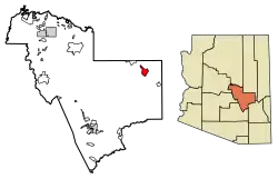 Location of Cedar Creek in Gila County, Arizona. | |
 Cedar Creek Location of Cedar Creek in Gila County, Arizona.  Cedar Creek Cedar Creek (the United States) | |
| Coordinates: 33°53′44″N 110°10′25″W | |
| Country | United States |
| State | Arizona |
| County | Gila |
| Area | |
| • Total | 17.04 sq mi (44.12 km2) |
| • Land | 17.04 sq mi (44.12 km2) |
| • Water | 0.00 sq mi (0.00 km2) |
| Elevation | 4,928 ft (1,502 m) |
| Population (2010) | |
| • Total | 5,015 |
| • Estimate (2016)[2] | N/A |
| Time zone | UTC-7 (Mountain (MST)) |
| Area code(s) | 928 |
| GNIS feature ID | 2619[3] |
Geography
Cedar Creek is located at 33.891399°N 110.195707°W.
According to the U.S. Census Bureau, the community has an area of 17.035 square miles (44.12 km2), all of it land.[5]
Transportation
The White Mountain Apache Tribe operates the Fort Apache Connection Transit, which provides local bus service. [7]
References
- "2016 U.S. Gazetteer Files". United States Census Bureau. Retrieved Jul 18, 2017.
- "Population and Housing Unit Estimates". Retrieved June 9, 2017.
- "Cedar Creek". Geographic Names Information System. United States Geological Survey.
- "2010 Census Interactive Population Search". census.gov. Archived from the original on 2014-04-13. Retrieved 2014-04-13.
- "2010 Census Gazetteer Files: Places - Arizona". U.S. Census Bureau. Archived from the original on September 6, 2013. Retrieved July 16, 2014.
- "Census of Population and Housing". Census.gov. Retrieved June 4, 2016.
- "Tribal Transportation". WMAT DOT. Retrieved 2020-02-03.
Municipalities and communities of Gila County, Arizona, United States | ||
|---|---|---|
| City |  | |
| Towns | ||
| CDPs |
| |
| Populated places | ||
| Indian reservations | ||
| Ghost towns | ||
| Footnotes | ‡This populated place also has portions in an adjacent county or counties | |
| ||
This article is issued from Wikipedia. The text is licensed under Creative Commons - Attribution - Sharealike. Additional terms may apply for the media files.