Copper Hill, Arizona
Copper Hill is a census-designated place in Gila County, Arizona. Copper Hill is located near US Route 60, northeast of the city of Globe. The population as of the 2010 U.S. Census was 108.[4]
Copper Hill, Arizona | |
|---|---|
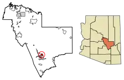 Location of Copper Hill in Gila County, Arizona. | |
 Copper Hill Location of Copper Hill in Gila County, Arizona.  Copper Hill Copper Hill (the United States) | |
| Coordinates: 33°25′49″N 110°45′52″W | |
| Country | United States |
| State | Arizona |
| County | Gila |
| Area | |
| • Total | 7.35 sq mi (19.04 km2) |
| • Land | 7.35 sq mi (19.03 km2) |
| • Water | 0.00 sq mi (0.00 km2) |
| Elevation | 4,127 ft (1,258 m) |
| Population (2010) | |
| • Total | 11,825 |
| • Estimate (2016)[2] | N/A |
| Time zone | UTC-7 (Mountain (MST)) |
| Area code(s) | 928 |
| GNIS feature ID | 42763[3] |
Geography
Copper Hill is located at 33.433316°N 110.748494°W.
According to the U.S. Census Bureau, the community has an area of 7.349 square miles (19.03 km2); 7.348 square miles (19.03 km2) of its area is land, and 0.001 square miles (0.0026 km2) is water.[5]
References
- "2016 U.S. Gazetteer Files". United States Census Bureau. Retrieved Jul 18, 2017.
- "Population and Housing Unit Estimates". Retrieved June 9, 2017.
- "Copper Hill". Geographic Names Information System. United States Geological Survey.
- "Copper Hill, Arizona". Census.gov. Archived from the original on 2014-04-13. Retrieved 2014-06-03.
- "2010 Census Gazetteer Files: Places - Arizona". U.S. Census Bureau. Archived from the original on September 6, 2013. Retrieved July 16, 2014.
- "Census of Population and Housing". Census.gov. Retrieved June 4, 2016.
Municipalities and communities of Gila County, Arizona, United States | ||
|---|---|---|
| City |  | |
| Towns | ||
| CDPs |
| |
| Populated places | ||
| Indian reservations | ||
| Ghost towns | ||
| Footnotes | ‡This populated place also has portions in an adjacent county or counties | |
| ||
This article is issued from Wikipedia. The text is licensed under Creative Commons - Attribution - Sharealike. Additional terms may apply for the media files.