Centerville, Crawford County, Pennsylvania
Centerville is a borough in Crawford County, Pennsylvania, United States. The population was 218 at the 2010 census.[4] It was established in 1812.
Centerville, Pennsylvania | |
|---|---|
.jpg.webp) Centerville United Methodist Church | |
 Location of Centerville in Crawford County, Pennsylvania. | |
 Centerville Location of Centerville in Pennsylvania | |
| Coordinates: 41°44′7″N 79°45′16″W | |
| Country | United States |
| State | Pennsylvania |
| County | Crawford County |
| Founded | 1812 |
| Area | |
| • Total | 1.77 sq mi (4.59 km2) |
| • Land | 1.77 sq mi (4.59 km2) |
| • Water | 0.00 sq mi (0.00 km2) |
| Elevation [2] (middle of borough at PA 8 and Taylors Stand Road) | 1,308 ft (399 m) |
| Highest elevation [2] (PA 8 at borough line) | 1,510 ft (460 m) |
| Lowest elevation [2] (Oil Creek) | 1,248 ft (380 m) |
| Population (2010) | |
| • Total | 218 |
| • Estimate (2019)[3] | 204 |
| • Density | 115.25/sq mi (44.49/km2) |
| Time zone | UTC-4 (EST) |
| • Summer (DST) | UTC-5 (EDT) |
| Area code(s) | 814 |
| FIPS code | 42-12184 |
| GNIS feature ID | 1215132 |
Geography
Centerville is located in eastern Crawford County at 41°44′11″N 79°45′39″W (41.736376, -79.760965).[5] It is bordered by Rome Township to the north, east, and south; by Steuben Township to the southwest; and by Athens Township to the west.
According to the United States Census Bureau, the borough has a total area of 1.8 square miles (4.6 km2), all of it land.[4] Oil Creek, a south-flowing tributary of the Allegheny River, runs through the west side of town; the East Branch enters the borough from the northeast and joins the main creek west of the borough center, which is situated on a ridge that rises between the two creeks.
Pennsylvania Route 8 passes through Centerville, leading north 12 miles (19 km) to Union City and south 9 miles (14 km) to Titusville.
Demographics
| Historical population | |||
|---|---|---|---|
| Census | Pop. | %± | |
| 1870 | 322 | — | |
| 1880 | 307 | −4.7% | |
| 1890 | 274 | −10.7% | |
| 1900 | 260 | −5.1% | |
| 1910 | 264 | 1.5% | |
| 1920 | 218 | −17.4% | |
| 1930 | 229 | 5.0% | |
| 1940 | 273 | 19.2% | |
| 1950 | 245 | −10.3% | |
| 1960 | 238 | −2.9% | |
| 1970 | 246 | 3.4% | |
| 1980 | 245 | −0.4% | |
| 1990 | 249 | 1.6% | |
| 2000 | 247 | −0.8% | |
| 2010 | 218 | −11.7% | |
| 2019 (est.) | 204 | [3] | −6.4% |
| Sources:[6][7][8][9] | |||
As of the census[7] of 2000, there were 247 people, 99 households, and 67 families residing in the borough. The population density was 138.3 people per square mile (53.3/km²). There were 109 housing units at an average density of 61.0/sq mi (23.5/km²). The racial makeup of the borough was 98.79% White, 0.40% Asian, and 0.81% from two or more races.
There were 99 households, out of which 25.3% had children under the age of 18 living with them, 64.6% were married couples living together, 1.0% had a female householder with no husband present, and 32.3% were non-families. 24.2% of all households were made up of individuals, and 10.1% had someone living alone who was 65 years of age or older. The average household size was 2.49 and the average family size was 3.06.
In the borough the population was spread out, with 21.9% under the age of 18, 7.7% from 18 to 24, 29.1% from 25 to 44, 24.7% from 45 to 64, and 16.6% who were 65 years of age or older. The median age was 41 years. For every 100 females there were 109.3 males. For every 100 females age 18 and over, there were 105.3 males.
The median income for a household in the borough was $29,318, and the median income for a family was $32,778. Males had a median income of $30,417 versus $22,083 for females. The per capita income for the borough was $12,860. About 13.4% of families and 17.6% of the population were below the poverty line, including 34.8% of those under the age of eighteen and none of those sixty-five or over.
References
- "2019 U.S. Gazetteer Files". United States Census Bureau. Retrieved July 28, 2020.
- "Mystic Park Topo Map, Crawford County PA (Centerville Area)". TopoZone. Locality, LLC. Retrieved 2 September 2019.
- "Population and Housing Unit Estimates". United States Census Bureau. May 24, 2020. Retrieved May 27, 2020.
- "Geographic Identifiers: 2010 Census Summary File 1 (G001): Centerville borough (Crawford County), Pennsylvania". U.S. Census Bureau, American Factfinder. Archived from the original on February 13, 2020. Retrieved June 3, 2015.
- "US Gazetteer files: 2010, 2000, and 1990". United States Census Bureau. 2011-02-12. Retrieved 2011-04-23.
- "Census of Population and Housing". U.S. Census Bureau. Retrieved 11 December 2013.
- "U.S. Census website". United States Census Bureau. Retrieved 2008-01-31.
- "Incorporated Places and Minor Civil Divisions Datasets: Subcounty Resident Population Estimates: April 1, 2010 to July 1, 2012". Population Estimates. U.S. Census Bureau. Archived from the original on 11 June 2013. Retrieved 11 December 2013.
- Bureau, U. S. Census. "U.S. Census website". United States Census Bureau. US Census Bureau. Retrieved 17 July 2019.
| Wikimedia Commons has media related to Centerville, Crawford County, Pennsylvania. |
Municipalities and communities of Crawford County, Pennsylvania, United States | ||
|---|---|---|
| Cities | 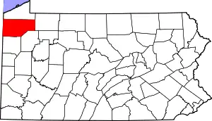 | |
| Boroughs | ||
| Townships |
| |
| CDPs | ||
| Unincorporated communities | ||
| ||