Conneaut Township, Crawford County, Pennsylvania
Conneaut Township is a township in Crawford County, Pennsylvania, United States. The population was 1,476 at the 2010 census.[4]
Conneaut Township, Crawford County, Pennsylvania | |
|---|---|
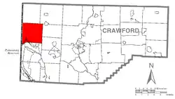 Location of Conneaut Township in Crawford County | |
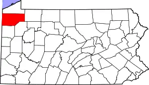 Location of Crawford County in Pennsylvania | |
| Country | United States |
| State | Pennsylvania |
| County | Crawford County |
| Area | |
| • Total | 41.66 sq mi (107.90 km2) |
| • Land | 40.88 sq mi (105.87 km2) |
| • Water | 0.78 sq mi (2.02 km2) |
| Highest elevation | 1,280 ft (390 m) |
| Lowest elevation [2] (Pymatuning Lake) | 1,080 ft (330 m) |
| Population (2010) | |
| • Total | 1,476 |
| • Estimate (2018)[3] | 1,394 |
| • Density | 34.66/sq mi (13.38/km2) |
| Time zone | UTC-4 (EST) |
| • Summer (DST) | UTC-5 (EDT) |
| Area code(s) | 814 |
Geography
Conneaut Township is in western Crawford County, bordered to the west by Ashtabula County, Ohio. According to the United States Census Bureau, the township has a total area of 41.7 square miles (107.9 km2), of which 40.9 square miles (105.9 km2) is land and 0.77 square miles (2.0 km2), or 1.88%, is water.[4] The northern end of the Pymatuning Reservoir, one of the largest reservoirs in Pennsylvania, is in the southwest. The township includes the unincorporated communities of Steamburg, Pennline, Conneaut Center, and Center Road, as well as the northern half of the Pymatuning North census-designated place.
Natural Features
Conneaut Township is located in the glaciated plateau of Northwest Pennsylvania. In general, the northern end is drained by Conneaut Creek, which drains to Lake Erie, while the southern end is drained by the Shenango River, via Pymatuning Reservoir. Elevations range from 1,008 ft (307 m) at Pymatuning Reservoir to 1,280 ft (390 m) northeast of Linesville, Pennsylvania.[2]
Demographics
| Historical population | |||
|---|---|---|---|
| Census | Pop. | %± | |
| 2000 | 1,550 | — | |
| 2010 | 1,476 | −4.8% | |
| 2018 (est.) | 1,394 | [3] | −5.6% |
| U.S. Decennial Census[5] | |||
As of the census[6] of 2000, there were 1,550 people, 569 households, and 434 families residing in the township. The population density was 37.9 people per square mile (14.6/km2). There were 791 housing units at an average density of 19.3/sq mi (7.5/km2). The racial makeup of the township was 98.71% White, 0.13% African American, 0.06% Native American, and 1.10% from two or more races. Hispanic or Latino of any race were 0.06% of the population.
There were 569 households, out of which 32.2% had children under the age of 18 living with them, 63.3% were married couples living together, 8.6% had a female householder with no husband present, and 23.6% were non-families. 19.9% of all households were made up of individuals, and 7.9% had someone living alone who was 65 years of age or older. The average household size was 2.72 and the average family size was 3.11.
In the township the population was spread out, with 27.6% under the age of 18, 6.3% from 18 to 24, 26.5% from 25 to 44, 25.9% from 45 to 64, and 13.6% who were 65 years of age or older. The median age was 39 years. For every 100 females, there were 103.7 males. For every 100 females age 18 and over, there were 102.9 males.
The median income for a household in the township was $33,512, and the median income for a family was $40,391. Males had a median income of $28,669 versus $22,557 for females. The per capita income for the township was $14,493. About 10.5% of families and 16.5% of the population were below the poverty line, including 29.0% of those under age 18 and 10.8% of those age 65 or over.
References
- "2016 U.S. Gazetteer Files". United States Census Bureau. Retrieved Aug 13, 2017.
- "Pymatuning Reservoir Topo Map, Crawford County PA (Greenville West Area)". TopoZone. Locality, LLC. Retrieved 1 September 2019.
- Bureau, U. S. Census. "U.S. Census website". United States Census Bureau. US Census Bureau. Retrieved 18 July 2019.
- "Geographic Identifiers: 2010 Census Summary File 1 (G001): Conneaut township, Crawford County, Pennsylvania". U.S. Census Bureau, American Factfinder. Archived from the original on February 13, 2020. Retrieved June 5, 2015.
- "Census of Population and Housing". Census.gov. Retrieved June 4, 2016.
- "U.S. Census website". United States Census Bureau. Retrieved 2008-01-31.
External links
Municipalities and communities of Crawford County, Pennsylvania, United States | ||
|---|---|---|
| Cities | | |
| Boroughs | ||
| Townships |
| |
| CDPs | ||
| Unincorporated communities | ||
| ||
| Authority control |
|
|---|