Hydetown, Pennsylvania
Hydetown is a borough in Crawford County, Pennsylvania, United States. The population was 526 at the 2010 census,[4] down from 605 at the 2000 census. It was established in 1862.
Hydetown, Pennsylvania | |
|---|---|
.jpg.webp) Fire Engine 2, Hydetown Volunteer Fire Department | |
 Location of Hydetown in Crawford County, Pennsylvania. | |
 Hydetown Location of Hydetown in Pennsylvania | |
| Coordinates: 41°39′8″N 79°43′33″W | |
| Country | United States |
| State | Pennsylvania |
| County | Crawford County |
| Founded | 1862 |
| Government | |
| • Mayor | Marc Bavas (D) |
| Area | |
| • Total | 2.25 sq mi (5.84 km2) |
| • Land | 2.25 sq mi (5.84 km2) |
| • Water | 0.00 sq mi (0.00 km2) |
| Elevation [2] (middle of borough) | 1,250 ft (380 m) |
| Highest elevation [2] (east side of borough) | 1,560 ft (480 m) |
| Lowest elevation | 1,220 ft (370 m) |
| Population (2010) | |
| • Total | 526 |
| • Estimate (2019)[3] | 508 |
| • Density | 225.28/sq mi (86.99/km2) |
| Time zone | UTC-4 (EST) |
| • Summer (DST) | UTC-5 (EDT) |
| Area code(s) | 814 |
Geography
Hydetown is located in eastern Crawford County at 41°39′8″N 79°43′33″W (41.652312, -79.725872).[5] It is surrounded by Oil Creek Township, a separate municipality. Pennsylvania Route 8 passes through the borough, leading southeast 3 miles (5 km) to Titusville and north 6 miles (10 km) to Centerville. Pennsylvania Route 408 leads west 8 miles (13 km) to Townville.
According to the United States Census Bureau, the borough has a total area of 2.2 square miles (5.8 km2), all of it land.[4] Oil Creek passes through the southwest side of the borough, flowing south past Titusville to the Allegheny River at Oil City.
Elevation
The lowest elevation in Hydetown is 1,220 ft (370 m) where Oil Creek flows out of the Borough. The highest elevation is 1,560 ft (480 m) at the eastern boundary.[2]
Watersheds
Hydetown is drained by Oil Creek and Thompson Creek, a tributary of Oil Creek.[2]
Demographics
| Historical population | |||
|---|---|---|---|
| Census | Pop. | %± | |
| 1870 | 428 | — | |
| 1880 | 405 | −5.4% | |
| 1890 | 247 | −39.0% | |
| 1900 | 337 | 36.4% | |
| 1910 | 413 | 22.6% | |
| 1920 | 336 | −18.6% | |
| 1930 | 420 | 25.0% | |
| 1940 | 446 | 6.2% | |
| 1950 | 530 | 18.8% | |
| 1960 | 679 | 28.1% | |
| 1970 | 725 | 6.8% | |
| 1980 | 760 | 4.8% | |
| 1990 | 681 | −10.4% | |
| 2000 | 605 | −11.2% | |
| 2010 | 526 | −13.1% | |
| 2019 (est.) | 508 | [3] | −3.4% |
| Sources:[6][7][8][9] | |||
As of the census[7] of 2000, there were 605 people, 251 households, and 157 families residing in the borough. The population density was 279.0 people per square mile (107.6/km²). There were 264 housing units at an average density of 121.7 per square mile (47.0/km²). The racial makeup of the borough was 99.17% White and 0.83% Asian. Hispanic or Latino of any race were 0.66% of the population.
There were 251 households, out of which 24.7% had children under the age of 18 living with them, 53.8% were married couples living together, 4.4% had a female householder with no husband present, and 37.1% were non-families. 30.3% of all households were made up of individuals, and 14.7% had someone living alone who was 65 years of age or older. The average household size was 2.41 and the average family size was 3.04.
In the borough the population was spread out, with 23.1% under the age of 18, 8.4% from 18 to 24, 23.6% from 25 to 44, 26.4% from 45 to 64, and 18.3% who were 65 years of age or older. The median age was 42 years. For every 100 females there were 106.5 males. For every 100 females age 18 and over, there were 100.4 males.
The median income for a household in the borough was $34,563, and the median income for a family was $42,188. Males had a median income of $26,389 versus $17,417 for females. The per capita income for the borough was $14,891. About 5.0% of families and 12.8% of the population were below the poverty line, including 19.1% of those under age 18 and 15.1% of those age 65 or over.
Hydetown is part of the Titusville Area School District.
References
- "2019 U.S. Gazetteer Files". United States Census Bureau. Retrieved July 28, 2020.
- "Hydetown Topo Map, Crawford County PA (Titusville North Area)". TopoZone. Locality, LLC. Retrieved 2 September 2019.
- "Population and Housing Unit Estimates". United States Census Bureau. May 24, 2020. Retrieved May 27, 2020.
- "Geographic Identifiers: 2010 Census Summary File 1 (G001): Hydetown borough, Pennsylvania". U.S. Census Bureau, American Factfinder. Archived from the original on February 13, 2020. Retrieved June 4, 2015.
- "US Gazetteer files: 2010, 2000, and 1990". United States Census Bureau. 2011-02-12. Retrieved 2011-04-23.
- "Census of Population and Housing". U.S. Census Bureau. Retrieved 11 December 2013.
- "U.S. Census website". United States Census Bureau. Retrieved 2008-01-31.
- "Incorporated Places and Minor Civil Divisions Datasets: Subcounty Resident Population Estimates: April 1, 2010 to July 1, 2012". Population Estimates. U.S. Census Bureau. Archived from the original on 11 June 2013. Retrieved 11 December 2013.
- Bureau, U. S. Census. "U.S. Census website". United States Census Bureau. US Census Bureau. Retrieved 17 July 2019.
Municipalities and communities of Crawford County, Pennsylvania, United States | ||
|---|---|---|
| Cities | 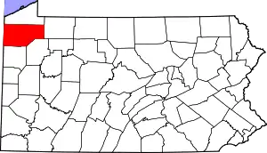 | |
| Boroughs | ||
| Townships |
| |
| CDPs | ||
| Unincorporated communities | ||
| ||