Centerville, South Dakota
Centerville is a city in Turner County, South Dakota, United States. The population was 882 at the 2010 census. Centerville is part of the Sioux Falls, South Dakota metropolitan area.
Centerville | |
|---|---|
| Centerville, South Dakota | |
| Motto(s): "Where YOU Make a Difference" | |
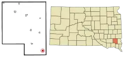 Location in Turner County and the state of South Dakota | |
| Coordinates: 43°7′3″N 96°57′38″W | |
| Country | United States |
| State | South Dakota |
| County | Turner |
| Incorporated | 1894[1] |
| Area | |
| • Total | 0.72 sq mi (1.86 km2) |
| • Land | 0.72 sq mi (1.86 km2) |
| • Water | 0.00 sq mi (0.00 km2) |
| Elevation | 1,227 ft (374 m) |
| Population | |
| • Total | 882 |
| • Estimate (2019)[4] | 872 |
| • Density | 1,211.11/sq mi (467.91/km2) |
| Time zone | UTC-6 (Central (CST)) |
| • Summer (DST) | UTC-5 (CDT) |
| ZIP code | 57014 |
| Area code(s) | 605 |
| FIPS code | 46-11060[5] |
| GNIS feature ID | 1267023[6] |
| Website | City of Centerville |
History
Centerville was platted in 1883.[7] It was named due to its location between Parker and Vermillion.[7]
One of the most powerful tornadoes in the 2003 South Dakota tornado outbreak was located around Centerville and was rated an F-2 on the Fujita scale. It had maximum winds of 135 miles per hour and caused damage in the town of Centerville and surrounding areas. No fatalities were reported with this tornado. Along with the F-2 tornado that was reported, 19 other tornadoes touched down within a 50-mile radius of Centerville.
Geography
Centerville is located at 43°7′3″N 96°57′38″W (43.117631, -96.960644).[8]
According to the United States Census Bureau, the city has a total area of 0.72 square miles (1.86 km2), all land.[9]
Centerville has been assigned the ZIP code 57014 and the FIPS place code 11060.
Demographics
| Historical population | |||
|---|---|---|---|
| Census | Pop. | %± | |
| 1890 | 723 | — | |
| 1900 | 871 | 20.5% | |
| 1910 | 971 | 11.5% | |
| 1920 | 1,104 | 13.7% | |
| 1930 | 1,169 | 5.9% | |
| 1940 | 1,046 | −10.5% | |
| 1950 | 1,053 | 0.7% | |
| 1960 | 887 | −15.8% | |
| 1970 | 910 | 2.6% | |
| 1980 | 892 | −2.0% | |
| 1990 | 887 | −0.6% | |
| 2000 | 910 | 2.6% | |
| 2010 | 882 | −3.1% | |
| 2019 (est.) | 872 | [4] | −1.1% |
| U.S. Decennial Census[10] | |||
2010 census
As of the census[3] of 2010, there were 882 people, 374 households, and 231 families living in the city. The population density was 1,225.0 inhabitants per square mile (473.0/km2). There were 425 housing units at an average density of 590.3 per square mile (227.9/km2). The racial makeup of the city was 98.2% White, 0.3% African American, 0.6% Native American, 0.2% Asian, 0.1% from other races, and 0.6% from two or more races. Hispanic or Latino of any race were 1.2% of the population.
There were 374 households, of which 27.5% had children under the age of 18 living with them, 50.5% were married couples living together, 6.4% had a female householder with no husband present, 4.8% had a male householder with no wife present, and 38.2% were non-families. 34.2% of all households were made up of individuals, and 17.9% had someone living alone who was 65 years of age or older. The average household size was 2.27 and the average family size was 2.91.
The median age in the city was 39.9 years. 23.9% of residents were under the age of 18; 8% were between the ages of 18 and 24; 22.5% were from 25 to 44; 24.7% were from 45 to 64; and 20.9% were 65 years of age or older. The gender makeup of the city was 50.0% male and 50.0% female.
2000 census
As of the census[5] of 2000, there were 910 people, 387 households, and 236 families living in the city. The population density was 1,265.9 people per square mile (488.0/km2). There were 429 housing units at an average density of 596.8 per square mile (230.1/km2). The racial makeup of the city was 99.34% White, 0.11% Native American, 0.11% Asian, and 0.44% from two or more races. Hispanic or Latino of any race were 0.66% of the population.
There were 387 households, out of which 26.1% had children under the age of 18 living with them, 50.9% were married couples living together, 6.7% had a female householder with no husband present, and 38.8% were non-families. 35.4% of all households were made up of individuals, and 22.5% had someone living alone who was 65 years of age or older. The average household size was 2.23 and the average family size was 2.90.
In the city, the population was spread out, with 23.6% under the age of 18, 6.3% from 18 to 24, 22.2% from 25 to 44, 20.2% from 45 to 64, and 27.7% who were 65 years of age or older. The median age was 44 years. For every 100 females, there were 87.2 males. For every 100 females age 18 and over, there were 81.9 males.
The median income for a household in the city was $29,615, and the median income for a family was $39,643. Males had a median income of $27,171 versus $20,000 for females. The per capita income for the city was $17,089. About 4.2% of families and 8.2% of the population were below the poverty line, including 2.3% of those under age 18 and 19.1% of those age 65 or over.
Notable people
- Clinton P. Anderson, Representative and Senator from New Mexico and Secretary of Agriculture, was born in Centerville.
- Ivan Dmitri (1900 – 1968), famous artist and photographer, was born in Centerville and lived there before moving with his family to North Dakota.[11]
References
- "SD Towns" (PDF). South Dakota State Historical Society. Archived from the original (PDF) on 2010-02-10. Retrieved 2010-02-11.
- "2019 U.S. Gazetteer Files". United States Census Bureau. Retrieved July 30, 2020.
- "U.S. Census website". United States Census Bureau. Retrieved 2012-06-21.
- "Population and Housing Unit Estimates". United States Census Bureau. May 24, 2020. Retrieved May 27, 2020.
- "U.S. Census website". United States Census Bureau. Retrieved 2008-01-31.
- "US Board on Geographic Names". United States Geological Survey. 2007-10-25. Retrieved 2008-01-31.
- Chicago and North Western Railway Company (1908). A History of the Origin of the Place Names Connected with the Chicago & North Western and Chicago, St. Paul, Minneapolis & Omaha Railways. p. 54.
- "US Gazetteer files: 2010, 2000, and 1990". United States Census Bureau. 2011-02-12. Retrieved 2011-04-23.
- "US Gazetteer files 2010". United States Census Bureau. Archived from the original on 2012-01-24. Retrieved 2012-06-21.
- United States Census Bureau. "Census of Population and Housing". Retrieved November 8, 2014.
- Morton County Historical Society (1975). Peterson, Marion Plath (ed.). Morton prairie roots. Dallas, Texas: Taylor Publishing Co. p. 212. OCLC 2062977.
Municipalities and communities of Turner County, South Dakota, United States | ||
|---|---|---|
| Cities | 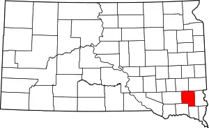 | |
| Towns | ||
| Townships | ||
| Unincorporated community | ||
| Footnotes | ‡This populated place also has portions in an adjacent county or counties | |
| ||
| Authority control |
|---|