Vermillion, South Dakota
Vermillion (Lakota: Waséoyuze;[7] "The Place Where Vermilion is Obtained") is a city in and the county seat of Clay County.[8] It is located in the southeastern corner of South Dakota, United States and is the eleventh largest city in the state. According to the 2010 Census, the population was 10,571. The city lies atop a bluff near the Missouri River.
Vermillion
Waséoyuze | |
|---|---|
| Vermillion, South Dakota | |
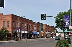 Downtown Vermillion | |
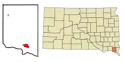 Location in Clay County and the state of South Dakota | |
 Vermillion Location in the United States | |
| Coordinates: 42°46′52″N 96°55′37″W | |
| Country | United States |
| State | South Dakota |
| County | Clay |
| Incorporated | 1877[1] |
| Government | |
| • Type | Council–manager[2] |
| • Mayor | Kelsey Collier-Wise |
| Area | |
| • Total | 4.57 sq mi (11.83 km2) |
| • Land | 4.57 sq mi (11.83 km2) |
| • Water | 0.00 sq mi (0.00 km2) |
| Elevation | 1,224 ft (373 m) |
| Population | |
| • Total | 10,571 |
| • Estimate (2019)[5] | 10,926 |
| • Density | 2,392.38/sq mi (923.67/km2) |
| Time zone | UTC−6 (Central (CST)) |
| • Summer (DST) | UTC−5 (CDT) |
| ZIP code | 57069 |
| Area code(s) | 605 Exchanges: 624,638,677 |
| FIPS code | 46-66700 |
| GNIS feature ID | 1258745[6] |
| Website | City of Vermillion |
The area has been home to Native American tribes for centuries. French fur traders first visited in the late 18th century. Vermillion was founded in 1859 and incorporated in 1873. The name refers to the Lakota name: wa sa wak pa'la (red stream). Home to the University of South Dakota, Vermillion has a mixed academic and rural character: the university is a major academic institution for the state, with its only law and medical schools and its only AACSB-accredited business school. Major farm products include corn, soybeans, and alfalfa.
History
Lewis and Clark camped at the mouth of the Vermillion River near the present-day town on August 24, 1804. The previous day, they had killed their first bison; the following day, they climbed Spirit Mound. In May 1843, John James Audubon visited the Vermillion ravine to view the bird life. The town was considered for the location of South Dakota's first mental institution (now the Human Services Center) in 1873, but the hospital was eventually awarded to nearby Yankton. The original town was entirely below the bluffs on the banks of the Missouri River, and three-quarters of it washed away in the Great Flood of 1881...
William Jennings Bryan and William Howard Taft—candidates for the U.S. Presidency in the 1908 election—spoke in Vermillion on September 28 and 29, 1908, respectively. Along with Eugene Chafin, they toured South Dakota by train, including stops in Mitchell, Tripp, Yankton, and Elk Point.[9]
John Philip Sousa conducted the Sousa Band on October 26, 1926, at the facility that in 1929 became known as Slagle Auditorium.[10]
On March 24, 1967, in Vermillion, Thomas James White Hawk and William Stands murdered jeweler James Yeado and raped his wife.[11]
Geography
According to the United States Census Bureau, the city has a total area of 4.03 square miles (10.44 km2), all land.[12]
The elevation of the city is 1,221 feet (372 m).
Climate
| Month | Jan | Feb | Mar | Apr | May | Jun | Jul | Aug | Sep | Oct | Nov | Dec | Year |
|---|---|---|---|---|---|---|---|---|---|---|---|---|---|
| Record high °F (°C) | 71 (22) |
74 (23) |
90 (32) |
97 (36) |
104 (40) |
108 (42) |
108 (42) |
106 (41) |
103 (39) |
98 (37) |
83 (28) |
69 (21) |
108 (42) |
| Average high °F (°C) | 31 (−1) |
37 (3) |
48 (9) |
63 (17) |
73 (23) |
82 (28) |
86 (30) |
84 (29) |
78 (26) |
65 (18) |
47 (8) |
33 (1) |
61 (16) |
| Daily mean °F (°C) | 21 (−6) |
26 (−3) |
37 (3) |
50 (10) |
61 (16) |
71 (22) |
75 (24) |
73 (23) |
65 (18) |
52 (11) |
37 (3) |
23 (−5) |
49 (10) |
| Average low °F (°C) | 11 (−12) |
15 (−9) |
26 (−3) |
37 (3) |
49 (9) |
59 (15) |
64 (18) |
62 (17) |
52 (11) |
39 (4) |
26 (−3) |
13 (−11) |
38 (3) |
| Record low °F (°C) | −30 (−34) |
−33 (−36) |
−22 (−30) |
7 (−14) |
20 (−7) |
36 (2) |
37 (3) |
36 (2) |
23 (−5) |
10 (−12) |
−24 (−31) |
−30 (−34) |
−33 (−36) |
| Average precipitation inches (mm) | 0.50 (13) |
0.63 (16) |
1.66 (42) |
3.17 (81) |
3.92 (100) |
4.05 (103) |
3.72 (94) |
2.75 (70) |
2.93 (74) |
2.24 (57) |
1.45 (37) |
0.64 (16) |
27.66 (703) |
| Source: [13] | |||||||||||||
Government
Vermillion operates under the council-manager form of government. Its governing body has nine members. Eight City Council members are elected from four wards, with two members representing each ward. The Mayor is elected at-large and presides over City Council meetings. The mayor may vote on all matters coming before the governing body. With the consent of the City Council, the mayor appoints individuals to serve on the Library Board and Planning Commission. The Library Board oversees the operations of the Vermillion Public Library and appoints a Library Director. All services and programs provided by the library are overseen by the board. The Planning Commission is charged with overseeing the long-range planning of the community, including zoning issues, subdivisions and formulation of the Comprehensive Plan. The Planning Commission serves a vital role in recommending major policy changes to the governing body for the development of the community.
Demographics
| Historical population | |||
|---|---|---|---|
| Census | Pop. | %± | |
| 1880 | 714 | — | |
| 1890 | 1,496 | 109.5% | |
| 1900 | 2,188 | 46.3% | |
| 1910 | 2,187 | 0.0% | |
| 1920 | 2,590 | 18.4% | |
| 1930 | 2,850 | 10.0% | |
| 1940 | 3,324 | 16.6% | |
| 1950 | 5,337 | 60.6% | |
| 1960 | 6,102 | 14.3% | |
| 1970 | 9,128 | 49.6% | |
| 1980 | 10,136 | 11.0% | |
| 1990 | 10,034 | −1.0% | |
| 2000 | 9,765 | −2.7% | |
| 2010 | 10,571 | 8.3% | |
| 2019 (est.) | 10,926 | [5] | 3.4% |
| U.S. Decennial Census[14] | |||
_(14767214961).jpg.webp)
2010 census
As of the census[4] of 2010, there were 10,571 people, 3,811 households, and 1,692 families residing in the city. The population density was 2,623.1 inhabitants per square mile (1,012.8/km2). There were 4,043 housing units at an average density of 1,003.2 per square mile (387.3/km2). The racial makeup of the city was 89.6% White, 1.7% African American, 3.6% Native American, 2.1% Asian, 0.5% from other races, and 2.6% from two or more races. Hispanic or Latino of any race were 2.4% of the population.
There were 3,811 households, of which 22.5% had children under the age of 18 living with them, 32.8% were married couples living together, 8.4% had a female householder with no husband present, 3.2% had a male householder with no wife present, and 55.6% were non-families. 35.3% of all households were made up of individuals, and 7.5% had someone living alone who was 65 years of age or older. The average household size was 2.21 and the average family size was 2.90.
The median age in the city was 23.4 years. 15.3% of residents were under the age of 18; 41.1% were between the ages of 18 and 24; 20.7% were from 25 to 44; 14.4% were from 45 to 64; and 8.4% were 65 years of age or older. The gender makeup of the city was 47.8% male and 52.2% female.
2000 census
As of the census of 2000, there were 9,765 people, 3,647 households, and 1,801 families residing in the city. The population density was 2,549.3 people per square mile (984.4/km2). There were 3,967 housing units at an average density of 1,035.6 per square mile (399.9/km2). The racial makeup of the city was 90.95% White, 1.29% African American, 3.37% Native American, 2.46% Asian, 0.01% Pacific Islander, 0.37% from other races, and 1.56% from two or more races. 1.07% of the population were Hispanic or Latino of any race.
There were 3,647 households, out of which 25.8% had children under the age of 18 living with them, 37.5% were married couples living together, 9.2% had a female householder with no husband present, and 50.6% were non-families. 34.1% of all households were made up of individuals, and 7.8% had someone living alone who was 65 years of age or older. The average household size was 2.24 and the average family size was 2.90.
In the city, the population was spread out, with 17.5% under the age of 18, 36.2% from 18 to 24, 24.5% from 25 to 44, 13.4% from 45 to 64, and 8.4% who were 65 years of age or older. The median age was 24 years. For every 100 females, there were 91.6 males. For every 100 females age 18 and over, there were 89.9 males.
As of 2000 the median income for a household in the city was $24,095, and the median income for a family was $40,109. Males had a median income of $28,180 versus $20,975 for females. The per capita income for the city was $13,909. 26.2% of the population and 16.2% of families were below the poverty line. Out of the total people living in poverty, 19.0% are under the age of 18 and 14.8% are 65 or older.
For the population 25 years and over, 90.7% have a high school education or higher; 45.4% have a bachelor's degree or higher; and 21.2% have a graduate or professional degree.
For ancestries, 36% claim German ancestry; 14.2% Norwegian; 13.4% Irish; 6.6% English; 5.5% Dutch; and 4% Swedish.
Major employers
| Company | Employees (est.)[15] | Location |
|---|---|---|
| Dakota Care Center of Vermillion | 90 | 125 S Walker St |
| Cafe Brule | 70 | 24 W. Main St |
| Eagle Creek Software Services | 50 | 1215 W. Cherry St |
| Hy-Vee | 135 | 525 W Cherry St |
| Polaris Industries | 120 | 1997 Polaris Pkwy |
| Sanford Health Network | 233 | 20 S Plum St |
| Sesdac Inc | 130 | 1314 E Cherry St |
| South Dakota Department of Military & Veterans Affairs | 96 | PO Box B434 |
| University of South Dakota | 800 | 414 E Clark St |
| Vermillion City | 157 | 25 Center St |
| Vermillion School District 13-1 | 170[16] | 17 Prospect St |
| Walmart | 100 | 1207 Princeton St |
Parks
Vermillion's nine parks, totaling 91 acres (37 ha), include several major city parks: Prentis Park, Cotton Park, Barstow Park, and Lions Park. Lions Park offers camping.[17] Prentis Park includes a new swimming pool opened in 2017, with a waterslide, diving board, shallow play area, "lazy river", and snack bar. The park also features a disc golf course and a baseball diamond which was the home of the Vermillion Red Sox, of the South Dakota Amateur Baseball Association. The baseball field is currently home of the Vermillion Grey Sox, Vermillion High School, Post 1 American Legion, University of South Dakota club, and VFW teams. The city owns and operates The Bluffs Golf Course,[18] an 18-hole championship golf course that overlooks the river bluffs. Vermillion also offers a bike trail along the Vermillion River and several neighborhood parks: Bliss Park, JC Park, Ty Park, Bluffs Park, and Rotary Park.[19]
Museums
The University of South Dakota's National Music Museum (NMM) is accredited by the American Alliance of Museums in Washington, D.C., and is recognized as "A Landmark of American Music" by the National Music Council. It includes more than 15,000 American, European, and non-Western instruments.[20]
Murals
Vermillion currently has five murals located in the downtown business district, three of which are community based murals. All three community murals are painted on the Coyote Twin Theater building; the first was painted in 2017, the second was painted in 2019, and the third was painted in 2020.[21] The first mural - Painting the Town - was designed as the first mural for the Vermillion Community Mural Project by Amber Hansen, a painting professor at the University of South Dakota.[22][21]
During the summer of 2019 and summer of 2020, Reyna Hernandez was the lead artist on two murals on the Coyote Twin Building the form a larger cohesive mural.[23] Hernandez is of the Yankton-Sioux Tribe tribe was assisted by Elizabeth Skye of the Standing Rock Sioux Tribe and Inkpa Mani of the Sisseton Wahpeton Dakota lead group discussions to help create imagery centered around Native Americans and Native American creation stories.[23][24]
Notable people
- Rachael Bella, actress
- Joseph Bottum, writer
- Kevin Brady, U.S. Representative (R-Texas)
- Shawn Colvin, singer-songwriter
- Doug Dickey, college football coach
- Carl Gunderson, former Governor of South Dakota
- Jon Hoadley, Michigan state legislator
- Chelsea Houska, television personality (Teen Mom 2)
- Jeanne Ives, Illinois state representative
- Tim Johnson, U.S. Senator (D-South Dakota)
- John L. Jolley, U.S. Congressman (R-South Dakota)
- Jeff Kidder, lawman
- Ben Leber, NFL football linebacker
- Andrew E. Lee, South Dakota's third Governor
- Paradise Fears, alternative pop-rock band (Cole Andre, Jordan Merrigan, Samuel Miller, Marcus Sand, Michael Walker, Lucas Zimmerman)
- Byron S. Payne, Attorney General of South Dakota[25]
- Billy Yost, musician (The Kickback)
- Todd Tiahrt, U.S. Representative (R-Kansas)
- Abby Whiteside, piano teacher and theorist
- Doug Steckler, radio personality [26][27]
Media
AM radio
| AM radio stations | |||||
|---|---|---|---|---|---|
| Frequency | Call sign | Name | Format | Owner | City |
| 570 kHz | WNAX | WNAX Radio 570 | News/Talk | Saga Communications | Yankton |
| 1450 kHz | KYNT | Yankton's Home Team | Soft Adult Contemporary | Riverfront Broadcasting LLC | Yankton |
| 1570 kHz | KVTK | 1570 "The Ticket" | Sports Talk | 5 Star Communications | Vermillion |
FM radio
| FM radio stations | ||||||
|---|---|---|---|---|---|---|
| Frequency | Call sign | Name | Format | Owner | Target city/market | City of license |
| 89.7 MHz | KUSD | South Dakota Public Broadcasting | National Public Radio | SD Board of Directors for Educational Telecommunications | Yankton/Vermillion | Vermillion |
| 91.1 MHz | KAOR | Coyote Radio 91.1 | College | The University of South Dakota | Yankton/Vermillion | Vermillion |
| 93.1 MHz | KKYA | KK93 | Country | Riverfront Broadcasting LLC | Yankton/Vermillion | Yankton |
| 94.3 MHz | KDAM | The Current | Top-40 | Riverfront Broadcasting LLC | Yankton/Vermillion | Hartington |
| 104.1 MHz | WNAX-FM | The Wolf 104.1 | Country | Saga Communications | Yankton/Vermillion | Yankton |
| 106.3 MHz | KVHT | Classic Hits 106.3 | Classic Hits | 5 Star Communications | Yankton/Vermillion | Vermillion |
Sister city
Ratingen in the German state of North Rhine-Westphalia has been the sister city of Vermillion since 1969.[28]
See also
References
- "SD Towns" (PDF). South Dakota State Historical Society. Retrieved 2010-02-16.
- "About Our Government". City of Vermillion. Retrieved 2019-12-16.
- "2019 U.S. Gazetteer Files". United States Census Bureau. Retrieved July 30, 2020.
- "U.S. Census website". United States Census Bureau. Retrieved 2012-06-21.
- "Population and Housing Unit Estimates". United States Census Bureau. May 24, 2020. Retrieved May 27, 2020.
- "US Board on Geographic Names". United States Geological Survey. 2007-10-25. Retrieved 2008-01-31.
- Ullrich, Jan F. (2014). New Lakota Dictionary (2nd ed.). Bloomington, IN: Lakota Language Consortium. ISBN 978-0-9761082-9-0.
- "Find a County". National Association of Counties. Archived from the original on May 31, 2011. Retrieved June 7, 2011.
- Tingley, Ralph (March 23, 1982). "Brass Bands and Huzzahs: Politics at the Corn Palace, 1908". South Dakota State Historical Society. 12 (1).
- Paul Edmund Bierley, The Incredible Band of John Philip Sousa (Urbana: University of Illinois Press, 2006), p. 190.
- Gerald Vizenor, "Thomas James White Hawk: Murder on Good Friday," and "Commutation of Death", in Tribal Scenes and Ceremonies, Minneapolis: Nodin Press, c. 1976.
- "US Gazetteer files 2010". United States Census Bureau. Archived from the original on July 2, 2012. Retrieved 2012-06-21.
- "Monthly Averages for Vermillion, SD". The Weather Channel. Retrieved September 11, 2014.
- United States Census Bureau. "Census of Population and Housing". Retrieved September 23, 2013.
- Dun & Bradstreet's Million Dollar Database (2010)
- "District Directory Information: Vermillion School District 13-1". National Center for Educational Statistics. 2015.
- "Park and Trail System". Vermillion, South Dakota. Retrieved September 14, 2017.
- "The Bluffs Golf Course".
- "Parks and Camping". Vermillion Parks and Recreation. Retrieved September 14, 2017.
- "University of South Dakota". National Music Museum. University of South Dakota. Retrieved July 28, 2014.
- "Vermillion Community Mural Project". Vermillion Cultural Association. Retrieved 2020-12-10.
- "USD Studio Art Professor Profile Amber Hansen". University of South Dakota | Amber Hansen.
- "The Story Behind the Vermillion Community Mural Project". We Are South Dakota. Retrieved 2020-12-10.
- "Credit Hour Interviews Artist Reyna Hernandez about Indigenous Media Representation". University of South Dakota. July 30, 2020. Retrieved December 10, 2020.
- Schwarz, J. C., ed. (1937). Who's Who In Law. I. New York, NY: J. C. Schwarz. p. 724 – via Google Books.
- https://en.wikipedia.org/wiki/The_Tim_Conway_Jr._Show
- https://www.imdb.com/name/nm0824299/
- "Ratingen - International Business - Partner Cities - Vermillion, South Dakota, USA". City of Ratingen (in German). Retrieved June 4, 2017.
External links
| Wikimedia Commons has media related to Vermillion, South Dakota. |
| Wikivoyage has a travel guide for Vermillion (South Dakota). |
Municipalities and communities of Clay County, South Dakota, United States | ||
|---|---|---|
| Cities | 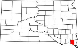 | |
| Town | ||
| Unincorporated communities |
| |
| Footnotes | ‡This populated place also has portions in an adjacent county or counties | |
| ||

| Authority control |
|---|