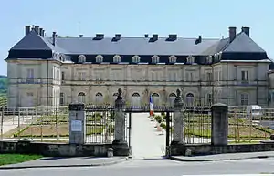
Champlitte
Champlitte is a commune in the Haute-Saône department in the region of Bourgogne-Franche-Comté in eastern France. The inhabitants of Champlitte are known in French as the Chanitois.
Champlitte | |
|---|---|
      | |
.svg.png.webp) Coat of arms | |
Location of Champlitte 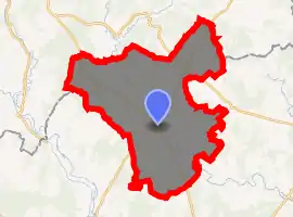
| |
 Champlitte  Champlitte | |
| Coordinates: 47°37′01″N 5°30′53″E | |
| Country | France |
| Region | Bourgogne-Franche-Comté |
| Department | Haute-Saône |
| Arrondissement | Vesoul |
| Canton | Dampierre-sur-Salon |
| Area 1 | 128.90 km2 (49.77 sq mi) |
| Population (2017-01-01)[1] | 1,639 |
| • Density | 13/km2 (33/sq mi) |
| Time zone | UTC+01:00 (CET) |
| • Summer (DST) | UTC+02:00 (CEST) |
| INSEE/Postal code | 70122 /70600 |
| Elevation | 208–379 m (682–1,243 ft) |
| 1 French Land Register data, which excludes lakes, ponds, glaciers > 1 km2 (0.386 sq mi or 247 acres) and river estuaries. | |
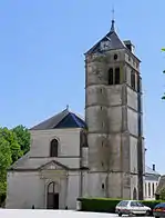
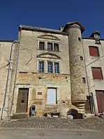
History
During the Roman Era, Champlitte was close to two major roads, one from Langres to Besançon and the other from Danmartin to Langres. Several villas have been found in the area, as has a hoard from the third century, confirming that the area was inhabited.[2]
The origin of the name come from Champlitte campus litensis or campus limites. We find the first written in the chronicle of the Abbey of Bèze. The first lord of Champlitte whose name is preserved was Gérard de Fouvent.[3]
The town prospered under the Lords of Vergy.
Champlitte was successively part of the dioceses of Langres, Dijon and Besançon. It was the chief town of the district from 1790 to 1795. The commune of Champlitte in its present form was created on 1 January 1972 by the merger of municipalities of Champlitte-and-the-Prélot, Champlitte-la-Ville, Leffond, Margilley, Montarlot-lès-Champlitte and Neuvelle-lès-Champlitte . On 1 July 1974, the municipality was enlarged by the annexation of Frettes, an old town formerly belonging to the department of Haute-Marne. In terms of area, it is the largest municipality in the department of Haute-Saône.
Champlitte is the third largest wine growing area in Franche-Comté.
Geography
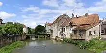
The city is situated on a hill at an elevation of 240 metres and is located at the edge of the regions Bourgogne-Franche-Comté and Grand Est. It overlooks the River Salon.
References
- "Populations légales 2017". INSEE. Retrieved 6 January 2020.
- Demard (2006) p. 11-21
- Bougaud, Garnier (1875) p.238
| Wikimedia Commons has media related to Champlitte. |
| Authority control |
|---|
