Charlotte Harbor, Florida
Charlotte Harbor is a census-designated place (CDP) in Charlotte County, Florida, United States. The name Charlotte Harbor also refers to Charlotte Harbor (estuary) and Charlotte Harbor Preserve State Park, a 42,000-acre (17,000 ha) preserve with 70 miles (110 km) of shoreline along Charlotte Harbor in Charlotte County.[3]
Charlotte Harbor, Florida | |
|---|---|
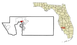 Location in Charlotte County and the state of Florida | |
| Coordinates: 26°57′50″N 82°3′44″W | |
| Country | United States |
| State | Florida |
| County | Charlotte |
| Area | |
| • Total | 5.0 sq mi (13.0 km2) |
| • Land | 2.3 sq mi (6.0 km2) |
| • Water | 2.7 sq mi (7.0 km2) |
| Elevation | 4 ft (1 m) |
| Population (2010) | |
| • Total | 3,714 |
| • Density | 1,612/sq mi (622.3/km2) |
| Time zone | UTC-5 (Eastern (EST)) |
| • Summer (DST) | UTC-4 (EDT) |
| Area code(s) | 941 |
| FIPS code | 12-11625[1] |
| GNIS feature ID | 0280326[2] |
The population of Charlotte Harbor was 3,710 at the 2010 census.[4] It is part of the Punta Gorda Metropolitan Statistical Area.
Geography
Charlotte Harbor is located at 26°57′50″N 82°3′44″W (26.963897, -82.062267)[5] on the north bank of the Peace River, the main tidal inlet to the Charlotte Harbor estuary, itself an arm of the Gulf of Mexico. U.S. Route 41, the Tamiami Trail, crosses the Peace River between Charlotte Harbor and Punta Gorda via the Barron Collier Bridge (northbound) and the Gilchrist Bridge (southbound).
According to the United States Census Bureau, the Charlotte Harbor CDP has a total area of 5.0 square miles (13.0 km2), of which 2.3 square miles (6.0 km2) is land and 2.7 square miles (7.0 km2), or 53.95%, is water.[4]
Notable event
On August 13, 2004, Hurricane Charley first made mainland landfall at the mouth of Charlotte Harbor.
References
- "U.S. Census website". United States Census Bureau. Retrieved January 31, 2008.
- "US Board on Geographic Names". United States Geological Survey. October 25, 2007. Retrieved January 31, 2008.
- Charlotte Harbor Preserve State Park
- "Geographic Identifiers: 2010 Demographic Profile Data (G001): Charlotte Harbor CDP, Florida". U.S. Census Bureau, American Factfinder. Archived from the original on February 12, 2020. Retrieved June 25, 2014.
- "US Gazetteer files: 2010, 2000, and 1990". United States Census Bureau. February 12, 2011. Retrieved April 23, 2011.
External links
Municipalities and communities of Charlotte County, Florida, United States | ||
|---|---|---|
| City | 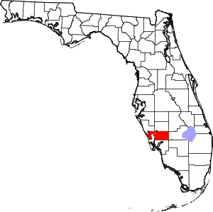 | |
| CDPs | ||
| Unincorporated communities | ||
| Ghost town | ||
| Footnotes | ‡This populated place also has portions in an adjacent county or counties | |
| ||
| Authority control |
|---|