Cheepie, Queensland
Cheepie is a town in the locality of Adavale in Shire of Quilpie, Queensland, Australia.[1] It has a population of 2 people.[2]
| Cheepie Queensland | |
|---|---|
 Cheepie | |
| Coordinates | 26.6288°S 145.0136°E |
| Postcode(s) | 4475 |
| Time zone | AEST (UTC+10:00) |
| Location |
|
| LGA(s) | Shire of Quilpie |
| State electorate(s) | Warrego |
| Federal Division(s) | Maranoa |
History
Margany (also known as Marganj, Mardigan, Marukanji, Maranganji) is an Australian Aboriginal language spoken by the Margany people. The Margany language region includes the landscape within the local government boundaries of the Quilpie Shire, taking in Quilpie, Cheepie and Beechal extending towards Eulo and Thargomindah, as well as the properties of Dynevor Downs and Ardoch.[3]
Gunya (also known as Kunya, Kunja, Kurnja) is an Australian Aboriginal language spoken by the Gunya people. The Gunya language region includes the landscape within the local government boundaries of the Paroo Shire Council, taking in Cunnamulla and extending north towards Augathella, east towards Bollon and west towards Thargomindah.[4]
Cheepie was originally a Cobb & Co station.[2]
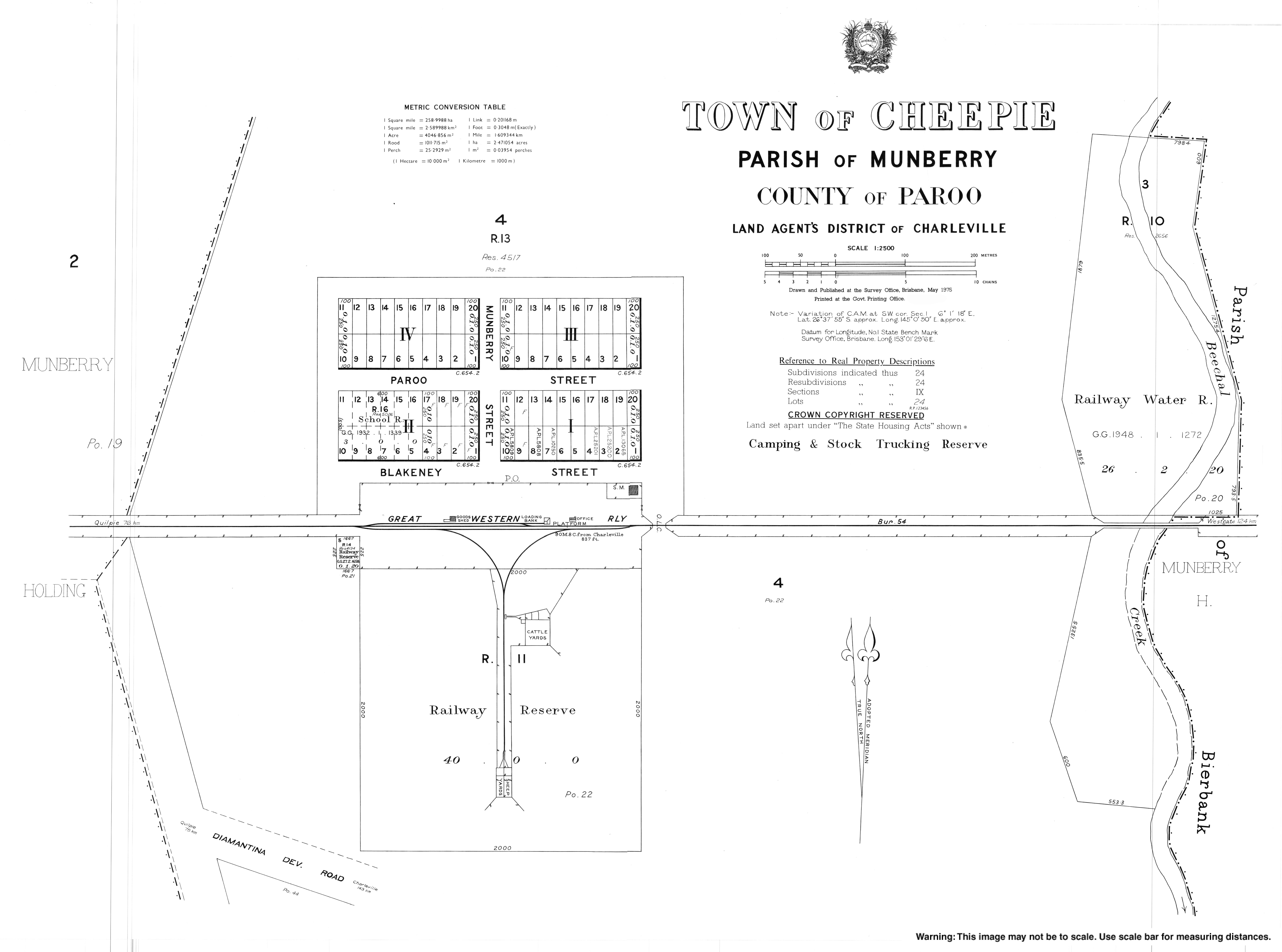
Cheepie railway station (26.6311°S 145.0136°E) on the Western railway line was built between 1914 and 1916 and was named by Queensland Railways Department, using an Aboriginal word, meaning the call of the whistling duck.[5]
The town takes its name from the Cheepie railway station.[1]
Cheepie Provisional School opened on 14 October 1915 but closed in June 1917. On 9 June 1930 Cheepie Provisional School reopened at a new site. It became Cheepie State School in 1933. It closed on 11 April 1974.[6] The school was on Blakeney Street (26.6297°S 145.0142°E); that land is now leased to the Quilpie Shire Council as a community centre.[7]
The Royal Mail was the first hotel in Cheepie, opening its door in 1926.[8]
In 1932, the Queensland Government offered for auction 50 town lots of 1 rood (11,000 sq ft; 1,000 m2) each in the town.[9]
References
- "Cheepie – town in Shire of Quilpie (entry 6968)". Queensland Place Names. Queensland Government. Retrieved 26 December 2017.
- "Cheepie". Quilpie Shire Council. Retrieved 22 October 2020.
-
 This Wikipedia article incorporates CC-BY-4.0 licensed text from: "Margany". Queensland Aboriginal and Torres Strait Islander languages map. State Library of Queensland. Retrieved 15 January 2020.
- "Gunya". State Library of Queensland. 21 January 2020.
- "Cheepie – railway station in Shire of Quilpie (entry 6969)". Queensland Place Names. Queensland Government. Retrieved 22 October 2020.
- Queensland Family History Society (2010), Queensland schools past and present (Version 1.01 ed.), Queensland Family History Society, ISBN 978-1-921171-26-0
- "Queensland Globe". State of Queensland. Retrieved 22 October 2020.
- www.australianexplorer.com. "Cheepie". Australian Explorer. Retrieved 12 October 2018.
- "Advertising". The Charleville Times. Queensland, Australia. 13 May 1932. p. 6. Retrieved 22 October 2020 – via National Library of Australia.